Mount Olive, Mississippi
Mount Olive is a town in Covington County, Mississippi, United States. The population was 982 at the 2010 census.[3]
Mount Olive, Mississippi | |
|---|---|
 Location of Mount Olive, Mississippi | |
 Mount Olive, Mississippi Location in the United States | |
| Coordinates: 31°45′24″N 89°39′13″W | |
| Country | United States |
| State | Mississippi |
| County | Covington |
| Area | |
| • Total | 3.10 sq mi (8.02 km2) |
| • Land | 3.10 sq mi (8.02 km2) |
| • Water | 0.00 sq mi (0.00 km2) |
| Elevation | 335 ft (102 m) |
| Population (2010) | |
| • Total | 982 |
| • Estimate (2018)[2] | 921 |
| • Density | 302.23/sq mi (116.68/km2) |
| Time zone | UTC-6 (Central (CST)) |
| • Summer (DST) | UTC-5 (CDT) |
| ZIP code | 39119 |
| Area code(s) | 601 |
| FIPS code | 28-49520 |
| GNIS feature ID | 0674103 |
| Website | Town website |
History
The town of Mount Olive was incorporated on May 18, 1900, making the town older than Magee to the north and older than Collins to the south. The railroad tracks were completed in 1899. The population of Mount Olive in 2016 was 975.[4]
Geography
U.S. Route 49, a four-lane divided highway, follows the western border of the town and leads northwest 52 miles (84 km) to Jackson, the state capital, and 38 miles (61 km) southeast to Hattiesburg. Mississippi Highway 35 passes through the southern end of town and leads northeast 10 miles (16 km) to Mize and southwest 39 miles (63 km) to Columbia.
According to the United States Census Bureau, the town has a total area of 3.1 square miles (8.0 km2), all land. It is in the valley of Okatoma Creek, part of the Pascagoula River watershed.
Demographics
| Historical population | |||
|---|---|---|---|
| Census | Pop. | %± | |
| 1910 | 1,077 | — | |
| 1920 | 778 | −27.8% | |
| 1930 | 812 | 4.4% | |
| 1940 | 775 | −4.6% | |
| 1950 | 827 | 6.7% | |
| 1960 | 841 | 1.7% | |
| 1970 | 923 | 9.8% | |
| 1980 | 993 | 7.6% | |
| 1990 | 914 | −8.0% | |
| 2000 | 893 | −2.3% | |
| 2010 | 982 | 10.0% | |
| Est. 2018 | 921 | [2] | −6.2% |
| U.S. Decennial Census[5] | |||
As of the census[6] of 2000, there were 893 people, 348 households, and 239 families residing in the town. The population density was 738.5 people per square mile (284.9/km²). There were 396 housing units at an average density of 327.5 per square mile (126.4/km²). The racial makeup of the town was 46.81% White, 51.96% African American, 0.11% Pacific Islander, and 1.12% from two or more races. Hispanic or Latino of any race were 0.56% of the population.
There were 348 households out of which 33.3% had children under the age of 18 living with them, 37.4% were married couples living together, 25.0% had a female householder with no husband present, and 31.3% were non-families. 30.5% of all households were made up of individuals and 14.1% had someone living alone who was 65 years of age or older. The average household size was 2.57 and the average family size was 3.19.
In the town, the population was spread out with 30.5% under the age of 18, 8.5% from 18 to 24, 25.3% from 25 to 44, 21.8% from 45 to 64, and 13.9% who were 65 years of age or older. The median age was 35 years. For every 100 females, there were 83.7 males. For every 100 females age 18 and over, there were 76.4 males.
The median income for a household in the town was $22,019, and the median income for a family was $26,146. Males had a median income of $26,250 versus $16,719 for females. The per capita income for the town was $11,008. About 26.9% of families and 34.2% of the population were below the poverty line, including 47.4% of those under age 18 and 24.6% of those age 65 or over.
Education
The town of Mount Olive is served by the Covington County School District. It is served by Mount Olive Elementary School and Mount Olive High School.
Notable people
- Steve McNair (1973-2009), All-Pro quarterback for the Tennessee Titans
- W. Ralph Eubanks, author, journalist, professor
- Hannah Roberts, Miss Mississippi 2015, 1st runner-up to Miss America 2016
References
- "2017 U.S. Gazetteer Files". United States Census Bureau. Retrieved Jan 6, 2019.
- "Population and Housing Unit Estimates". Retrieved February 20, 2020.
- "Geographic Identifiers: 2010 Demographic Profile Data (G001): Mount Olive town, Mississippi". U.S. Census Bureau, American Factfinder. Archived from the original on February 12, 2020. Retrieved October 8, 2014.
- "Home | Town of Mt. Olive Mississippi". Retrieved 25 July 2019.
- "Census of Population and Housing". Census.gov. Retrieved June 4, 2015.
- "U.S. Census website". United States Census Bureau. Retrieved 2008-01-31.
External links
Municipalities and communities of Covington County, Mississippi, United States | ||
|---|---|---|
| City | 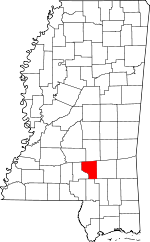 Map of Mississippi highlighting Covington County | |
| Towns | ||
| Unincorporated communities |
| |
.svg.png)