Wilkinson County, Mississippi
Wilkinson County is a county located in the U.S. state of Mississippi. As of the 2010 census, the population was 9,878.[1] Its county seat is Woodville.[2] The county is named for James Wilkinson, a Revolutionary War military leader and first governor of the Louisiana Territory after its acquisition by the United States in 1803.
Wilkinson County | |
|---|---|
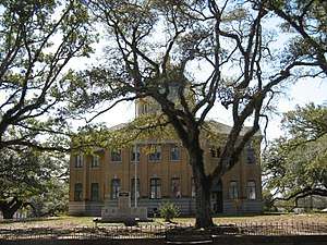 Wilkinson County courthouse in Woodville | |
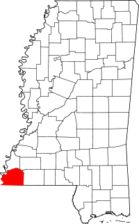 Location within the U.S. state of Mississippi | |
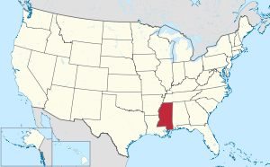 Mississippi's location within the U.S. | |
| Coordinates: 31°10′N 91°19′W | |
| Country | |
| State | |
| Founded | 1802 |
| Named for | James Wilkinson |
| Seat | Woodville |
| Largest town | Centreville |
| Area | |
| • Total | 688 sq mi (1,780 km2) |
| • Land | 678 sq mi (1,760 km2) |
| • Water | 9.7 sq mi (25 km2) 1.4% |
| Population (2010) | |
| • Total | 9,878 |
| • Estimate (2018) | 8,792 |
| • Density | 14/sq mi (5.5/km2) |
| Time zone | UTC−6 (Central) |
| • Summer (DST) | UTC−5 (CDT) |
| Congressional district | 3rd |
| Website | www |
History

In the 19th century, this county was developed by European-American settlers as cotton plantations along the Mississippi River, which forms the western border of the county. Much of the bottomlands and interior were undeveloped frontier until after the American Civil War. The intensive cultivation depended on the labor of numerous enslaved African Americans; in the early 19th century, more than a million slaves were relocated to the Deep South from the Upper South in a major forced migration. The population of this county quickly became majority black as enslaved workers were brought in.
The West Feliciana Railroad was later built to help get the cotton commodity crop to market. Some planters got wealthy during the antebellum years and built fine mansions in the county seat of Woodville, Mississippi. Jane and Samuel Emory Davis family moved here in 1812 with their several children, and lived at a plantation near Woodville. Their youngest son, Jefferson Davis, attended the Wilkinson Academy in Woodville for two years before going to Kentucky to another school.[3]
After the Civil War, freedmen and planters negotiated new working arrangements, and sharecropping became widespread. Although cotton continued as the commodity crop, a long agricultural depression kept prices low.
Following Reconstruction, white violence against blacks increased through the later decades of the 19th century and into the early 20th century. According to 2017 data compiled in Lynching in America (2015-2017), some nine lynchings of African Americans were recorded in Wilkinson County.[4]
The peak of population in the county was reached in 1900, after which many blacks left in the Great Migration to the North and Midwest, to escape the racial segregation and violence, and the disfranchisement suffered in the state since passage by the white Democratic-dominated legislature of a new constitution in 1890 raising barriers to voter registration. More constraints came with Jim Crow laws.
In the early 20th century the boll weevil infestation destroyed much of the cotton crops, and mechanization caused a further loss of agricultural jobs. The exit of many African Americans from the state did not change the state's exclusion of African Americans from politics. They were not enabled to vote until after passage of the federal Voting Rights Act in 1965. Cotton cultivation was revived, but it is produced on a highly mechanized, industrial scale.
Southwest Mississippi was an area of white violence against blacks during the Civil Rights Movement. In February 1964, the White Knights of the Ku Klux Klan officially formed. Clifton Walker, 37, a married father of five and employee of International Paper Company in Natchez, who was not politically active, was killed in an ambush on Poor House Road near his home. The evidence showed there had been a crowd of shooters on both sides of the road.[5] This lynching cold case has never been solved, although it was among numerous ones that the FBI was investigating since 2007, before the Donald Trump administration ended the effort in 2018.
Timber has been harvested and processed in the county as a new commodity crop. The population of the rural county has continued to decline because of lack of jobs. Towns have started to develop heritage tourism to attract more visitors.
Geography
According to the U.S. Census Bureau, the county has a total area of 688 square miles (1,780 km2), of which 678 square miles (1,760 km2) is land and 9.7 square miles (25 km2) (1.4%) is water.[6]
Major highways


Adjacent counties
- Adams County (north)
- Franklin County (northeast)
- Amite County (east)
- East Feliciana Parish, Louisiana (southeast)
- West Feliciana Parish, Louisiana (south)
- Concordia Parish, Louisiana (west)
National protected area
- Homochitto National Forest (part)
State protected area
Demographics
| Historical population | |||
|---|---|---|---|
| Census | Pop. | %± | |
| 1810 | 5,068 | — | |
| 1820 | 9,718 | 91.8% | |
| 1830 | 11,686 | 20.3% | |
| 1840 | 14,193 | 21.5% | |
| 1850 | 16,914 | 19.2% | |
| 1860 | 15,933 | −5.8% | |
| 1870 | 12,705 | −20.3% | |
| 1880 | 17,815 | 40.2% | |
| 1890 | 17,592 | −1.3% | |
| 1900 | 21,453 | 21.9% | |
| 1910 | 18,075 | −15.7% | |
| 1920 | 15,319 | −15.2% | |
| 1930 | 13,957 | −8.9% | |
| 1940 | 15,955 | 14.3% | |
| 1950 | 14,116 | −11.5% | |
| 1960 | 13,235 | −6.2% | |
| 1970 | 11,099 | −16.1% | |
| 1980 | 10,021 | −9.7% | |
| 1990 | 9,678 | −3.4% | |
| 2000 | 10,312 | 6.6% | |
| 2010 | 9,878 | −4.2% | |
| Est. 2018 | 8,792 | [8] | −11.0% |
| U.S. Decennial Census[9] 1790-1960[10] 1900-1990[11] 1990-2000[12] 2010-2013[1] | |||
As of the 2010 United States Census, there were 9,878 people living in the county. 70.8% were Black or African American, 28.7% White, 0.1% Native American, 0.1% of some other race and 0.3% of two or more races. 0.4% were Hispanic or Latino (of any race).
As of the census[13] of 2000, there were 10,312 people, 3,578 households, and 2,511 families living in the county. The population density was 15 people per square mile (6/km²). There were 5,106 housing units at an average density of 8 per square mile (3/km²). The racial makeup of the county was 68.21% Black or African American, 31.22% White, 0.10% Native American, 0.03% Asian, 0.07% from other races, and 0.38% from two or more races. 0.44% of the population were Hispanic or Latino of any race.
There were 3,578 households out of which 32.90% had children under the age of 18 living with them, 40.40% were married couples living together, 24.50% had a female householder with no husband present, and 29.80% were non-families. 27.90% of all households were made up of individuals and 12.00% had someone living alone who was 65 years of age or older. The average household size was 2.59 and the average family size was 3.16.
In the county, the population was spread out with 25.80% under the age of 18, 10.70% from 18 to 24, 29.00% from 25 to 44, 20.60% from 45 to 64, and 13.90% who were 65 years of age or older. The median age was 35 years. For every 100 females there were 108.00 males. For every 100 females age 18 and over, there were 106.60 males.
The median income for a household in the county was $18,929, and the median income for a family was $23,447. Males had a median income of $24,509 versus $16,088 for females. The per capita income for the county was $10,868. About 33.10% of families and 37.70% of the population were below the poverty line, including 48.90% of those under age 18 and 33.40% of those age 65 or over.
Wilkinson County has the sixth lowest per capita income in Mississippi and the 52nd lowest in the United States.
Education
Wilkinson County School District serves the county.
Wilkinson County Christian Academy, which was established in 1969 as a segregation academy.[14]
Communities
Towns
- Centreville (partly in Amite County)
- Crosby (partly in Amite County)
- Woodville (county seat)
Unincorporated communities
Ghost towns
Notable people
- Regina Barrow (born 1966), Louisiana state senator from Baton Rouge, Louisiana, since 2016; former state representative from 2005 to 2016; native of Wilkinson County[15]
- Jefferson Davis, President of the Confederate States of America; grew up at Rosemont plantation just east of Woodville
- Anne Moody (1940-2015), civil rights activist and author
- Edward Grady Partin (1924–1990), Teamsters Union business agent in Baton Rouge, native of Woodville
- William Grant Still, African-American classical composer and Mississippi Musicians Hall of Fame inductee was born in Woodville in 1895
Politics
| Year | Republican | Democratic | Third parties |
|---|---|---|---|
| 2016 | 31.3% 1,318 | 67.7% 2,857 | 1.0% 43 |
| 2012 | 29.2% 1,415 | 70.3% 3,412 | 0.5% 26 |
| 2008 | 30.4% 1,560 | 68.8% 3,534 | 0.9% 45 |
| 2004 | 35.6% 1,563 | 63.7% 2,794 | 0.6% 28 |
| 2000 | 34.7% 1,423 | 62.3% 2,551 | 3.0% 124 |
| 1996 | 24.8% 1,016 | 68.4% 2,807 | 6.8% 279 |
| 1992 | 28.3% 1,399 | 64.9% 3,210 | 6.8% 336 |
| 1988 | 36.2% 1,528 | 63.4% 2,678 | 0.4% 17 |
| 1984 | 39.3% 1,722 | 59.9% 2,627 | 0.8% 35 |
| 1980 | 32.0% 1,442 | 66.2% 2,981 | 1.7% 77 |
| 1976 | 33.1% 1,273 | 65.4% 2,514 | 1.5% 58 |
| 1972 | 52.7% 1,608 | 46.1% 1,409 | 1.2% 37 |
| 1968 | 6.9% 272 | 54.7% 2,144 | 38.4% 1,503 |
| 1964 | 93.5% 1,473 | 6.5% 103 | |
| 1960 | 14.2% 174 | 17.7% 216 | 68.1% 832 |
| 1956 | 28.2% 240 | 30.6% 260 | 41.3% 351 |
| 1952 | 55.4% 699 | 44.6% 563 | |
| 1948 | 2.4% 21 | 4.9% 43 | 92.7% 810 |
| 1944 | 8.5% 80 | 91.5% 863 | |
| 1940 | 4.7% 46 | 95.3% 942 | |
| 1936 | 2.7% 21 | 97.1% 767 | 0.3% 2 |
| 1932 | 2.2% 18 | 97.5% 813 | 0.4% 3 |
| 1928 | 8.7% 73 | 91.3% 767 | |
| 1924 | 10.1% 40 | 89.9% 355 | |
| 1920 | 3.5% 15 | 96.1% 416 | 0.5% 2 |
| 1916 | 1.7% 8 | 97.5% 460 | 0.9% 4 |
| 1912 | 1.9% 8 | 90.9% 379 | 7.2% 30 |
References
- "State & County QuickFacts". United States Census Bureau. Retrieved September 7, 2013.
- "Find a County". National Association of Counties. Retrieved 2011-06-07.
- Strode, Hudson (1955). Jefferson Davis, Volume I: American Patriot. New York: Harcourt, Brace & Company, pp. 11-27
- Lynching in America, Supplement: Lynching by County, 3rd edition, 2017, p.7; accessed 07 June 2018
- Frank Morris, "Cold Case: Ambush on Poor House Road: The 1964 murder of Clifton Walker", Concordia Sentinel, 22 July 2012; accessed 07 June 2018
- "2010 Census Gazetteer Files". United States Census Bureau. August 22, 2012. Archived from the original on September 28, 2013. Retrieved November 8, 2014.
- "Clark Creek". MDWFP Parks & Destinations. Retrieved 22 March 2018.
- "Population and Housing Unit Estimates". Retrieved November 8, 2019.
- "U.S. Decennial Census". United States Census Bureau. Retrieved November 8, 2014.
- "Historical Census Browser". University of Virginia Library. Retrieved November 8, 2014.
- "Population of Counties by Decennial Census: 1900 to 1990". United States Census Bureau. Retrieved November 8, 2014.
- "Census 2000 PHC-T-4. Ranking Tables for Counties: 1990 and 2000" (PDF). United States Census Bureau. Retrieved November 8, 2014.
- "U.S. Census website". United States Census Bureau. Retrieved 2008-01-31.
- Dangerfileld, Celnisha. "Mapping Race, School Segregation, and Black Identities in Woodville, Mississippi: A Case Study of a Rural Community". Journal of Rural Community Psychology - Mapping Race. Archived from the original on January 23, 2009.
- "Regina Ashford Barrow". Project Vote Smart. Retrieved April 27, 2015.
- Leip, David. "Dave Leip's Atlas of U.S. Presidential Elections". uselectionatlas.org. Retrieved 2018-03-03.
External links
Places adjacent to Wilkinson County, Mississippi | ||||||||||
|---|---|---|---|---|---|---|---|---|---|---|
| ||||||||||
Municipalities and communities of Wilkinson County, Mississippi, United States | ||
|---|---|---|
| Towns | Map of Mississippi highlighting Wilkinson County | |
| Unincorporated communities | ||
| Ghost towns | ||
| Footnotes | ‡This populated place also has portions in an adjacent county or counties | |
.svg.png)
| Authority control |
|
|---|