Montigny-Lengrain
Montigny-Lengrain is a commune in the Aisne department in Hauts-de-France in northern France.
Montigny-Lengrain | |
|---|---|
The town hall and school of Montigny-Lengrain | |
 Coat of arms | |
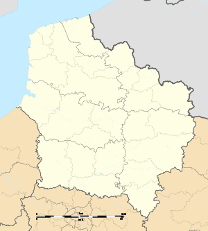
Location of Montigny-Lengrain 
| |
 Montigny-Lengrain  Montigny-Lengrain | |
| Coordinates: 49°22′20″N 3°06′00″E | |
| Country | France |
| Region | Hauts-de-France |
| Department | Aisne |
| Arrondissement | Soissons |
| Canton | Vic-sur-Aisne |
| Intercommunality | Pays de la Vallée de l'Aisne |
| Government | |
| • Mayor (2008–2014) | Serge Brabant |
| Area 1 | 11.38 km2 (4.39 sq mi) |
| Population (2017-01-01)[1] | 702 |
| • Density | 62/km2 (160/sq mi) |
| Time zone | UTC+01:00 (CET) |
| • Summer (DST) | UTC+02:00 (CEST) |
| INSEE/Postal code | 02514 /02290 |
| Elevation | 36–163 m (118–535 ft) |
| 1 French Land Register data, which excludes lakes, ponds, glaciers > 1 km2 (0.386 sq mi or 247 acres) and river estuaries. | |
Population
| Historical population | ||
|---|---|---|
| Year | Pop. | ±% |
| 1962 | 649 | — |
| 1968 | 617 | −4.9% |
| 1975 | 584 | −5.3% |
| 1982 | 574 | −1.7% |
| 1990 | 585 | +1.9% |
| 1999 | 635 | +8.5% |
| 2008 | 663 | +4.4% |
History
On Easter day 1945, the castle of Montigny-Lengrain, guarded by the faithful of King Louis IV of France, was taken by Herbert III of Vermandois, assisted by the Count of Tours and Blois Thibaud. The latter, vassal of Hugues the Great, participates in it as indirect support of Hugues to the fight against the king. (Y Sassier, Hugues Capet, Paris, Fayard, 2008, p115.)
Places and Monuments
- Church of Saint-Martin de Montigny-Lengrain, historical monument since 1921.
- The Renaissance cross within the walls of the church, become with the church historical monument
- The monument to the dead.
- Road crosses.
- Église Saint-Martin
- portail de l'ancien cimetière
- Croix Renaissance, MH
- Monument aux morts
- Un croix de chemin
See also
References
- "Populations légales 2017". INSEE. Retrieved 6 January 2020.
| Wikimedia Commons has media related to Montigny-Lengrain. |
This article is issued from Wikipedia. The text is licensed under Creative Commons - Attribution - Sharealike. Additional terms may apply for the media files.