Monroe, Ohio
Monroe is a city located in east central Butler and west central Warren counties in the southwestern part of the U.S. state of Ohio. As of the 2010 Census, the city population was 12,442, up from 4,008 in 1990.
Monroe, Ohio | |
|---|---|
 | |
| Motto(s): "firmly founded - proudly growing" | |
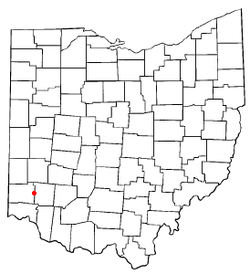 Location of Monroe, Ohio | |
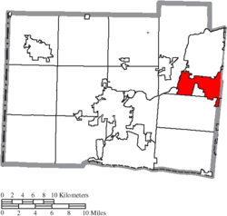 Location of Monroe in Butler County | |
| Coordinates: 39°26′41″N 84°21′51″W | |
| Country | United States |
| State | Ohio |
| Counties | Butler, Warren |
| Government | |
| • Mayor | Robert Routson[1] |
| Area | |
| • Total | 15.89 sq mi (41.15 km2) |
| • Land | 15.87 sq mi (41.10 km2) |
| • Water | 0.02 sq mi (0.05 km2) |
| Elevation | 833 ft (254 m) |
| Population | |
| • Total | 12,442 |
| • Estimate (2019[5]) | 14,015 |
| • Density | 784.0/sq mi (302.7/km2) |
| Time zone | UTC-5 (Eastern (EST)) |
| • Summer (DST) | UTC-4 (EDT) |
| ZIP codes | 45050, 45073, 45099 |
| Area code(s) | 513 |
| FIPS code | 39-51310[6] |
| GNIS feature ID | 1061157[3] |
| Website | City website |
History
Monroe was laid out in 1817 on the Dayton and Cincinnati pike.[7] The city is named for President James Monroe, fifth President of the United States.[8]
In the early 1830s, Monroe contained one store and 119 inhabitants.[9]
Geography
Monroe is located at 39°26′41″N 84°21′51″W (39.444658, −84.364044).[10]
According to the United States Census Bureau, the city has a total area of 15.89 square miles (41.15 km2), of which 15.87 square miles (41.10 km2) is land and 0.02 square miles (0.05 km2) is water.[2]
Demographics
| Historical population | |||
|---|---|---|---|
| Census | Pop. | %± | |
| 1850 | 198 | — | |
| 1870 | 324 | — | |
| 1880 | 365 | 12.7% | |
| 1910 | 255 | — | |
| 1920 | 266 | 4.3% | |
| 1930 | 285 | 7.1% | |
| 1940 | 307 | 7.7% | |
| 1950 | 360 | 17.3% | |
| 1960 | 2,193 | 509.2% | |
| 1970 | 3,492 | 59.2% | |
| 1980 | 4,256 | 21.9% | |
| 1990 | 4,490 | 5.5% | |
| 2000 | 7,133 | 58.9% | |
| 2010 | 12,442 | 74.4% | |
| Est. 2019 | 14,015 | [5] | 12.6% |
| Sources:[6][11][12][13][14][15][16][17] | |||
2010 census
As of the census[4] of 2010, there were 12,442 people, 4,649 households, and 3,481 families living in the city. The population density was 784.0 inhabitants per square mile (302.7/km2). There were 4,896 housing units at an average density of 308.5 per square mile (119.1/km2). The racial makeup of the city was 92.6% White, 3.7% African American, 0.2% Native American, 1.7% Asian, 0.7% from other races, and 1.3% from two or more races. Hispanic or Latino of any race were 1.8% of the population.
There were 4,649 households of which 39.2% had children under the age of 18 living with them, 61.6% were married couples living together, 8.8% had a female householder with no husband present, 4.5% had a male householder with no wife present, and 25.1% were non-families. 21.3% of all households were made up of individuals and 10.1% had someone living alone who was 65 years of age or older. The average household size was 2.63 and the average family size was 3.07.
The median age in the city was 36.9 years. 27% of residents were under the age of 18; 5.9% were between the ages of 18 and 24; 29.7% were from 25 to 44; 23.1% were from 45 to 64; and 14.3% were 65 years of age or older. The gender makeup of the city was 48.8% male and 51.2% female.
2000 census
As of the census[6] of 2000, there were 7,133 people, 2,685 households, and 2,040 families living in the city. The population density was 459.9 people per square mile (177.6/km²). There were 2,822 housing units at an average density of 182.0 per square mile (70.3/km²). The racial makeup of the city was 97.15% White, 1.42% African American, 0.10% Native American, 0.34% Asian, 0.22% from other races, and 0.77% from two or more races. Hispanic or Latino of any race were 0.64% of the population.
There were 2,685 households out of which 32.4% had children under the age of 18 living with them, 65.1% were married couples living together, 6.9% had a female householder with no husband present, and 24.0% were non-families. 20.3% of all households were made up of individuals and 9.3% had someone living alone who was 65 years of age or older. The average household size was 2.52 and the average family size was 2.91.
In the city the population was spread out with 22.8% under the age of 18, 6.5% from 18 to 24, 29.1% from 25 to 44, 22.6% from 45 to 64, and 19.0% who were 65 years of age or older. The median age was 40 years. For every 100 females, there were 91.7 males. For every 100 females age 18 and over, there were 88.3 males.
The median income for a household in the city was $56,012, and the median income for a family was $62,528. Males had a median income of $44,864 versus $27,385 for females. The per capita income for the city was $24,735. About 1.0% of families and 1.9% of the population were below the poverty line, including 0.4% of those under age 18 and 2.1% of those age 65 or over.
Schools and utilities
Most of the city is in the Monroe Local School District with some falling in the Lakota School District. Telephone service is provided through the Monroe, Middletown, and Mason exchanges. Mail is delivered through the Monroe, Middletown, and Lebanon post offices. There is both a police station and a fire station on the main road.
Tourism
- Lux Mundi statue, located at the former site of the King of Kings statue (also known as "Touchdown Jesus" and "Big Butter Jesus") which was struck by lightning in 2010 and destroyed by fire.
- Traders World Flea Market
- Treasure Aisles (formerly Turtlecreek Flea Market)
- Cincinnati Premium Outlets
Notable person
- Chase Crawford, actor and producer
References
- "City & Village Information". Butler County Engineer's Office. Retrieved 3 June 2018.
- "US Gazetteer files 2010". United States Census Bureau. Archived from the original on 2013-04-01. Retrieved 2013-01-06.
- "US Board on Geographic Names". United States Geological Survey. 2007-10-25. Retrieved 2008-01-31.
- "U.S. Census website". United States Census Bureau. Retrieved 2013-01-06.
- "Population and Housing Unit Estimates". Retrieved May 21, 2020.
- "U.S. Census website". United States Census Bureau. Retrieved 2008-01-31.
- Bartlow, Bert Surene (1905). Centennial History of Butler County, Ohio. B. F. Bowen. p. 340.
- Overman, William Daniel (1958). Ohio Town Names. Akron, OH: Atlantic Press. p. 90.
- Kilbourn, John (1833). The Ohio Gazetteer, or, a Topographical Dictionary. Scott and Wright. pp. 321. Retrieved 12 December 2013.
- "US Gazetteer files: 2010, 2000, and 1990". United States Census Bureau. 2011-02-12. Retrieved 2011-04-23.
- "Population of Civil Divisions Less than Counties" (PDF). Statistics of the Population of the United States at the Ninth Census. U.S. Census Bureau. 1870. Retrieved 24 April 2020.
- "Population of Civil Divisions Less than Counties" (PDF). Statistics of the Population of the United States at the Tenth Census. U.S. Census Bureau. 1880. Retrieved 28 November 2013.
- "Population: Ohio" (PDF). 1910 U.S. Census. U.S. Census Bureau. Retrieved 28 November 2013.
- "Population: Ohio" (PDF). 1930 US Census. U.S. Census Bureau. Retrieved 28 November 2013.
- "Number of Inhabitants: Ohio" (PDF). 18th Census of the United States. U.S. Census Bureau. 1960. Retrieved 24 April 2020.
- "Ohio: Population and Housing Unit Counts" (PDF). U.S. Census Bureau. Retrieved 22 November 2013.
- "Incorporated Places and Minor Civil Divisions Datasets: Subcounty Population Estimates: April 1, 2010 to July 1, 2012". U.S. Census Bureau. Archived from the original on 11 June 2013. Retrieved 25 November 2013.
- Jim Blount. The 1900s: 100 Years In the History of Butler County, Ohio. Hamilton, Ohio: Past Present Press, 2000.
- Butler County Engineer's Office. Butler County Official Transportation Map, 2003. Fairfield Township, Butler County, Ohio: The Office, 2003.
- A History and Biographical Cyclopaedia of Butler County, Ohio with Illustrations and Sketches of Its Representative Men and Pioneers. Cincinnati, Ohio: Western Biographical Publishing Company, 1882.
- Ohio Secretary of State. The Ohio municipal and township roster, 2002–2003. Columbus, Ohio: The Secretary, 2003.
- Marcia McCartt. "Images of America; Monroe." Arcadia Publishing, 2009.
External links
- City website
- Main Street Monroe
- Monroe Observer
- History of Monroe
- Monroe Historical Society
- 45050 Watch
Municipalities and communities of Butler County, Ohio, United States | ||
|---|---|---|
| Cities |
|  Map of Ohio highlighting Butler County |
| Villages | ||
| Townships | ||
| CDPs | ||
| Unincorporated communities | ||
| Footnotes | ‡This populated place also has portions in an adjacent county or counties | |
Municipalities and communities of Warren County, Ohio, United States | ||
|---|---|---|
| Cities |
|  Map of Ohio highlighting Warren County |
| Villages | ||
| Townships | ||
| CDPs | ||
| Unincorporated communities |
| |
| Ghost towns | ||
| Footnotes | ‡This populated place also has portions in an adjacent county or counties | |
| Authority control |
|
|---|