Four Bridges, Ohio
Four Bridges is a census-designated place (CDP) in Liberty Township, Butler County, Ohio, United States. The population was 2,919 at the 2010 census.[3]
Four Bridges, Ohio | |
|---|---|
 Four Bridges | |
| Coordinates: 39°22′58″N 84°21′11″W | |
| Country | United States |
| State | Ohio |
| County | Butler |
| Area | |
| • Total | 2.2 sq mi (5.7 km2) |
| • Land | 2.2 sq mi (5.7 km2) |
| • Water | 0.0 sq mi (0.0 km2) |
| Elevation | 850 ft (260 m) |
| Population (2010) | |
| • Total | 2,919 |
| • Density | 1,330/sq mi (513.6/km2) |
| Time zone | UTC-5 (Eastern (EST)) |
| • Summer (DST) | UTC-4 (EDT) |
| FIPS code | 39-28058[2] |
| GNIS feature ID | 2584362[1] |
Geography
Four Bridges is located along the eastern border of Butler County, in the southeast part of Liberty Township. It is bordered to the south by West Chester Township and to the east by the city of Mason in Warren County. Four Bridges consists primarily of housing developments around two golf courses, Four Bridges Country Club and Green Crest Golf Club.
Interstate 75 forms the western edge of the CDP, with access from Exit 24 (Liberty Way). Downtown Cincinnati is 24 miles (39 km) to the south, and Dayton is 30 miles (48 km) to the north.
According to the United States Census Bureau, the Four Bridges CDP has a total area of 2.2 square miles (5.7 km2), all land.[3]
References
- "US Board on Geographic Names". United States Geological Survey. 2007-10-25. Retrieved 2008-01-31.
- "U.S. Census website". United States Census Bureau. Retrieved 2008-01-31.
- "Geographic Identifiers: 2010 Demographic Profile Data (G001): Four Bridges CDP, Ohio". U.S. Census Bureau, American Factfinder. Archived from the original on February 12, 2020. Retrieved February 21, 2014.
External links
Municipalities and communities of Butler County, Ohio, United States | ||
|---|---|---|
| Cities |
| 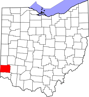 Map of Ohio highlighting Butler County |
| Villages | ||
| Townships | ||
| CDPs | ||
| Unincorporated communities | ||
| Footnotes | ‡This populated place also has portions in an adjacent county or counties | |