Lapai
Lapai is a Local Government Area in Niger State, Nigeria, adjoining the Federal Capital Territory. Its headquarters are in the town of Lapai on the A124 highway in the west of the area at 9°03′00″N 6°34′00″E.
Lapai | |
|---|---|
LGA and town | |
 Lapai Location in Nigeria | |
| Coordinates: 8°49′N 6°41′E | |
| Country | |
| State | Niger State |
| Government | |
| • Local Government Chairman and the Head of the Local Government Council | Abdulkadir A. Umar |
| • Etsu | Umaru Bago Tafida |
| Area | |
| • Total | 3,051 km2 (1,178 sq mi) |
| Population (2006 census) | |
| • Total | 110,127 |
| Time zone | UTC+1 (WAT) |
| 3-digit postal code prefix | 911 |
| ISO 3166 code | NG.NI.LP |
It has an area of 3,051 km² and a population of 110,127 at the 2006 census. The area is roughly coterminous with the Lapai Emirate.
The postal code of the area is 911.[1]
References
- "Post Offices- with map of LGA". NIPOST. Archived from the original on 2012-11-26. Retrieved 2009-10-20.
State capital: Minna | ||
| Local Government Areas | 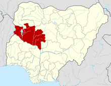 | |
This article is issued from Wikipedia. The text is licensed under Creative Commons - Attribution - Sharealike. Additional terms may apply for the media files.