Agaie
Agaie is a Local Government Area in Niger State, Nigeria. Its headquarters are in the town of Agaie on the A124 highway.
Agaie Garin Mallam Babba Farin Kasa | |
|---|---|
LGA and town | |
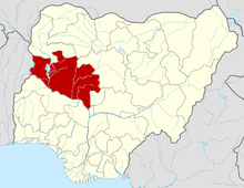
 Agaie Location in Nigeria | |
| Coordinates: 9°01′N 6°19′E | |
| Country | |
| State | Niger State |
| Government | |
| • Local Government Chairman and the Head of the Local Government Council | Captain. Hassan Baro |
| • Emir | Alhaji Yusuf Nuhu |
| Area | |
| • Total | 1,903 km2 (735 sq mi) |
| Population (2006 census) | |
| • Total | 132,907 |
| Time zone | UTC+1 (WAT) |
| 3-digit postal code prefix | 911 |
| ISO 3166 code | NG.NI.AA |
It has an area of 1,903 km² and a population of 132,907 at the 2006 census.
The postal code of the area is 911.[1]
History
Agaie was a 19th-century state in present-day Nigeria covering roughly the same land of the present LGA. It was originally inhabited by Nupe people, but became an emirate and part of the Fulani Empire in 1822, after Fulani mercenaries intervened in the Nupe civil wars. In the early 20th century, the land became a part of the British Empire.The Etsu nupe Agaie is Alhaji Yusuf Nuhu [2]
References
- "Post Offices- with map of LGA". NIPOST. Archived from the original on 7 October 2009. Retrieved 2009-10-20.
- "The AGAIE EMIRATE". Nuhu Lafarma (Education) Foundation. Archived from the original on 2011-04-16. Retrieved 2010-09-01.
This article is issued from Wikipedia. The text is licensed under Creative Commons - Attribution - Sharealike. Additional terms may apply for the media files.