Mescalero, New Mexico
Mescalero is a census-designated place (CDP) in Otero County, New Mexico, United States, located on the Mescalero Apache Reservation. The population was 1,338 at the 2010 census.
Mescalero, New Mexico | |
|---|---|
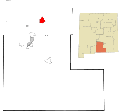 Location of Mescalero, New Mexico | |
 Mescalero Location in the United States  Mescalero Mescalero (the United States) | |
| Coordinates: 33°9′27″N 105°46′50″W | |
| Country | |
| State | |
| County | Otero |
| Area | |
| • Total | 17.9 sq mi (46.3 km2) |
| • Land | 17.9 sq mi (46.3 km2) |
| • Water | 0.0 sq mi (0.0 km2) |
| Elevation | 6,611 ft (2,015 m) |
| Population (2010) | |
| • Total | 1,338 |
| • Density | 68.9/sq mi (26.6/km2) |
| Time zone | UTC-7 (Mountain (MST)) |
| • Summer (DST) | UTC-6 (MDT) |
| ZIP code | 88340 |
| Area code(s) | 575 |
| FIPS code | 35-47920 |
| GNIS feature ID | 0923626 |
History
The settlement was originally called Blazer's Mill, the location of a famous gunfight during the Lincoln County War.[1]
Geography
Mescalero is located at 33°9′27″N 105°46′50″W (33.157440, -105.780482).[2]
According to the United States Census Bureau, the CDP has a total area of 17.9 square miles (46 km2).17.9 square miles (46.3 km²) of it is land and none of the area is covered with water.
Demographics
At the 2010 census there were 1,338 people, 404 households, and 283 families in the CDP. The population density was 68.9 people per square mile (26.6/km²). There were 373 housing units at an average density of 20.9 per square mile (8.1/km²). The racial makeup of the CDP was 4.06% White, 0.16% African American, 90.59% Native American, 0.08% Asian, 0.08% Pacific Islander, 2.27% from other races, and 2.76% from two or more races. Hispanic or Latino of any race were 8.68%.[3]
Of the 351 households 49.9% had children under the age of 18 living with them, 40.5% were married couples living together, 33.3% had a female householder with no husband present, and 20.2% were non-families. 16.2% of households were one person and 2.8% were one person aged 65 or older. The average household size was 3.50 and the average family size was 3.88.
The age distribution was 38.4% under the age of 18, 12.0% from 18 to 24, 28.8% from 25 to 44, 16.3% from 45 to 64, and 4.5% 65 or older. The median age was 25 years. For every 100 females, there were 93.9 males. For every 100 females age 18 and over, there were 88.8 males.
The median household income was $22,353 and the median family income was $22,969. Males had a median income of $23,125 versus $20,573 for females. The per capita income for the CDP was $8,554. About 34.5% of families and 39.0% of the population were below the poverty line, including 40.7% of those under age 18 and 34.0% of those age 65 or over.
References
- Caldwell, pg. 101
- "US Gazetteer files: 2010, 2000, and 1990". United States Census Bureau. 2011-02-12. Retrieved 2011-04-23.
- "U.S. Census website". United States Census Bureau. Retrieved 2008-01-31.
- Caldwell, C.R. (2008). Dead right: the Lincoln County war. self published. ISBN 0-615-17152-4.
| Wikimedia Commons has media related to Mescalero, New Mexico. |
Municipalities and communities of Otero County, New Mexico, United States | ||
|---|---|---|
| City | 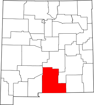 Map of New Mexico highlighting Otero County | |
| Villages | ||
| CDPs | ||
| Other unincorporated communities | ||
| Indian reservation |
| |
| Footnotes | ‡This populated place also has portions in an adjacent county or counties | |