Memphrémagog Regional County Municipality
Memphrémagog is a regional county municipality in the Estrie region of Quebec, Canada.
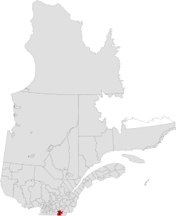
Memphrémagog | |
|---|---|
 | |
| Coordinates: 45°16′N 72°05′W[1] | |
| Country | |
| Province | |
| Region | Estrie |
| Effective | January 1, 1982 |
| County seat | Magog |
| Government | |
| • Type | Prefecture |
| • Prefect | Jacques Demers |
| Area | |
| • Total | 1,449.00 km2 (559.46 sq mi) |
| • Land | 1,319.29 km2 (509.38 sq mi) |
| Population (2016)[3] | |
| • Total | 50,415 |
| • Density | 38.2/km2 (99/sq mi) |
| • Change 2011-2016 | |
| • Dwellings | 30,430 |
| Time zone | UTC−5 (EST) |
| • Summer (DST) | UTC−4 (EDT) |
| Area code(s) | 819 |
| Website | www.mrc memphremagog.com |
History
After the signing of the Treaty of Paris on September 3, 1783, the American Revolutionary War ended. the state of Vermont was established in 1791. The border of Lower Canada was then defined at approximately 45 degrees north latitude.[4][5] The territory immediately adjacent to it became part of Quebec in 1848.
Subdivisions
There are 17 subdivisions within the RCM:[2]
|
|
|
|
Demographics
Population
| Canada census – Memphrémagog Regional County Municipality community profile | |||
|---|---|---|---|
| 2016 | 2011 | 2006 | |
| Population: | 50,415 (+3.8% from 2011) | 48,551 (+7.2% from 2006) | 45,310 (+7.2% from 2001) |
| Land area: | 1,319.29 km2 (509.38 sq mi) | 1,320.96 km2 (510.03 sq mi) | 1,318.74 km2 (509.17 sq mi) |
| Population density: | 38.2/km2 (99/sq mi) | 36.8/km2 (95/sq mi) | 34.4/km2 (89/sq mi) |
| Median age: | 51.6 (M: 50.9, F: 52.1) | 48.8 (M: 48.4, F: 49.3) | 45.8 (M: 45.4, F: 46.2) |
| Total private dwellings: | 30,430 | 28,760 | 26,742 |
| Median household income: | $58,045 | $49,541 | $44,338 |
| References: 2016[6] 2011[7] 2006[8] earlier[9] | |||
| Historical Census Data - Memphrémagog Regional County Municipality, Quebec | |||||||||||||||||||||||||||||||
|---|---|---|---|---|---|---|---|---|---|---|---|---|---|---|---|---|---|---|---|---|---|---|---|---|---|---|---|---|---|---|---|
|
| ||||||||||||||||||||||||||||||
| [10][3] (A) adjusted figures due to boundary changes. | |||||||||||||||||||||||||||||||
Language
| Canada Census Mother Tongue - Memphrémagog Regional County Municipality, Quebec[10][3] | ||||||||||||||||||
|---|---|---|---|---|---|---|---|---|---|---|---|---|---|---|---|---|---|---|
| Census | Total | French |
English |
French & English |
Other | |||||||||||||
| Year | Responses | Count | Trend | Pop % | Count | Trend | Pop % | Count | Trend | Pop % | Count | Trend | Pop % | |||||
2016 |
49,585 |
41,325 | 83.34% | 6,675 | 13.46% | 570 | 1.1% | 915 | 1.84% | |||||||||
2011 |
47,940 |
39,455 | 82.30% | 7,155 | 14.92% | 585 | 1.22% | 745 | 1.55% | |||||||||
2006 |
44,745 |
35,645 | 79.66% | 7,785 | 17.40% | 325 | 0.73% | 990 | 2.21% | |||||||||
2001 |
41,195 |
32,215 | 78.20% | 7,860 | 19.08% | 475 | 1.15% | 645 | 1.57% | |||||||||
1996 |
37,830 |
29,175 | n/a | 77.12% | 7,715 | n/a | 20.39% | 450 | n/a | 1.19% | 490 | n/a | 1.30% | |||||
Transportation
Access Routes
Highways and numbered routes that run through the municipality, including external routes that start or finish at the county border:[11]
See also
References
- Reference number 141054 of the Commission de toponymie du Québec (in French)
- "Ministère des Affaires municipales, des Régions et de l'Occupation du territoire: Memphrémagog Regional County Municipality". Archived from the original on 2014-07-23. Retrieved 2012-03-11.
- "Census Profile, 2016 Census: Memphrémagog, Municipalité régionale de comté [Census division], Quebec". Statistics Canada. Retrieved December 4, 2019.
- Van Zandt, Franklin K. Boundaries of the United States and the Several States. Geological Survey Professional Paper 909. Washington, DC; Government Printing Office, 1976. The Standard Compilation for its subject. P. 12.
- Parry, Clive, ed. Consolidated Treaty Series. 231 Volumes. Dobbs Ferry, New York City; Oceana Publications, 1969-1981. Volume 48; pp. 481; 487; 491-492.
- "2016 Community Profiles". 2016 Canadian Census. Statistics Canada. February 21, 2017. Retrieved 2019-12-04.
- "2011 Community Profiles". 2011 Canadian Census. Statistics Canada. July 5, 2013. Retrieved 2014-02-27.
- "2006 Community Profiles". 2006 Canadian Census. Statistics Canada. March 30, 2011. Retrieved 2014-02-27.
- "2001 Community Profiles". 2001 Canadian Census. Statistics Canada. February 17, 2012.
- Statistics Canada: 1996, 2001, 2006, 2011 census
- Official Transport Quebec Road Map
External links
- Official tourist site for Memphrémagog
- Dix, John Ross. A hand book for Lake Memphremagog, with route list (tourist handbook from 1859). Boston : Printed by Evans & Co., 1859. Accessed July 18, 2012, in PDF format.
Adjacent Counties & Equivalent Territories | |
|---|---|
| Regional county municipalities and equivalent territories | |
|---|---|
| Municipalities |
|
This article is issued from Wikipedia. The text is licensed under Creative Commons - Attribution - Sharealike. Additional terms may apply for the media files.