Mayronnes
Mayronnes is a commune in the Aude department in southern France.
Mayronnes | |
|---|---|
.svg.png) Coat of arms | |
Location of Mayronnes 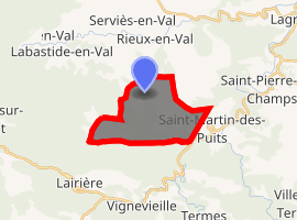
| |
 Mayronnes  Mayronnes | |
| Coordinates: 43°03′27″N 2°31′33″E | |
| Country | France |
| Region | Occitanie |
| Department | Aude |
| Arrondissement | Carcassonne |
| Canton | La Montagne d'Alaric |
| Intercommunality | Canton of Lagrasse |
| Government | |
| • Mayor (2008–2014) | Claude Joubert |
| Area 1 | 11.86 km2 (4.58 sq mi) |
| Population (2017-01-01)[1] | 35 |
| • Density | 3.0/km2 (7.6/sq mi) |
| Time zone | UTC+01:00 (CET) |
| • Summer (DST) | UTC+02:00 (CEST) |
| INSEE/Postal code | 11227 /11220 |
| Elevation | 192–704 m (630–2,310 ft) (avg. 203 m or 666 ft) |
| 1 French Land Register data, which excludes lakes, ponds, glaciers > 1 km2 (0.386 sq mi or 247 acres) and river estuaries. | |
Geography
The commune is located in the Corbières Massif.
The village lies in the northwestern part of the commune, on the left bank of the Madourneille brook, a tributary of the Orbieu, which forms part of the commune's southeastern border.
Population
| Historical population | ||
|---|---|---|
| Year | Pop. | ±% |
| 1962 | 17 | — |
| 1968 | 24 | +41.2% |
| 1975 | 46 | +91.7% |
| 1982 | 38 | −17.4% |
| 1990 | 40 | +5.3% |
| 1999 | 40 | +0.0% |
| 2008 | 36 | −10.0% |
References
- "Populations légales 2017". INSEE. Retrieved 6 January 2020.
| Wikimedia Commons has media related to Mayronnes. |
| Authority control |
|
|---|
This article is issued from Wikipedia. The text is licensed under Creative Commons - Attribution - Sharealike. Additional terms may apply for the media files.