Corbières Massif
The Corbières Massif (Catalan: Corberes; French: Massif des Corbières) is a mountain range in the Pre-Pyrenees. It is the only true foothill of the Pyrenees on their northern side.[1]
| Corbières Range | |
|---|---|
| Massif des Corbières | |
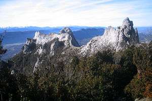 Puig de Bugarag, highest point in the range | |
| Highest point | |
| Elevation | 1,230 m (4,040 ft) |
| Coordinates | 42°50′27″N 2°45′8″E |
| Geography | |
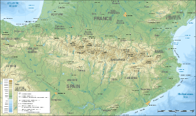 Corbières Range Location in the Pre-Pyrenees area | |
| Location | Languedoc-Roussillon, France |
| Parent range | Pre-Pyrenees |
| Climbing | |
| Easiest route | Drive from Villerouge-Termenès, Mouthoumet, Caudiès-de-Fenouillèdes, Saint-Paul-de-Fenouillet, Quillan, Espéraza, Rennes-les-Bains or Limoux |
Geography
The Corbières are a mountain region in the Languedoc-Roussillon in southeastern France, located in the departements of Aude and Pyrénées-Orientales.
The River Aude borders the Corbières to the west and north, and the River Agly more or less to the south. The eastern border is the Mediterranean Sea. The eastern part of the Corbières bordering the Mediterranean and the Etangs is also known as the Corbières Maritimes, and has a special kind of climate and typical vegetation (thermo-mediterranean vegetation) which cannot be found in the western part.
The highest point of the Corbières is the 1,230 m high Pic de Bugarach.[2]
 Map of the Corbières Massif
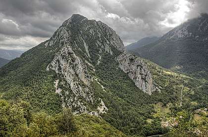 Serre de la Quière, Corbières
See also
References
- Pirineus-Prepirineus Archived July 23, 2008, at the Wayback Machine
- Christophe Neff : Les Corbières maritimes – forment-elles un étage de végétation méditerranéenne thermophile masqué par la pression humaine ? In: Eric Fouache (Edit.): The Mediterranean World Environment and History. IAG Working Group on Geo-archeology, Symposium Proceedings. Environmental Dynamics and History in Mediterranean Areas, Paris, Université de Paris – Sorbonne 24 – 26 avril 2002. Paris, 2003, 191 – 202, (Elsevier France, ISBN 2-84299-452-3).