Mayoyao, Ifugao
Mayoyao, officially the Municipality of Mayoyao is a 4th class municipality in the province of Ifugao, Philippines. According to the 2015 census, it has a population of 17,331 people.[3]
Mayoyao | |
|---|---|
| Municipality of Mayoyao | |
 Seal | |
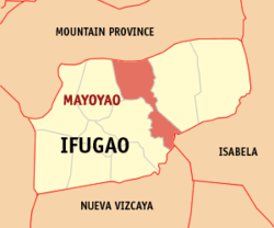 Map of Ifugao with Mayoyao highlighted | |
| |
.svg.png) Mayoyao Location within the Philippines | |
| Coordinates: 16°58′N 121°13′E | |
| Country | |
| Region | Cordillera Administrative Region (CAR) |
| Province | Ifugao |
| District | Lone District |
| Barangays | 27 (see Barangays) |
| Government | |
| • Type | Sangguniang Bayan |
| • Mayor | Jimmy B. Padchanan Jr. |
| • Vice Mayor | Rudy N. Chilagan Jr. |
| • Congressman | Solomon R. Chungalao |
| • Electorate | 8,008 voters (2019) |
| Area | |
| • Total | 238.05 km2 (91.91 sq mi) |
| Elevation | 1,073.9 m (3,523.3 ft) |
| Population (2015 census)[3] | |
| • Total | 17,331 |
| • Density | 73/km2 (190/sq mi) |
| • Households | 4,071 |
| Economy | |
| • Income class | 4th municipal income class |
| • Poverty incidence | 29.58% (2015)[4] |
| • Revenue (₱) | 79,599,407.61 (2016) |
| Time zone | UTC+8 (PST) |
| ZIP code | 3602 |
| PSGC | |
| IDD : area code | +63 (0)74 |
| Climate type | tropical rainforest climate |
| Native languages | Ifugao language Tuwali language Ilocano Tagalog |
Barangays
Mayoyao is politically subdivided into 27 barangays. [2]
- Aduyongan
- Alimit
- Ayangan
- Balangbang
- Banao
- Banhal
- Bongan
- Buninan
- Chaya
- Chumang
- Guinihon
- Inwaloy
- Langayan
- Liwo
- Maga
- Magulon
- Mapawoy
- Mayoyao Proper
- Mongol
- Nalbu
- Nattum
- Palaad
- Poblacion
- Talboc
- Tulaed
- Bato-Alatbang
- Epeng
Climate
| Climate data for Mayoyao, Ifugao | |||||||||||||
|---|---|---|---|---|---|---|---|---|---|---|---|---|---|
| Month | Jan | Feb | Mar | Apr | May | Jun | Jul | Aug | Sep | Oct | Nov | Dec | Year |
| Average high °C (°F) | 19 (66) |
21 (70) |
23 (73) |
26 (79) |
26 (79) |
26 (79) |
25 (77) |
24 (75) |
24 (75) |
23 (73) |
22 (72) |
20 (68) |
23 (74) |
| Average low °C (°F) | 14 (57) |
15 (59) |
15 (59) |
17 (63) |
18 (64) |
18 (64) |
18 (64) |
18 (64) |
18 (64) |
17 (63) |
17 (63) |
15 (59) |
17 (62) |
| Average precipitation mm (inches) | 103 (4.1) |
73 (2.9) |
49 (1.9) |
38 (1.5) |
141 (5.6) |
144 (5.7) |
172 (6.8) |
181 (7.1) |
155 (6.1) |
148 (5.8) |
147 (5.8) |
208 (8.2) |
1,559 (61.5) |
| Average rainy days | 17.1 | 12.8 | 11.0 | 9.6 | 18.9 | 21.5 | 22.5 | 24.5 | 21.7 | 16.1 | 17.1 | 20.5 | 213.3 |
| Source: Meteoblue [5] | |||||||||||||
History
Battle of Mayoyao Ridge
From July 26, to August 9, 1945, Filipino soldiers under the command of Donald Blackburn, supported by airstrikes by Army Air Forces, captured the Japanese stronghold of Mayoyao, Ifugao in Northern Luzon.[6]:305–320
The memorial or historical marker, located at Mount Nagchajan in Mayoyao, Ifugao, marks the site of the “Battle of Mayoyao Ridge”. The battle was fought between the Japanese Imperial forces and the combined Filipino and American soldiers, towards the end of World War II. The result was key to the eventual surrender of General Yamashita at Kiangan, Ifugao.
Demographics
| Population census of Mayoyao | ||
|---|---|---|
| Year | Pop. | ±% p.a. |
| 1918 | 10,226 | — |
| 1939 | 9,184 | −0.51% |
| 1948 | 8,093 | −1.40% |
| 1960 | 15,028 | +5.29% |
| 1970 | 20,189 | +2.99% |
| 1975 | 24,422 | +3.89% |
| 1980 | 24,022 | −0.33% |
| 1990 | 23,942 | −0.03% |
| 1995 | 14,733 | −8.70% |
| 2000 | 14,191 | −0.80% |
| 2007 | 16,722 | +2.29% |
| 2010 | 16,413 | −0.68% |
| 2015 | 17,331 | +1.04% |
| Source: Philippine Statistics Authority[3][7][8][9] | ||
In the 2015 census, the population of Mayoyao was 17,331 people,[3] with a density of 73 inhabitants per square kilometre or 190 inhabitants per square mile.
References
- "Municipality". Quezon City, Philippines: Department of the Interior and Local Government. Retrieved 31 May 2013.
- "Province: Ifugao". PSGC Interactive. Quezon City, Philippines: Philippine Statistics Authority. Retrieved 12 November 2016.
- Census of Population (2015). "Cordillera Administrative Region (CAR)". Total Population by Province, City, Municipality and Barangay. PSA. Retrieved 20 June 2016.
- "PSA releases the 2015 Municipal and City Level Poverty Estimates". Quezon City, Philippines. Retrieved 12 October 2019.
- "Mayoyao: Average Temperatures and Rainfall". Meteoblue. Retrieved 8 March 2020.
- Harkins, P., 1956, Blackburn's Headhunters, London: Cassell & Co. LTD
- Census of Population and Housing (2010). "Cordillera Administrative Region (CAR)". Total Population by Province, City, Municipality and Barangay. NSO. Retrieved 29 June 2016.
- Censuses of Population (1903–2007). "Cordillera Administrative Region (CAR)". Table 1. Population Enumerated in Various Censuses by Province/Highly Urbanized City: 1903 to 2007. NSO.
- "Province of Ifugao". Municipality Population Data. Local Water Utilities Administration Research Division. Retrieved 17 December 2016.
External links
- Mayoyao Profile at PhilAtlas.com
- Mayoyao Rice Terraces
- Philippine Standard Geographic Code
- Philippine Census Information
- Local Governance Performance Management System
- Heritage Town: Mayoyao, Ifugao
- Chasing Waterfalls: Tenogtog Falls
- Chasing Waterfalls: Manhencha Falls
Places adjacent to Mayoyao, Ifugao | ||||||||||
|---|---|---|---|---|---|---|---|---|---|---|
| ||||||||||