Hungduan, Ifugao
Hungduan, officially the Municipality of Hungduan is a 4th class municipality in the province of Ifugao, Philippines. According to the 2015 census, it has a population of 9,400 people.[3]
Hungduan | |
|---|---|
| Municipality of Hungduan | |
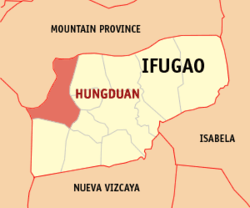 Map of Ifugao with Hungduan highlighted | |
| |
.svg.png) Hungduan Location within the Philippines | |
| Coordinates: 16°50′N 121°00′E | |
| Country | |
| Region | Cordillera Administrative Region (CAR) |
| Province | Ifugao |
| District | Lone District |
| Barangays | 9 (see Barangays) |
| Government | |
| • Type | Sangguniang Bayan |
| • Mayor | Casan P. Dumulag |
| • Vice Mayor | Lucas A. Bugatti |
| • Congressman | Solomon R. Chungalao |
| • Electorate | 6,293 voters (2019) |
| Area | |
| • Total | 260.30 km2 (100.50 sq mi) |
| Elevation | 1,099.2 m (3,606.3 ft) |
| Population (2015 census)[3] | |
| • Total | 9,400 |
| • Density | 36/km2 (94/sq mi) |
| • Households | 1,939 |
| Economy | |
| • Income class | 4th municipal income class |
| • Poverty incidence | 27.02% (2015)[4] |
| • Revenue (₱) | 71,484,065.62 (2016) |
| Time zone | UTC+8 (PST) |
| ZIP code | 3603 |
| PSGC | |
| IDD : area code | +63 (0)74 |
| Climate type | tropical rainforest climate |
| Native languages | Ifugao language Kallahan language Tuwali language Ilocano Tagalog |
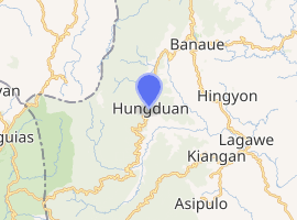
It is bounded on the north-east by the town of Banaue in the east by Hingyon and on the southeast by the town of Kiangan. It borders in the south with the town of Tinoc, Ifugao. On its westside, the town is bordered by the towns of Sabangan and Bauko, Mountain Province.
Barangays
Hungduan is politically subdivided into 9 barangays. [2]
- Abatan
- Bangbang
- Maggok
- Poblacion
- Bokiawan
- Hapao
- Lubo-ong
- Nungulunan
- Ba-ang
Climate
| Climate data for Hungduan, Ifugao | |||||||||||||
|---|---|---|---|---|---|---|---|---|---|---|---|---|---|
| Month | Jan | Feb | Mar | Apr | May | Jun | Jul | Aug | Sep | Oct | Nov | Dec | Year |
| Average high °C (°F) | 21 (70) |
22 (72) |
24 (75) |
25 (77) |
25 (77) |
25 (77) |
24 (75) |
24 (75) |
24 (75) |
24 (75) |
23 (73) |
21 (70) |
24 (74) |
| Average low °C (°F) | 14 (57) |
15 (59) |
16 (61) |
18 (64) |
19 (66) |
19 (66) |
19 (66) |
19 (66) |
19 (66) |
17 (63) |
16 (61) |
15 (59) |
17 (63) |
| Average precipitation mm (inches) | 35 (1.4) |
46 (1.8) |
63 (2.5) |
117 (4.6) |
402 (15.8) |
400 (15.7) |
441 (17.4) |
471 (18.5) |
440 (17.3) |
258 (10.2) |
94 (3.7) |
68 (2.7) |
2,835 (111.6) |
| Average rainy days | 9.9 | 11.1 | 13.9 | 18.9 | 26.0 | 27.3 | 28.9 | 28.5 | 26.1 | 19.7 | 14.5 | 12.8 | 237.6 |
| Source: Meteoblue [5] | |||||||||||||
Demographics
| Population census of Hungduan | ||
|---|---|---|
| Year | Pop. | ±% p.a. |
| 1939 | 12,937 | — |
| 1948 | 3,540 | −13.41% |
| 1960 | 7,603 | +6.58% |
| 1970 | 8,958 | +1.65% |
| 1975 | 12,301 | +6.57% |
| 1980 | 9,857 | −4.33% |
| 1990 | 7,254 | −3.02% |
| 1995 | 9,491 | +5.17% |
| 2000 | 9,380 | −0.25% |
| 2007 | 9,601 | +0.32% |
| 2010 | 9,933 | +1.24% |
| 2015 | 9,400 | −1.04% |
| Source: Philippine Statistics Authority[3][6][7][8] | ||
In the 2015 census, the population of Hungduan was 9,400 people,[3] with a density of 36 inhabitants per square kilometre or 93 inhabitants per square mile.
References
- "Municipality". Quezon City, Philippines: Department of the Interior and Local Government. Retrieved 31 May 2013.
- "Province: Ifugao". PSGC Interactive. Quezon City, Philippines: Philippine Statistics Authority. Retrieved 12 November 2016.
- Census of Population (2015). "Cordillera Administrative Region (CAR)". Total Population by Province, City, Municipality and Barangay. PSA. Retrieved 20 June 2016.
- "PSA releases the 2015 Municipal and City Level Poverty Estimates". Quezon City, Philippines. Retrieved 12 October 2019.
- "Hungduan: Average Temperatures and Rainfall". Meteoblue. Retrieved 8 March 2020.
- Census of Population and Housing (2010). "Cordillera Administrative Region (CAR)". Total Population by Province, City, Municipality and Barangay. NSO. Retrieved 29 June 2016.
- Censuses of Population (1903–2007). "Cordillera Administrative Region (CAR)". Table 1. Population Enumerated in Various Censuses by Province/Highly Urbanized City: 1903 to 2007. NSO.
- "Province of Ifugao". Municipality Population Data. Local Water Utilities Administration Research Division. Retrieved 17 December 2016.
External links
- Hungduan Profile at PhilAtlas.com
- Philippine Standard Geographic Code
- Philippine Census Information
- Local Governance Performance Management System
- Heritage Town: Hungduan, Ifugao
- Chasing Waterfalls: Balentimol Falls
Places adjacent to Hungduan, Ifugao | ||||||||||
|---|---|---|---|---|---|---|---|---|---|---|
| ||||||||||
Lagawe (capital) | |
| Municipalities | |
| Barangays | |
This article is issued from Wikipedia. The text is licensed under Creative Commons - Attribution - Sharealike. Additional terms may apply for the media files.