Alfonso Lista, Ifugao
Alfonso Lista, formerly known as Potia, officially the Municipality of Alfonso Lista is a 3rd class municipality in the province of Ifugao, Philippines. According to the 2015 census, it has a population of 32,119 people.[3]
Alfonso Lista | |
|---|---|
| Municipality of Alfonso Lista | |
 | |
 Seal | |
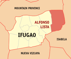 Map of Ifugao with Alfonso Lista highlighted | |
OpenStreetMap 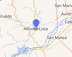
| |
.svg.png) Alfonso Lista Location within the Philippines | |
| Coordinates: 16°55′23″N 121°29′19″E | |
| Country | |
| Region | Cordillera Administrative Region (CAR) |
| Province | Ifugao |
| District | Lone District |
| Barangays | 20 (see Barangays) |
| Government | |
| • Type | Sangguniang Bayan |
| • Mayor | Edralin B. Alipio |
| • Vice Mayor | Agapito B. Dominguez Jr. |
| • Congressman | Solomon R. Chungalao |
| • Electorate | 18,384 voters (2019) |
| Area | |
| • Total | 347.46 km2 (134.16 sq mi) |
| Elevation | 141.5 m (464.2 ft) |
| Population (2015 census)[3] | |
| • Total | 32,119 |
| • Density | 92/km2 (240/sq mi) |
| • Households | 7,138 |
| Economy | |
| • Income class | 3rd municipal income class |
| • Poverty incidence | 20.84% (2015)[4] |
| • Revenue (₱) | 143,179,042.20 (2016) |
| Time zone | UTC+8 (PST) |
| ZIP code | 3608 |
| PSGC | |
| IDD : area code | +63 (0)74 |
| Climate type | tropical rainforest climate |
| Native languages | Ga'dang Ifugao language Tuwali language Ilocano Tagalog |
| Website | www |
History
It was created as the municipal district of Potia in 1955 from the barrios of Potia, Dolowog, San Juan, San Quintin, Cabicalan, Pinto, Busilac, Santa Maria, and Namillangan in the municipal district of Mayaoyao.[5] In 1959 the name was changed to Alfonso Lista to memorialize the first mayor.
Originally organized during the Osmena Commonwealth administration as a part of San Mateo, Isabela, the barangays which presently compose Alfonso Lista were transferred to Mayoyao (then a part of Mountain Province).
Barangays
Alfonso Lista is politically subdivided into 20 barangays. [2]
- Bangar
- Busilac
- Calimag
- Calupaan
- Caragasan
- Dolowog
- Kiling
- Laya
- Little Tadian
- Namnama
- Namillangan
- Ngileb
- Pinto
- Potia
- San Jose
- San Juan
- San Marcos
- San Quintin
- Santa Maria (Poblacion)
- Santo Domingo (Cabicalan)
Climate
| Climate data for Aguinaldo, Ifugao | |||||||||||||
|---|---|---|---|---|---|---|---|---|---|---|---|---|---|
| Month | Jan | Feb | Mar | Apr | May | Jun | Jul | Aug | Sep | Oct | Nov | Dec | Year |
| Average high °C (°F) | 25 (77) |
26 (79) |
28 (82) |
31 (88) |
31 (88) |
31 (88) |
30 (86) |
30 (86) |
30 (86) |
29 (84) |
27 (81) |
25 (77) |
29 (84) |
| Average low °C (°F) | 20 (68) |
20 (68) |
21 (70) |
22 (72) |
23 (73) |
24 (75) |
24 (75) |
24 (75) |
23 (73) |
23 (73) |
22 (72) |
21 (70) |
22 (72) |
| Average precipitation mm (inches) | 103 (4.1) |
73 (2.9) |
49 (1.9) |
38 (1.5) |
141 (5.6) |
144 (5.7) |
172 (6.8) |
181 (7.1) |
155 (6.1) |
148 (5.8) |
147 (5.8) |
208 (8.2) |
1,559 (61.5) |
| Average rainy days | 17.1 | 12.8 | 11.0 | 9.6 | 18.9 | 21.5 | 22.5 | 24.5 | 21.7 | 16.1 | 17.1 | 20.5 | 213.3 |
| Source: Meteoblue [6] | |||||||||||||
Demographics
| Population census of Alfonso Lista | ||
|---|---|---|
| Year | Pop. | ±% p.a. |
| 1960 | 4,343 | — |
| 1970 | 5,796 | +2.92% |
| 1975 | 8,196 | +7.20% |
| 1980 | 11,016 | +6.09% |
| 1990 | 14,816 | +3.01% |
| 1995 | 17,552 | +3.23% |
| 2000 | 21,167 | +4.10% |
| 2007 | 25,323 | +2.50% |
| 2010 | 28,410 | +4.27% |
| 2015 | 32,119 | +2.36% |
| Source: Philippine Statistics Authority[3][7][8][9] | ||
In the 2015 census, the population of Alfonso Lista was 32,119 people,[3] with a density of 92 inhabitants per square kilometre or 240 inhabitants per square mile.
The indigenes are largely Ifugao-speakers, with smaller numbers of Bontoc and Gaddang originating in the surrounding areas.[10] The majority of the population, however, are Ilokano who began farming the area in the 1930s.
See also
- List of renamed cities and municipalities in the Philippines
References
- "Municipality". Quezon City, Philippines: Department of the Interior and Local Government. Retrieved 31 May 2013.
- "Province: Ifugao". PSGC Interactive. Quezon City, Philippines: Philippine Statistics Authority. Retrieved 12 November 2016.
- Census of Population (2015). "Cordillera Administrative Region (CAR)". Total Population by Province, City, Municipality and Barangay. PSA. Retrieved 20 June 2016.
- "PSA releases the 2015 Municipal and City Level Poverty Estimates". Quezon City, Philippines. Retrieved 12 October 2019.
- "An Act Creating the Municipal District of Potia in the Mountain Province". LawPH.com. Archived from the original on 2012-07-09. Retrieved 2011-04-11.
- "Alfonso Lista: Average Temperatures and Rainfall". Meteoblue. Retrieved 8 March 2020.
- Census of Population and Housing (2010). "Cordillera Administrative Region (CAR)". Total Population by Province, City, Municipality and Barangay. NSO. Retrieved 29 June 2016.
- Censuses of Population (1903–2007). "Cordillera Administrative Region (CAR)". Table 1. Population Enumerated in Various Censuses by Province/Highly Urbanized City: 1903 to 2007. NSO.
- "Province of Ifugao". Municipality Population Data. Local Water Utilities Administration Research Division. Retrieved 17 December 2016.
- https://www.dilgcar.com/index.php/2015-07-10-09-25-49/municipality-of-alfonso-lista
External links

- Alfonso Lista Profile at PhilAtlas.com
- Philippine Standard Geographic Code
- Philippine Census Information
- Local Governance Performance Management System
Places adjacent to Alfonso Lista, Ifugao | ||||||||||
|---|---|---|---|---|---|---|---|---|---|---|
| ||||||||||
Lagawe (capital) | |
| Municipalities | |
| Barangays | |