Maxfield, Maine
Maxfield is a town in Penobscot County, Maine, United States. The population was 97 at the 2010 census.[4]
Maxfield, Maine | |
|---|---|
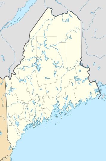 Maxfield, Maine Location within the state of Maine | |
| Coordinates: 45°17′0″N 68°45′8″W | |
| Country | United States |
| State | Maine |
| County | Penobscot |
| Area | |
| • Total | 19.20 sq mi (49.73 km2) |
| • Land | 18.93 sq mi (49.03 km2) |
| • Water | 0.27 sq mi (0.70 km2) |
| Elevation | 226 ft (69 m) |
| Population | |
| • Total | 97 |
| • Estimate (2012[3]) | 103 |
| • Density | 5.1/sq mi (2.0/km2) |
| Time zone | UTC-5 (Eastern (EST)) |
| • Summer (DST) | UTC-4 (EDT) |
| ZIP code | 04453 |
| Area code(s) | 207 |
| FIPS code | 23-44340 |
| GNIS feature ID | 0582586 |
Geography
Maxfield sits along the Piscataquis River.
According to the United States Census Bureau, the town has a total area of 19.20 square miles (49.73 km2), of which, 18.93 square miles (49.03 km2) of it is land and 0.27 square miles (0.70 km2) is water.[1]
History
Maxfield was originally the Brighton Academy grant.
In the early 1890s Maxfield was within the range of a giant (400 pound) wild black bear named "Old Ranger" who was eventually shot and killed by a local hunting party after a lifetime of raiding orchards, and having survived numerous other attempts to do him in. According to a New York Sun obituary of Old Ranger, "the whole of Penobscot County knew the bear, and he defied the entire population."[5]
Demographics
| Historical population | |||
|---|---|---|---|
| Census | Pop. | %± | |
| 1830 | 186 | — | |
| 1840 | 185 | −0.5% | |
| 1850 | 186 | 0.5% | |
| 1860 | 162 | −12.9% | |
| 1870 | 156 | −3.7% | |
| 1880 | 139 | −10.9% | |
| 1890 | 134 | −3.6% | |
| 1900 | 115 | −14.2% | |
| 1910 | 79 | −31.3% | |
| 1920 | 67 | −15.2% | |
| 1930 | 116 | 73.1% | |
| 1940 | 67 | −42.2% | |
| 1950 | 26 | −61.2% | |
| 1960 | 39 | 50.0% | |
| 1970 | 24 | −38.5% | |
| 1980 | 64 | 166.7% | |
| 1990 | 86 | 34.4% | |
| 2000 | 87 | 1.2% | |
| 2010 | 97 | 11.5% | |
| Est. 2014 | 102 | [6] | 5.2% |
| U.S. Decennial Census[7] | |||
2010 census
As of the census[2] of 2010, there were 97 people, 41 households, and 26 families living in the town. The population density was 5.1 inhabitants per square mile (2.0/km2). There were 61 housing units at an average density of 3.2 per square mile (1.2/km2). The racial makeup of the town was 91.8% White, 4.1% Native American, 1.0% Pacific Islander, and 3.1% from two or more races. Hispanic or Latino of any race were 1.0% of the population.
There were 41 households of which 22.0% had children under the age of 18 living with them, 43.9% were married couples living together, 12.2% had a female householder with no husband present, 7.3% had a male householder with no wife present, and 36.6% were non-families. 29.3% of all households were made up of individuals and 12.2% had someone living alone who was 65 years of age or older. The average household size was 2.37 and the average family size was 2.77.
The median age in the town was 40.5 years. 20.6% of residents were under the age of 18; 7.3% were between the ages of 18 and 24; 27.8% were from 25 to 44; 26.8% were from 45 to 64; and 17.5% were 65 years of age or older. The gender makeup of the town was 50.5% male and 49.5% female.
2000 census
As of the census[8] of 2000, there were 87 people, 39 households, and 23 families living in the town. The population density was 4.6 people per square mile (1.8/km²). There were 52 housing units at an average density of 2.7/sq mi (1.1/km²). The racial makeup of the town was 100.00% White.
There were 39 households out of which 25.6% had children under the age of 18 living with them, 51.3% were married couples living together, 10.3% had a female householder with no husband present, and 38.5% were non-families. 25.6% of all households were made up of individuals and 5.1% had someone living alone who was 65 years of age or older. The average household size was 2.23 and the average family size was 2.71.
In the town, the population was spread out with 21.8% under the age of 18, 3.4% from 18 to 24, 28.7% from 25 to 44, 33.3% from 45 to 64, and 12.6% who were 65 years of age or older. The median age was 44 years. For every 100 females, there were 97.7 males. For every 100 females age 18 and over, there were 94.3 males.
See also
References
- "US Gazetteer files 2010". United States Census Bureau. Retrieved 2012-12-16.
- "U.S. Census website". United States Census Bureau. Retrieved 2012-12-16.
- "Population Estimates". United States Census Bureau. Archived from the original on 2013-06-11. Retrieved 2013-07-06.
- "Geographic Identifiers: 2010 Demographic Profile Data (G001): Maxfield town, Penobscot County, Maine". U.S. Census Bureau, American Factfinder. Archived from the original on February 12, 2020. Retrieved November 20, 2012.
- "Bold Old Ranger", New York Sun, reprinted in The Sunday Shield (Ohio), July 17, 1892, p. 9
- "Annual Estimates of the Resident Population for Incorporated Places: April 1, 2010 to July 1, 2014". Archived from the original on May 23, 2015. Retrieved June 4, 2015.
- "Census of Population and Housing". Census.gov. Retrieved June 4, 2015.
- "U.S. Census website". United States Census Bureau. Retrieved 2008-01-31.
Municipalities and communities of Penobscot County, Maine, United States | ||
|---|---|---|
| Cities | 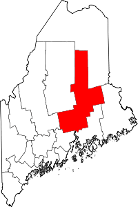 Penobscot County map | |
| Towns |
| |
| Plantations | ||
| Unorganized territories | ||
| CDPs | ||
| Other villages | ||
| Indian reservation | ||