Martelange
Martelange (German: Martelingen, Luxembourgish: Maartel pronounced [ˈmaːtəl] (![]()
Martelange | |
|---|---|
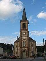 St. Martin's church | |
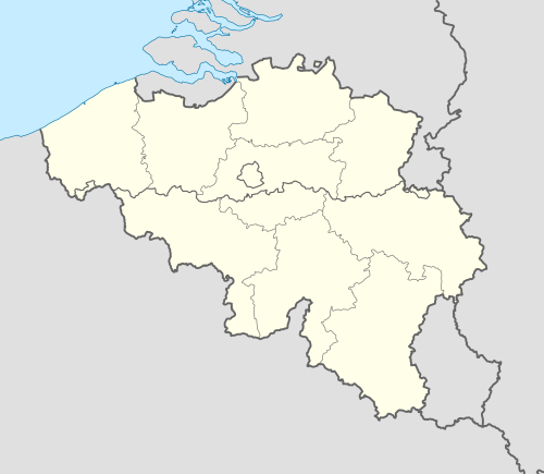 Martelange Location in Belgium
Location of Martelange in Luxembourg province 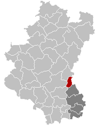 | |
| Coordinates: 49°50′N 05°44′E | |
| Country | Belgium |
| Community | French Community |
| Region | Wallonia |
| Province | Luxembourg |
| Arrondissement | Arlon |
| Government | |
| • Mayor | Daniel Waty |
| • Governing party/ies | UC |
| Area | |
| • Total | 29.67 km2 (11.46 sq mi) |
| Population (2018-01-01)[1] | |
| • Total | 1,820 |
| • Density | 61/km2 (160/sq mi) |
| Postal codes | 6630 |
| Area codes | 063 |
| Website | www.martelange.be |
On 1 January 2007 the municipality, which covers 29.67 km2, had 1,584 inhabitants, giving a population density of 53.4 inhabitants per km². Besides Martelange itself, the municipality includes the population centers of Grumelange and Radelange.
For some 1.8 kilometres (1.1 mi), the N4 Brussels to Arlon road, which passes through the village, forms the border with the Grand Duchy of Luxembourg. Because fuel, tobacco, and alcohol taxes are lower in Luxembourg than in Belgium, the eastern, Luxembourgish side of this stretch of road has become lined with numerous petrol stations and liquor stores.
.jpg)
History
Between 1830 and 1947, the town was a major slate quarrying centre, though the industry has now completely disappeared.
On August 21, 1967, a French tanker lorry containing 45 000 litres of Liquefied petroleum gas suffered from failing brakes while driving downhill. It exploded in the middle of the village, killing 22 people[2] and injuring 54.[3] Dozens of houses were completely destroyed.
References
- "Wettelijke Bevolking per gemeente op 1 januari 2018". Statbel. Retrieved 9 March 2019.
- News bulletin 21/8/1967 (Martelange accident), RTBF
- Martelange: l'horreur et la tristesse il y a 45 ans, La Meuse, 20 August 2012
External links

Municipalities of Luxembourg Province | ||
|---|---|---|
| Arlon |  | |
| Bastogne | ||
| Marche-en-Famenne | ||
| Neufchâteau | ||
| Virton | ||