Attert
Attert (Atert in Luxembourgish, Ater in Walloon) is a Walloon municipality of Belgium located in the province of Luxembourg. On 1 January 2007 the municipality, which covers 70.94 km², had 4,802 inhabitants, giving a population density of 67.7 inhabitants per km².
Attert | |
|---|---|
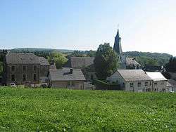 Neighbourhood of St. Stephen's Church | |
 Flag .svg.png) Coat of arms | |
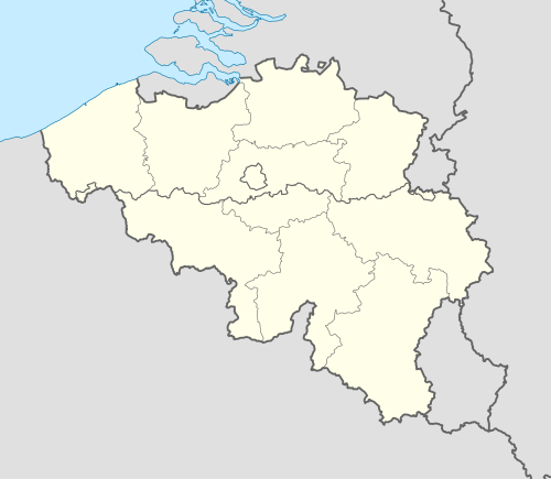 Attert Location in Belgium
Location of Attert in Luxembourg province  | |
| Coordinates: 49°45′N 5°47′E | |
| Country | Belgium |
| Community | French Community |
| Region | Wallonia |
| Province | Luxembourg |
| Arrondissement | Arlon |
| Government | |
| • Mayor | Joseph Arens |
| Area | |
| • Total | 70.94 km2 (27.39 sq mi) |
| Population (2018-01-01)[1] | |
| • Total | 5,537 |
| • Density | 78/km2 (200/sq mi) |
| Postal codes | 6717 |
| Area codes | 063 |
| Website | www.attert.be (in French) |
The municipality consists of the following sub-municipalities: Attert proper, Nobressart, Nothomb, Thiaumont, and Tontelange. Other population centers include:
- Almeroth
- Grendel
- Heinstert
- Lischert
- Lottert
- Louchert
- Luxeroth
- Metzert
- Parette
- Post
- Rodenhoff
- Schadeck
- Schockville
The municipality falls within the Luxembourgish-speaking Arelerland and several street name signs are bilingual.
Sister cities
Attert is twinned with:[2]

.svg.png)


References
- "Wettelijke Bevolking per gemeente op 1 januari 2018". Statbel. Retrieved 9 March 2019.
- Twinning page on official site (in French).
External links

Municipalities of Luxembourg Province | ||
|---|---|---|
| Arlon | 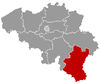 | |
| Bastogne | ||
| Marche-en-Famenne | ||
| Neufchâteau | ||
| Virton | ||
This article is issued from Wikipedia. The text is licensed under Creative Commons - Attribution - Sharealike. Additional terms may apply for the media files.