Manatee Airport
Manatee Airport (IATA: MZE) is a public use airport serving the rural community of Spanish Lookout, Cayo District, Belize.
Manatee Airport | |||||||||||
|---|---|---|---|---|---|---|---|---|---|---|---|
| Summary | |||||||||||
| Airport type | Private | ||||||||||
| Serves | Spanish Lookout, Belize | ||||||||||
| Elevation AMSL | 343 ft / 105 m | ||||||||||
| Coordinates | 17°16′42″N 89°1′25″W | ||||||||||
| Map | |||||||||||
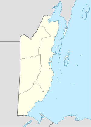 MZE Location of Manatee Airport in Belize | |||||||||||
| Runways | |||||||||||
| |||||||||||
The Belize VOR-DME (Ident: BZE) is located 43.5 nautical miles (81 km) east-northeast of the runway.[4]
See also

- Transport in Belize
- List of airports in Belize
References
- Airport record for Manatee Airport at Landings.com. Retrieved 2013-09-02
- Google (2013-09-02). "location of Manatee Airport" (Map). Google Maps. Google. Retrieved 2013-09-02.
- Airport information for Manatee Airport at Great Circle Mapper.
- "Belize VOR". Our Airports. Retrieved 29 November 2018.
External links
- OpenStreetMap - Manatee Airport
- OurAirports - Manatee Airport
- FallingRain - Manatee Airport
- Aerodromes in Belize - pdf
This article is issued from Wikipedia. The text is licensed under Creative Commons - Attribution - Sharealike. Additional terms may apply for the media files.