Mahendragarh
Mahendragarh is a town and a municipal committee in Mahendragarh district in the north Indian state of Haryana.[1] It is 100 kilometres (62 mi) from Gurgaon and comes under National Capital Region (India).[2]
Mahendragarh | |
|---|---|
Town | |
 Mahendragarh Location in Haryana, India  Mahendragarh Mahendragarh (India) | |
| Coordinates: 28.28°N 76.15°E | |
| Country | |
| State | Haryana |
| District | Mahendragarh |
| Founded by | Anganpal Singh |
| Elevation | 262 m (860 ft) |
| Population (2011) | |
| • Total | 29,128 |
| Languages | |
| • Official | Hindi |
| • Spoken | Ahirwati |
| Time zone | UTC+5:30 (IST) |
| PIN | 123029 |
| ISO 3166 code | IN-HR |
| Vehicle registration | HR 34 |
| Website | www |
Etymology
Earlier named kanaud, in early 1860s it was renamed after Maharaja Mahendra Singh (r. 1721-1748 CE) of Patiala State who was gifted this area by the British East India Company rule for his help in crushing the Indian Rebellion of 1857.[3]
Geography
Mahendragarh is located at 28.28°N 76.15°E.[4] It has an average elevation of 262 metres (859 feet). Mahendragarh district is bounded on the north by Bhiwani and Rohtak districts, on the east by Rewari district and Alwar district of Rajasthan, on the south by Alwar, Jaipur and Sikar districts of Rajasthan, and on the west by Sikar and Jhunjhunu districts of Rajasthan. It has four tehsils of Narnaul, Ateli,Nangal choudhary And Mahendergarh.
It is situated at the bank of Dohan River (which was a seasonal river), which is at the verge of extinction.
History
The city of Mahendragarh was formerly known as Kanoud because of Kanauadia populated by Brahmins. It is said that Malik Mahadud Khan, a servant of Babar had settled. In the seventeenth century, Maratha ruler Tanti Tope built a fort here. In 1861, ruler Maharaja Narendra Singh of Patiala principality had named this fort in Mahendergarh in honor of his son Mohinder Singh. Because of the name of the fort, this town came to be known as Mahendragarh and the name of Narnaul Nizam was changed to Mahendragarh Nizam. In 1948, with the formation of PEPSU Mahendragarh territory from Patiala State, Dadri territory (Now Charkhi Dadri) from Jind and Bawal territory from Nabha State were constituted into Mahendragarh district with the headquarters at Narnaul. At that time, there were three tehsils, namely; Narnaul, Charkhi Dadri and Bawal and Mahendragarh was a sub-tehsil. In 1949, Mahendragarh sub-tehsil was made a tehsil. In 1950, Bawal tehsil was broken up and 78 villages were transferred to Gurgaon district forming Bawal as a sub-tehsil and remaining villages were added to Narnaul and Mahendragarh. In 1956 the Rewari tehsil (except 61 villages ) was excluded from Gurgaon district and included in Mahendragarh district. The Charkhi-Dadri sub- division was excluded from Mahendragarh district and included in the newly constituted district of Bhiwani. In 1977, 81 villages of Rewari tehsil was constituted into Bawal tehsil. In 1978 the district comprised 4 tehsils (Mahendragarh, Rewari, Narnaul and Bawal). Rewari and Bawal tehsils (taken from Mahendragarh district) and Kosli tehsil except 10 villages (taken from Rohtak district) were constituted into a new district of Rewari as on 1 November 1989. Presently district has 3 sub-divisions (Narnaul,Mahendragarh and Kanina), 5 tehsils (1. Narnaul, 2. Mahendragarh, 3. Nangal Chaudhary, 4. Ateli, 5. Kanina) and 1 sub-tehsil (Satnali)
Demographics
As of 2011 India census,[5] Mahendragarh had a population of 23,977. Males constitute 53% of the population and females 47%. Mahendragarh has an average literacy rate of 76, higher than the national average of 75%: male literacy is 89%, and female literacy is 67%. In Mahendragarh, 14% of the population is under 6 years of age. Hindus constitute 98% of the population.
In spite of being a district headquarters, there is no administrative office. All the relevant work is done in Narnaul. The very first guggul (Commiphora wightii) vatika (place where medicinal plants are planted) was established here.
Now many government offices have opened in Mahendragarh near Government Boys college in new Court.
Notable personalities
- Swami Ramdev - yoga guru
- Rao Tula Ram - freedom fighter
- Gujarmal Modi - founder of Modi Industries and Modi Nagar
- Satish Kaushik - Indian film director, producer and actor
References
- "Gurgaon per capita income 10 times that of Mahendragarh". Indian Express. 19 January 2013. Retrieved 6 July 2014.
- "Mahendragarh, Bhiwani included in NCR". Hindustan Times. Archived from the original on 7 September 2013. Retrieved 6 July 2014.
- Magnificent havelis of Nangal-Sirohi, The Tribune, 22 June 2002.
- Falling Rain Genomics, Inc - Mahendragarh
- "Census of India 2001: Data from the 2001 Census, including cities, villages and towns (Provisional)". Census Commission of India. Archived from the original on 16 June 2004. Retrieved 1 November 2008.
Mahendragarh district topics | ||
|---|---|---|
| History | 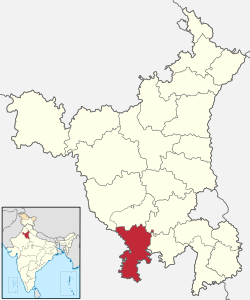 | |
| Cities and towns |
| |
| Education | ||
| Lok Sabha constituencies |
| |
Villages of Mahendragarh District | ||
|---|---|---|
| Villages in Satnali Block Mahendragarh |
| |
| Villages in Nizampur Block Mahendragarh |
| |
| Villages in Sihma Block Mahendragarh |
| |
| Villages in Mahendragarh Block Mahendragarh |
| |
| Villages in Kanina Block Mahendragarh |
| |
| Villages in Ateli Nangal Block Mahendragarh |
| |
| Villages in Nangal Chaudhry Block Mahendragarh |
Ishmilpur | |
| Villages in Narnaul Block Mahendragarh |
| |