Machoi Peak
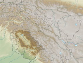
Machoi Peak is a mountain with a peak elevation of 17,907 ft (5,458 metres), in Drass region of Ladakh and Ganderbal district of Jammu and Kashmir , India. Machoi Peak is part of the Himalaya Range, and is located between Amarnath cave and Zojila. It lies 105 km north east from Srinagar, 25 km from Sonamarg in the east and 30 km from Drass. It rises from the glacier of its name Machoi Glacier is the source of Dras River in Drass, Ladakh and Sind River in the vicinity of Kashmir valley. Machoi Peak rises from the Machoi glacier is a pyramid-shaped peak with ice falls and ice fields at its bottom and ridges.[1][2]
| Machoi Peak | |
|---|---|
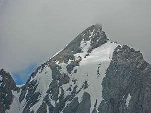 Machoi Peak, as seen on an overcast day, in 2013. | |
| Highest point | |
| Elevation | 5,458 m (17,907 ft) |
| Coordinates | 34°13′42″N 75°35′10″E |
| Geography | |
| Parent range | Himalaya |
| Climbing | |
| First ascent | 10 September 1984 Indian army Team |
| Easiest route | Right side of Amarnath cave |
Climbing history and routes
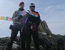
Machoi Peak was first surveyed by a British medical team headed by Dr Ernest Neve in 1912. It was later climbed by a team of Indian army on 10 September 1984.[1][3]
The easiest route to climb Mechoi Peak is from the right side of Amarnath cave[4] which leads to its west face, starts from Baltal a 20 kilometers high altitude alpine tract leads to the foothills of the peak. From the north side it is steep and one has to cross the whole Machoi glacier with ridges and falling ice. The east face of the peak is more difficult due to the remoteness of the area which starts from Matayan, Dras.[1]
References
- "SONAMARG AS A CLIMBING CENTRE. : Himalayan Journal vol.02/7". www.himalayanclub.org. Retrieved 28 January 2019.
- "Geography of Kashmir". kousa.org. Retrieved 25 April 2012.
- "ASCENT OF K12 (7428 m) IN SALTORO HILLS (RANGE) : Himalayan Journal vol.41/15". www.himalayanclub.org. Retrieved 28 January 2019.
- "Machoi glacier". seebeforeyoudie.net. Archived from the original on 11 September 2012. Retrieved 25 April 2012.
| Wikimedia Commons has media related to Machoi Peak. |