Mabaruma
Mabaruma is the administrative centre for Region One (Barima-Waini) of Guyana, claimed by Venezuela as part of Delta Amacuro state, who is localizated in the Guayana Esequiba.
Mabaruma | |
|---|---|
 | |
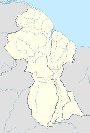 Mabaruma Location in Guayana Esequiba | |
| Coordinates: 8°12′0″N 59°47′0″W | |
| Country | |
| Region State | Barima-Waini (Delta Amacuro state by Venezuela) |
| Elevation | 43 ft (13 m) |
It is located close to the Aruka River (the Venezuelan border) on a narrow plateau above the surrounding rainforest at an elevation of 13 metres.
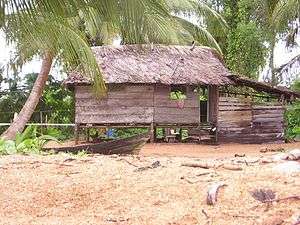
It replaced Morawhanna as the regional capital after the former was deemed at risk from flooding. There is a government guest house in the town as well as the Mabaruma Post Office and a Police Station where court cases are tried. Because of its size however, only petty crimes are tried. Mabaruma was once a large estate owned by the Broomes family. Cocoa was one of the products manufactured before the Government of Guyana bought part of the land to build Governmental Institutions. Mainly Amerindians live in this area. Some of the tribes include Arawaks, Caribs and Warao. Mabaruma also has a large Afro-Guyanese population with small East Indian, Chinese and Portuguese communities too. Mabaruma contains the region's first secondary school, North West Secondary School, established in 1965.The 2018 population was 800 people. Mabaruma became a town in 2017 with the surrounding village of Hosororo joining. Most local people either do farming or fishing work for a living.
Climate
| Climate data for Mabaruma | |||||||||||||
|---|---|---|---|---|---|---|---|---|---|---|---|---|---|
| Month | Jan | Feb | Mar | Apr | May | Jun | Jul | Aug | Sep | Oct | Nov | Dec | Year |
| Average high °C (°F) | 30 (86) |
30 (86) |
29 (85) |
31 (87) |
30 (86) |
29 (85) |
31 (88) |
32 (89) |
32 (89) |
32 (89) |
31 (88) |
29 (85) |
31 (87) |
| Average low °C (°F) | 22 (71) |
21 (70) |
22 (71) |
22 (72) |
23 (73) |
22 (72) |
22 (72) |
22 (72) |
22 (72) |
23 (73) |
22 (72) |
22 (71) |
22 (72) |
| Average precipitation mm (inches) | 210 (8.2) |
110 (4.2) |
120 (4.7) |
170 (6.8) |
310 (12.3) |
350 (13.6) |
340 (13.5) |
250 (9.7) |
200 (7.8) |
200 (7.9) |
220 (8.8) |
320 (12.5) |
2,800 (110) |
| Source: Weatherbase [2] | |||||||||||||
References
- "Official Announcements". Archived from the original on 8 September 2016. Retrieved 28 July 2016.
- "Weatherbase: Historical Weather for Mabaruma, Guyana". Weatherbase. 2011. Retrieved on November 24, 2011.