Maasdriel
Maasdriel (![]()
Maasdriel | |
|---|---|
.JPG) Church in Alem | |
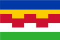 Flag Coat of arms | |
.svg.png) Location in Gelderland | |
| Coordinates: 51°46′N 5°20′E | |
| Country | Netherlands |
| Province | Gelderland |
| Government | |
| • Body | Municipal council |
| • Mayor | Henny van Kooten (SGP) |
| Area | |
| • Total | 75.46 km2 (29.14 sq mi) |
| • Land | 66.02 km2 (25.49 sq mi) |
| • Water | 9.44 km2 (3.64 sq mi) |
| Elevation | 4 m (13 ft) |
| Population (January 2019)[4] | |
| • Total | 24,693 |
| • Density | 374/km2 (970/sq mi) |
| Time zone | UTC+1 (CET) |
| • Summer (DST) | UTC+2 (CEST) |
| Postcode | 5320–5335, 6624 |
| Area code | 0418, 0487, 073 |
| Website | www |
Maasdriel was formed on 1 January, 1999 by the merger of the former municipalities of Ammerzoden (including Well, Wellseind en Wordragen), Hedel, Heerewaarden, Maasdriel (Alem, Hoenzadriel, Kerkdriel and Velddriel) and Rossum (including Hurwenen). The former municipality of Maasdriel was called "Driel" before 1944.[5]
Populated places
Topography

Dutch Topographic map of the municipality of Maasdriel, June 2015
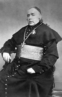
Joannes Zwijsen
Notable people
- Johannes Zwijsen (1794 in Kerkdriel – 1877) Roman Catholic Archbishop of Utrecht
- Jacobus Groenendaal (1805 in Heerewaarden – 1860) a South African statesman
- Johannes Hubertus Leonardus de Haas (1832 in Hedel – 1908) a Dutch animal and landscape painter of the Hague School
- Hendrik van der Veen (1888 in Rossum – 1977) a Dutch missionary worker and linguist who worked in Tana Toraja, Dutch East Indies.
- Thijs de Graauw (born 1942 in Kerkdriel) a Dutch astronomer
- Boet van Dulmen (born 1948 in Ammerzoden) a Dutch former Grand Prix motorcycle road racer
Gallery
 "Castle" Rossum
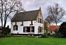 Teisterbant in Kerkdriel
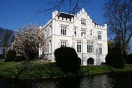
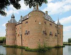 Ammersoyen Castle in Ammerzoden
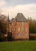 The castle of Well
%2C_2010-06-27_14.00%2C_Villa_Ouderzorg.jpg) Villa Ouderzorg in Hurwenen
Villa Ouderzorg in Hurwenen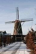 The windmill Sarah Catharina in Kerkdriel
- Hubertus-church in Alem
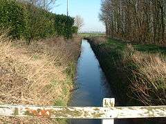 Meersloot in Ammerzoden
References
- "Burgemeester drs. G.E.W. Prick" (in Dutch). Gemeente Maasdriel. Retrieved 9 July 2014.
- "Kerncijfers wijken en buurten" [Key figures for neighbourhoods]. CBS Statline (in Dutch). CBS. 2 July 2013. Retrieved 12 March 2014.
- "Postcodetool for 5331CB". Actueel Hoogtebestand Nederland (in Dutch). Het Waterschapshuis. Archived from the original on 21 September 2013. Retrieved 9 July 2014.
- "Bevolkingsontwikkeling; regio per maand" [Population growth; regions per month]. CBS Statline (in Dutch). CBS. 1 January 2019. Retrieved 1 January 2019.
- Ad van der Meer and Onno Boonstra, "Repertorium van Nederlandse gemeenten", KNAW, 2006. "Archived copy". Archived from the original on 2007-02-20. Retrieved 2009-12-03.CS1 maint: archived copy as title (link)
External links
| Wikimedia Commons has media related to Maasdriel. |

- Official website
Places adjacent to Maasdriel | ||||||||||
|---|---|---|---|---|---|---|---|---|---|---|
| ||||||||||

| Authority control |
|
|---|
This article is issued from Wikipedia. The text is licensed under Creative Commons - Attribution - Sharealike. Additional terms may apply for the media files.