Lorraine (CDP), New York
Lorraine is a hamlet and census-designated place (CDP) in the town of Lorraine in Jefferson County, New York, United States. The population was 174 at the 2010 census,[1] out of 1,037 in the entire town of Lorraine.
Lorraine, New York | |
|---|---|
 Lorraine  Lorraine | |
| Coordinates: 43°45′57″N 75°57′33″W | |
| Country | United States |
| State | New York |
| County | Jefferson |
| Town | Lorraine |
| Area | |
| • Total | 0.48 sq mi (1.25 km2) |
| • Land | 0.48 sq mi (1.25 km2) |
| • Water | 0.0 sq mi (0.0 km2) |
| Elevation | 998 ft (304 m) |
| Population (2010) | |
| • Total | 174 |
| • Density | 360/sq mi (139.1/km2) |
| Time zone | UTC-5 (Eastern (EST)) |
| • Summer (DST) | UTC-4 (EDT) |
| ZIP code | 13659 |
| Area code(s) | 315 |
| FIPS code | 36-43533 |
| GNIS feature ID | 0955999 |
Geography
The hamlet of Lorraine is in southern Jefferson County, northeast of the center of the town of Lorraine. The community sits in the valley of Big Brook on the northwestern edge of the Tug Hill Plateau.
According to the United States Census Bureau, the CDP has a total area of 0.48 square miles (1.25 km2), all of it recorded as land.[1]
Lorraine is at the intersection of County Routes 189, 93, and 92. It is 20 miles (32 km) by highway (or 15 miles (24 km) in a straight line) south of Watertown, the county seat. It is 5 miles (8 km) southeast of Adams via County Route 189.
References
- "Geographic Identifiers: 2010 Census Summary File 1 (G001): Lorraine CDP, New York". American Factfinder. U.S. Census Bureau. Archived from the original on February 13, 2020. Retrieved October 3, 2018.
Municipalities and communities of Jefferson County, New York, United States | ||
|---|---|---|
| City | 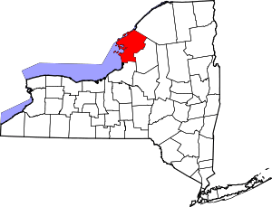 | |
| Towns | ||
| Villages | ||
| CDPs | ||
| Hamlets | ||