List of rivers of Albania
Albania has more than 152 rivers and streams, forming 8 large rivers flowing from southeast to northwest, mainly discharging towards the Adriatic coast. The rivers of Albania have a total annual flow rate of 1,308 m3/s (46,200 cu ft/s), or 41.25 km3 (9.90 cu mi) per year.[1][2]
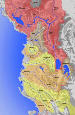
A majority of the precipitation that falls on Albania, drains into the rivers and reaches the coast on the west without even leaving the country. In the north, only one small stream escapes Albania. In the south, an even smaller rivulet drains into Greece. Due to the topographical divide is east of the border with the Republic of North Macedonia. An extensive portion of the basin of the White Drin, basin is in the Dukagjin region, across the northeastern border with Kosovo. The Lake of Ohrid, Lake of Prespa and the Small Lake of Prespa on the southeast, as well as the streams that flow into them, drain into the Black Drin. The watershed divide in the south also dips nearly 75 km (47 mi) into Greece at one point. Several tributaries of the Vjosa River rise in that area. About 65% of their watershed lies within the Albanian territory. The water temperature ranges from 3.5 to 8.9 °C in the winter, and from 17.8 to 24.6 °C in the summer months.
Main rivers
| # | Name | Image | Length | Nearest cities | Location |
|---|---|---|---|---|---|
| 1 | Drin Drini | 285 km (177 mi) | Kukës, Shkodër, Lezhë |  | |
| 2 | Vjosë Vjosa |  | 272 km (169 mi) | Përmet, Këlcyrë, Tepelenë, Memaliaj, Levan | |
| 3 | Devoll Devolli | .jpg) | 196 km (122 mi) | Bilisht, Maliq, Gramsh, Kuçova | |
| 4 | Shkumbin Shkumbini | 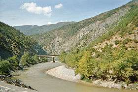 | 181 km (112 mi) | Librazhd, Elbasan, Cërrik, Peqin, Rrogozhina | |
| 5 | Osum Osumi | 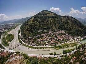 | 161 km (100 mi) | Erseka, Çorovoda, Berat, Kuçova | |
| 6 | Mat Mati |  | 115 km (71 mi) | Burrel, Milot | |
| 7 | Erzen Erzeni |  | 109 km (68 mi) | Shijak | |
| 8 | Fan Fani |  | 94 km (58 mi) | Rrëshen, Rubik | |
| 9 | Seman Semani |  | 85 km (53 mi) | Fier, Kuçovë | |
| 10 | Drino Drino |  | 84.6 km (53 mi) | Gjirokastër, Libohovë | |
Other rivers
| # | Name | Image | Length | Nearest cities | Location |
|---|---|---|---|---|---|
| 1 | Shushicë Shushica | 80 km (50 mi) | Armen | | |
| 2 | Ishëm Ishmi |  | 62.2 km (39 mi) | Tirana, Fushë-Krujë, Kamza | |
| 3 | Cem Cemi |  | 58.8 km (37 mi) | Tamarë | |
| 4 | Kir Kiri | 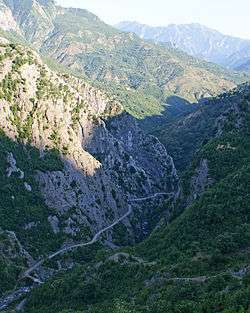 | 52 km (32 mi) | Pult, Shkodër | |
| 5 | Valbonë Valbona | 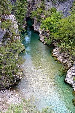 | 50.6 km (31 mi) | Bajram Curri | |
| 6 | Bunë Buna | 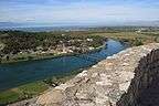 | 44 km (27 mi) | Shkodër, Velipojë | |
| 7 | Lengaricë Lengarica |  | 37 km (23 mi) | Petran | |
| 8 | Lanë Lana | 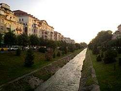 | 29 km (18 mi) | Tirana | |
| 9 | Gash Gashi | 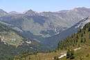 | 27 km (17 mi) | Bajram Curri | |
| 10 | Pavllë Pavlla | 50 km (31 mi) | Konispol, Sarandë |
Basins
Organized by drainage basin. Albanian-language names are listed if different than English. Italics indicate that the body of water is not in or bordering Albania.
Adriatic Sea
- Bojana – Bunë, Buna
- Great Drin – Drin, Drini
- White Drin – Drini i Bardhë
- Black Drin – Drini i Zi
- Lake Ohrid – Liqeni i Ohrit
- Valbona
- Shala
- Kir
- Lake Skadar – Liqeni i Shkodrës
- Great Drin – Drin, Drini
- Gulf of Drin – Gjiri i Drinit
- Small Drin; see Great Drin above
- Aoös – Vjosë
- Seman
- Shkumbin
- Mat
- Erzen
- Ishëm
- Gjole
- Tërzukë
- Tiranë
- Zezë
- Gjole
See also
| Wikimedia Commons has media related to Rivers of Albania. |
References
- Cullaj, A., Hasko, A., Miho, A., Schanz, F., Brandl, H. & Bachofen, R. (2005). "The quality of Albanian natural waters and the human impact". Environment International. 31: 137.CS1 maint: uses authors parameter (link)
- Agim SELENICA. "WATER RESOURCES OF ALBANIA". medhycos.mpl.ird.fr.