List of mountains in Greenland
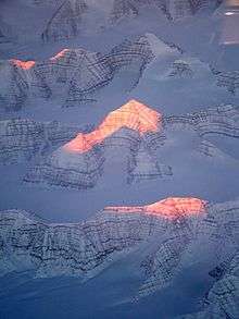
Mountain peaks lit by the sun in East Greenland
This is a list of mountains in Greenland.
List
For each mountain, the municipality in which it is located is given, along with coordinates indicating the approximate centre of the mountain (follow the link to see satellite images of the location).
Above 3000 m
Above 2000 m
Above 1000 m
| Mountain | Coordinates | Region | Height (m) | Height (feet) | Notes |
|---|---|---|---|---|---|
| Payer Peak | 73°8′N 26°23′W | NE Greenland National Park | 1,979[1] | 6,493 | Suess Land |
| Helvetia Tinde | 83°20′N 34°40′W | NE Greenland National Park | 1,929 | 6,329 | Roosevelt Range highest point; Peary Land |
| Ansbjerg | 63°34′N 41°40′W | Sermersooq | 1,917[1] | 6,289 | Thorland |
| Favre Bjerg | 73°56′N 23°17′W | NE Greenland National Park | 1,900[8] | 6,233 | Hudson Land High Point (height approximate) |
| Snehatten | 62°44′N 42°51′W | Sermersooq | 1,892 | 6,208 | Timmiarmiut Fjord |
| Ulamertorsuaq | 60°22′N 44°32′W | Kujalleq | 1,858 | 6,096 | Tasermiut Fjord |
| Tuvilissuaq | 60°11′N 44°30′W | Kujalleq | 1,838 | 6,030 | Torsukattak Fjord |
| Angiartarfik | 60°11′N 44°29′W | Kujalleq | 1,824 | 5,984 | Torsukattak Fjord |
| Angelin Bjerg | 73°9′N 24°19′W | NE Greenland National Park | 1,821[1] | 5,975 | Ymer Island |
| Hjelmen | 76°34′N 25°18′W | NE Greenland National Park | 1,758 | 5,767 | Queen Louise Land |
| Alleruusakasiit | 60°8′N 44°31′W | Kujalleq | 1,743 | 5,721 | Known for the Thumbnail cliff.[9] Torsukattak Fjord |
| Azimuthbjerg | 63°27′N 41°50′W | Sermersooq | 1,738 | 5,702 | Skjoldungen Island |
| Mount Wistar | 82°53′N 32°30′W | NE Greenland National Park | 1,737 | 5,699 | |
| Qingassat Qaqqaat | 60°34′N 44°42′W | Kujalleq | 1,730 | 5,676 | |
| Tininnertuup Qaqqaat | 60°28′N 44°25′W | Kujalleq | 1,720 | 5,643 | |
| Wiedemann Range High Point | 68°39′N 28°29′W | Sermersooq | 1,715 | 5,627 | Wiedemann Range |
| Valhaltinde | 61°26′N 45°19′W | Kujalleq | 1,690 | 5,545 | |
| Qalutaassuaq | 60°12′N 44°31′W | Kujalleq | 1,665 | 5,463 | |
| Illerfissalik (Burjfjeld) | 61°03′N 45°17′W | Kujalleq | 1,662 | 5,453 | Near Igaliku |
| Sulussugutaasaa | 60°59′N 45°12′W | Kujalleq | 1,660 | 5,446 | |
| Holm Land HP | 80°28′N 19°36′W | NE Greenland National Park | 1,627 | 5,340 | [1] Princess Caroline-Mathilde Alps |
| Harder Bjerg | 73°25′N 22°50′W | NE Greenland National Park | 1,627 | 5,338 | Hjelm Range |
| Ensom Majestaet | 63°48′N 41°2′W | Sermersooq | 1,591 | 5,220 | [1] Odinland |
| Allerulik | 61°04′N 45°10′W | Kujalleq | 1,587 | 5,207 | |
| Akuliarusersuaq | 60°34′N 43°44′W | Kujalleq | 1,534 | 5,034 | Lindenow Fjord |
| Suikkassuaq | 60°21′N 44°36′W | Kujalleq | 1,524 | 5,000 | |
| Putooruttoq | 60°14′N 44°40′W | Kujalleq | 1,519 | 4,984 | |
| Ingolf Fjeld | 66°25′N 35°38′W | Sermersooq | 1,503 | 4,931 | Kangertittivatsiaq |
| Iffit Qaqqaat | 60°30′N 44°35′W | Kujalleq | 1,488 | 4,882 | |
| Haffner Bjerg | 76°26′N 62°18′W | Qaasuitsup | 1,483 | 4,865 | |
| Princess Elizabeth Alps HP | 80°44′N 18°47′W | NE Greenland National Park | 1,466 | 4,811 | [1] Princess Elizabeth Alps |
| Utsussuatsiaat | 60°16′N 44°29′W | Kujalleq | 1,460 | 4,790 | |
| Issuttussoq | 60°11′N 44°22′W | Kujalleq | 1,457 | 4,780 | |
| Qasigeerneq | 60°17′N 44°41′W | Kujalleq | 1,450 | 4,757 | |
| Aqqutikitsoq | 67°06′N 53°13′W | Qeqqata | 1,448 | 4,751 | (old spelling:Avqutikitsoq) |
| Stjernebannertinde | 83°19′N 28°12′W | NE Greenland National Park | 1,433 | 4,701 | H. H. Benedict Range HP, Peary Land |
| Uumannanngua | 60°08′N 44°36′W | Kujalleq | 1,425 | 4,675 | |
| Kuunnaat | 61°13′N 48°25′W | Sermersooq | 1,418 | 4,652 | (old spelling: Kûngnât) |
| Sermitsiap Qaqqaat | 60°33′N 44°25′W | Kujalleq | 1,417 | 4,649 | |
| Daly Range HP | 83°20′N 27°26′W | NE Greenland National Park | 1,399 | 4,593 | Peary Land |
| Faraway How | 74°25′N 23°33′W | NE Greenland National Park | 1,398 | 4,587 | Wordie Glacier |
| Ilimmaasaq | 61°00′N 45°56′W | Kujalleq | 1,390 | 4,560 | (old spelling: Ilímaussaq) |
| Qassi | 64°09′N 51°17′W | Sermersooq | 1,382 | 4,534 | |
| Nasannguaq | 61°01′N 45°53′W | Kujalleq | 1,380 | 4,528 | |
| Ippissuasiip Qaqqaa | 60°25′N 44°49′W | Kujalleq | 1,376 | 4,514 | |
| Akuliaruseq | 60°29′N 44°46′W | Kujalleq | 1,352 | 4,436 | |
| Devil's Castle (Teufelsschloss) | 73°22′N 25°29′W | NE Greenland National Park | 1,303 | 4,275 | Andrée Land |
| Nuussuup Qaqqaa | 60°23′N 44°44′W | Kujalleq | 1,302 | 4,272 | |
| Niviarsiat | 61°25′N 45°13′W | Kujalleq | 1,300 | 4,265 | |
| Napasorsuaq (Kirkespiret) | 60°22′N 44°46′W | Kujalleq | 1,287 | 4,222 | Southern Sermilik fjord |
| Nordkrone | 82°45′N 31°0′W | NE Greenland National Park | 1,280 | 4,200 | |
| Natinnguaq | 61°17′N 45°39′W | Kujalleq | 1,279 | 4,196 | |
| Killavaat (Savtakkerne) | 60°17′N 45°18′W | Kujalleq | 1,276 | 4,186 | (old spelling: Kitdlavât) |
| Qajuuttaa | 64°14′N 50°54′W | Sermersooq | 1,254 | 4,114 | |
| Usumeersip Qaqqaa | 60°30′N 44°52′W | Kujalleq | 1,248 | 4,094 | |
| Qajarsuup Qaqqaa | 60°29′N 44°53′W | Kujalleq | 1,229 | 4,032 | |
| Marrat Qaqqaat | 60°32′N 44°45′W | Kujalleq | 1,214 | 3,983 | |
| Naajarsuit | 61°02′N 45°48′W | Kujalleq | 1,212 | 3,976 | |
| Sermitsiaq | 64°18′N 51°30′W | Sermersooq | 1,210 | 3,970 | Sermitsiaq Island |
| Nakkaalaaq | 60°58′N 45°54′W | Kujalleq | 1,207 | 3,960 | |
| Naajatsiaat Qaqqaat | 60°32′N 44°47′W | Kujalleq | 1,196 | 3,924 | |
| Kingittorsuaq (Hjortetakken) | 64°07′N 51°35′W | Sermersooq | 1,184 | 3,885 | (old spelling: Kingigtorssuaq) near Nuuk |
| Ulunnguarsuaq | 61°14′N 45°47′W | Kujalleq | 1,160 | 3,806 | |
| Mara Mountain | 83°34′N 30°28′W | NE Greenland National Park | 1,155 | 3,790 | Roosevelt Range |
| Qaqqarsuaq | 64°14′N 51°03′W | Sermersooq | 1,154 | 3,786 | |
| Arpatsivik | 60°19′N 44°48′W | Kujalleq | 1,152 | 3,780 | |
| Ujarasussuttaliit Qaqqaa | 60°23′N 44°52′W | Kujalleq | 1,143 | 3,750 | |
| Uilorsuaq | 60°27′N 44°49′W | Kujalleq | 1,109 | 3,638 | |
| Arpatsiviip Qaqqaat | 60°18′N 44°53′W | Kujalleq | 1,107 | 3,632 | |
| Balkonen | 61°22′N 45°14′W | Kujalleq | 1,105 | 3,625 | |
| Paarnaliarsuup Qaqqaa | 60°18′N 44°52′W | Kujalleq | 1,101 | 3,612 | |
| Vegas Fjeld | 65°41′N 37°44′W | Sermersooq | 1,096 | 3,596 | |
| Ymer Nunatak | 77°27′N 24°37′W | NE Greenland National Park | 1,096 | 3,596 | |
| Kayser Mountain | 81°33′15″N 58°58′28″W | Qaasuitsup | 1,094 | 3,589 | Haug Range, Hall Land |
| Qilakitsoq (Laksefjeld) | 61°16′N 47°56′W | Sermersooq | 1,091 | 3,579 | |
| Teqqiingalik | 64°08′N 51°27′W | Sermersooq | 1,075 | 3,527 | |
| Puilasorsuit Qaqqaat | 60°24′N 44°51′W | Kujalleq | 1,071 | 3,514 | |
| Uummannaq | 70°42′47″N 52°07′52″W | Qaasuitsup | 1,070 | 3,839 | |
| Qupik | 64°13′N 51°06′W | Sermersooq | 1,069 | 3,507 | |
| Qaqortukuluup Qaqqaa | 60°51′N 45°47′W | Kujalleq | 1,059 | 3,474 | |
| Pisissarfik | 67°07′N 52°59′W | Qeqqata | 1,050 | 3,445 | (old spelling: Pisigsarfik) near Kapisillit |
| Qoornip Qaqqartivaa (Rødhorn) | 65°50′N 37°21′W | Sermersooq | 1,038 | 3,406 | |
| Matorsuaq | 60°45′N 45°16′W | Kujalleq | 1,023 | 3,356 | |
| Oriartorfik | 64°11′N 51°22′W | Sermersooq | 1,012 | 3,320 | |
| Imertivap Qaqqartivaa (Sofias Fjeld) | 65°42′N 37°35′W | Sermersooq | 1,010 | 3,314 | |
| Qimmeertaajaliip Qaqqartivaa (Polhems Fjeld) | 65°40′N 37°31′W | Sermersooq | 1,003 | 3,291 | |
| Inussussuaq | 64°04′N 51°12′W | Sermersooq | 1,001 | 3,284 |
Other relevant mountains
| Mountain | Coordinates | Region | Height (m) | Height (feet) | Notes |
|---|---|---|---|---|---|
| Uunnguttoq | 65°37′N 37°48′W | Sermersooq | 973 | 3,192 | |
| Aqqitsoq | 64°11′N 51°26′W | Sermersooq | 943 | 3,094 | |
| Mittivakkat | 65°43′N 37°47′W | Sermersooq | 931 | 3,054 | |
| Pic de Gerlache | 78°36′N 21°40′W | NE Greenland National Park | 899 | 2,949 | Duc d'Orleans Land |
| Qassinnguit | 64°10′N 51°20′W | Sermersooq | 895 | 2,936 | |
| Aqajarua | 67°06′N 53°34′W | Qeqqata | 894 | 2,933 | |
| Kangerluluup Qaqqaa | 60°36′N 45°31′W | Kujalleq | 890 | 2,920 | |
| Tasiusap Qaqqaa | 61°12′N 45°43′W | Kujalleq | 890 | 2,920 | |
| Meqqutoqqat Qaqqaa | 60°53′N 45°38′W | Kujalleq | 884 | 2,900 | |
| Kuannersuit (Kvanefjeld) | 60°59′N 45°59′W | Kujalleq | 879 | 2,884 | |
| Niaqornaarsuk | 60°18′N 44°41′W | Kujalleq | 876 | 2,874 | |
| Aajuitsoq | 64°07′N 51°28′W | Sermersooq | 855 | 2,805 | |
| Innajuattoq | 67°05′N 52°44′W | Qeqqata | 853 | 2,799 | |
| Mittivakkat | 65°46′N 37°29′W | Sermersooq | 852 | 2,795 | |
| Ittikasaat Qaqqaat (Blokken) | 65°48′N 36°56′W | Sermersooq | 851 | 2,792 | |
| Asingaleq | 65°52′N 37°40′W | Sermersooq | 847 | 2,779 | |
| Timilequssuanngua | 60°54′N 45°36′W | Kujalleq | 840 | 2,756 | |
| Niviarsiat | 73°4′N 25°13′W | NE Greenland National Park | 837 | 2,746 | Suess Land |
| Ymers Bjerg | 65°36′N 37°46′W | Sermersooq | 830 | 2,723 | |
| Avalaatseq | 65°51′N 36°57′W | Sermersooq | 829 | 2,720 | |
| Nuuluk | 60°58′N 45°26′W | Kujalleq | 823 | 2,700 | |
| Nina Bang Mountain | 81°38′22″N 57°38′58″W | Qaasuitsup | 815 | 2.674 | Nyeboe Land |
| Sulussugutaasaasaq | 64°09′N 50°58′W | Sermersooq | 814 | 2,671 | |
| Taatsukajik | 65°36′N 37°03′W | Sermersooq | 807 | 2,648 | |
| Iviangiusaq Kangilleq | 60°51′N 45°54′W | Kujalleq | 805 | 2,641 | |
| Sisoorajooq | 64°08′N 51°31′W | Sermersooq | 792 | 2,598 | |
| Talut | 60°56′N 45°59′W | Kujalleq | 791 | 2,595 | |
| Ukkusissat Kangilequtaat | 64°11′N 51°33′W | Sermersooq | 787 | 2,582 | |
| Nasaasaaq (Kællingehætten) | 66°56′N 53°34′W | Qeqqata | 784 | 2,572 | |
| Ukkusissat (Store Malene) | 64°10′N 51°37′W | Sermersooq | 772 | 2,533 | |
| Nunasarnaasaq | 60°54′N 45°53′W | Kujalleq | 770 | 2,526 | |
| Mallemuk Mountain | 80°11′8″N 16°37′9″W | NE Greenland National Park | 762 | 2,500 | Holm Land |
| Erngata Qaqqaa | 61°17′N 45°34′W | Kujalleq | 749 | 2,457 | |
| Kiinaaliitaa | 60°35′N 45°40′W | Kujalleq | 730 | 2,395 | |
| Sivingasoq | 64°09′N 51°33′W | Sermersooq | 720 | 2,362 | |
See also
- List of mountain peaks of Greenland
- List of mountain ranges of Greenland
- List of nunataks of Greenland
- List of Ultras of Greenland
References
- Google Earth
- "North America, Greenland, Ejnar Mikkelsen Fjeld, Watkins Mountains, East Greenland". AAJ. Retrieved 5 July 2016.
- Summit Station
- Higgins, Anthony K. (2010-12-21). "Exploration history and place names of northern East Greenland" (PDF). Geological Survey of Denmark and Greenland Bulletin. Copenhagen, Denmark: Geological Survey of Denmark and Greenland (GEUS). 21: 1–368. ISSN 1604-8156. Retrieved 2019-12-01.
- "North America, Greenland, East Coast, Sortebrae Mountains, Seven Ascents". AAJ. Retrieved 24 June 2016.
- "North America, Greenland, South Greenland". AAJ. Retrieved 5 July 2016.
- Sailing Directions for East Greenland and Iceland, p. 117
- "Catalogue of place names in northern East Greenland". Geological Survey of Denmark. Retrieved 30 September 2019.
- Ian Parnell: Learning Process. American Alpine Journal (AAJ) 2001, pp. 57–70, Greenland: The Thumbnail. Fragile moments, pp. 61–65
Bibliography
- Gazetteer of Greenland Compiled by Per Ivar Haug. UBiT, Universitetsbiblioteket i Trondheim, August 2005, ISBN 82-7113-114-1.
- Exploration and place names in Northeastern Greenland
This article is issued from Wikipedia. The text is licensed under Creative Commons - Attribution - Sharealike. Additional terms may apply for the media files.