List of lighthouses in São Tomé and Príncipe
Lighthouses
| Name | Image | Year built | Location & coordinates | Class of Light [2] | Focal height [2] | NGA number [2] | Admiralty number [2] | Range nml [2] |
|---|---|---|---|---|---|---|---|---|
| Ana Chaves Range Rear Lighthouse | 1994 | São Tomé 0°21′24.9″N 6°43′33.6″E | Iso G 4s. | 9 metres (30 ft) | 25200 | D4234.1 | 6 | |
| Ilhéu Bom Bom Lighthouse | 1997 | Príncipe 1°41′58.7″N 7°24′09.7″E | Fl (2) WR 10s. | 64 metres (210 ft) | 25180 | D4158 | white: 12 red: 9 | |
| Ilhéu das Cabras Lighthouse | .jpg) | 1890 | São Tomé 0°24′32.6″N 6°42′58.7″E | Fl (2+1) W 15s. | 98 metres (322 ft) | 25184 | D4230 | 12 |
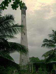
| Ilhéu Gago Coutinho Lighthouse | 1929 | São Tomé 0°00′22.1″N 6°31′11.3″E | Fl (2) W 10s. | 106 metres (348 ft) | 25204 | D4241 | 12 | |
| Lagoa Azul Lighthouse |  | 1997 | São Tomé 0°24′26.8″N 6°36′36.4″E | Fl (2) W 15s. | 34 metres (112 ft) | 25183 | D4243 | 12 |
| Ponta Furada Lighthouse | n/a | São Tomé 0°14′37.3″N 6°28′05.8″E | Fl W 8s. | 49 metres (161 ft) | 25205 | D4242 | 12 | |
| Pónta da Mina Lighthouse | 1996 | Príncipe 1°38′52.5″N 7°26′15.3″E | Fl (2) W 6s. | 54 metres (177 ft) | 25172 | D4154 | 9 | |
| Santo António do Príncipe Lighthouse | 1964 | Santo António 1°38′34.5″N 7°25′14.8″E | Fl (3) WRG 10s. | 13 metres (43 ft) | 25176 | D4155 | white: 9 red: 6 green: 6 | |
| São Sebastião Lighthouse | .jpg) | 1928 | São Tomé 0°20′45.6″N 6°44′22.7″E | Fl (4) WR 12s. | 14 metres (46 ft) | 25192 | D4237 | white: 12 red: 9 |
See also
- Lists of lighthouses and lightvessels
References
- São Tomé and Príncipe The Lighthouse Directory. University of North Carolina at Chapel Hill. Retrieved 26 September 2016
- List of Lights, Pub. 113: The West Coasts of Europe and Africa, the Mediterranean Sea, Black Sea and Azovskoye More (Sea of Azov) (PDF). List of Lights. United States National Geospatial-Intelligence Agency. 2016. Retrieved 26 September 2016
External links
| Wikimedia Commons has media related to Lighthouses in São Tomé and Príncipe. |
Rowlett, Russ. "The Lighthouse Directory". University of North Carolina at Chapel Hill.
| Types |
| _-_cropped.jpg) | ||||
|---|---|---|---|---|---|---|
| Fixtures | ||||||
| Maintenance | ||||||
| Locations | ||||||
| Categories |
| |||||
| Global organizations | ||||||
| ||||||
Lists of lighthouses in Africa | ||||||
|---|---|---|---|---|---|---|
| Sovereign states |
|  | ||||
This article is issued from Wikipedia. The text is licensed under Creative Commons - Attribution - Sharealike. Additional terms may apply for the media files.