List of crossings of the River Wye
Crossings of the River Wye in the UK cover the whole length of the 215 kilometres (134 mi) from its source to the River Severn. For much of its length the river forms part of the border between England and Wales. The lower Wye Valley is an Area of Outstanding Natural Beauty.[1][2] There are some 15 Grade II listed bridges, just 1 Grade II* listed bridge and 3 Grade I listed bridges.
.jpeg)
River Wye
Crossings
| Status | Criteria[3] |
|---|---|
| I | Grade I listed. Bridge of exceptional interest, sometimes considered to be internationally important |
| II* | Grade II* listed. Particularly important bridge of more than special interest |
| II | Grade II listed. Bridge of national importance and special interest |
In order, moving downstream:
| Crossing | Coordinates | Built | Heritage status |
Locality | Notes | Refs | Image |
|---|---|---|---|---|---|---|---|
| Y Drum Bridge | grid reference SN 854 828 | 1965 | Pont Rhydgaled | The first bridge over the Wye, 3.2 kilometres (2.0 mi) below its source. A steel beam structure with a wooden deck, 10 metres (33 ft) long with two cylindrical columns mid-span. | [4] | ||
| Pont Cefn-Brwyn | grid reference SN 830 836 | about 1910 | Pont Rhygaled | Built to serve the lead mines in Nant Iago. The bridge was strengthened in 1975 to allow road vehicles from the Institute of Hydrology to reach a weir upstream of the bridge. | [4] | 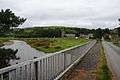 | |
| Pont Rhydgaled | 1800[4] | Pont Rhydgaled | Carries A44 over river just above its confluence with the Afon Tarrenig. Close to Sweeter Still rally stage. | ||||
| Nanty | grid reference SN 854 820 | 1992 | A 3-span wooden footbridge built to replace an earlier structure. The Nanty Lead Mine was located here, but closed in 1867 - the bridge is also known as the Nanty Mine Bridge. | [4] | | ||
| Footbridge | 1992 | The Wye Valley Walk footbridge | 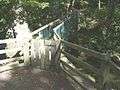 | ||||
| Waun Capel Parc footbridge | grid reference SN 968 681 | 1965 | - | Rhayader | A single-span made of three continuous truss girders of welded steel, built by the Royal Monmouthshire Royal Engineers. | [4] | 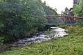 |
| Rhayader road bridge | Carries the B4518 road. | 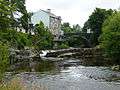 | |||||
| Glyn Bridge | 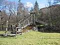 | ||||||
| Llanwrthwl Bridge | |||||||
| Yr Allt Farm bridge | Farm access | ||||||
| Newbridge-on-Wye Bridge | |||||||
| Brynwern Bridge | |||||||
| Builth Road Railway Bridge | Near Builth Road railway station. | Located on the Heart of Wales Line. | 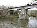 | ||||
| Wye Bridge, Builth Wells | II | Builth Wells | 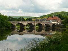 | ||||
| Erwood Bridge | Erwood | Carries the B4594 road. |  | ||||
| Lady Milford's Bridge | - | Llanstephan | 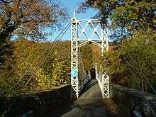 | ||||
| Boughrood Bridge | II |  | |||||
| Glasbury Bridge | 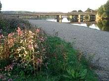 | ||||||
| Hay Bridge | Crossed over the river from Radnorshire to Brecknockshire as well as the currently closed Hereford, Hay and Brecon Railway. It is near the former Hay-on-Wye station which is on the southern side in Herefordshire. | 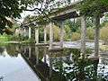 | |||||
| Whitney-on-Wye Railway Bridge | Demolished on the former Hereford, Hay and Brecon Railway which is currently closed. | 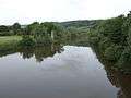 | |||||
| Whitney-on-Wye toll bridge | II | 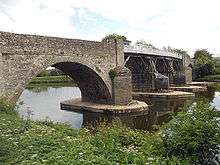 | |||||
| Bredwardine Bridge | II | 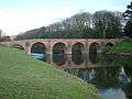 | |||||
| Bridge Sollers Bridge | This bridge replaced one dating from 1896, it was opened in 2004. | 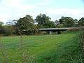 | |||||
| Hunderton Bridge | - | Hereford | On the former Goods Line, part of the original Newport, Abergavenny and Hereford Railway | 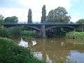 | |||
| Greyfriars bridge (A49 road) | 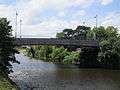 | ||||||
| Wye Bridge (Hereford) | I | Late C15, widened 1826. Ashlar sandstone. 6 arches, 1
rebuilt C17; V-shaped cutwaters with refuges over; bands; chamfered ashlar coping. |
 | ||||
| Victoria Bridge | II | Footbridge over River Wye. c1897. Built by Findlay of Motherwell. Concrete piers with ashlar cutwaters; semi-suspension central span; lattice-work towers and parapets; terracotta piers with cast-iron lamp columns. Erected by public subscription to mark Diamond Jubilee of Queen Victoria. | 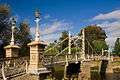 | ||||
| Greenway Bridge | - | Rotherwas, Hereford | Bridge links the Bartonsham and Rotherwas areas of Hereford. |  | |||
| Eign Bridge | - | Rotherwas, Hereford | Built as part of the Hereford, Ross and Gloucester Railway which line is largely closed apart from the section here which is part of the Welsh Marches Line. |  | |||
| Holme Lacy Bridge | - | 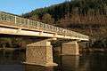 | |||||
| Ballingham Railway Bridge | grid reference SO 569 306 | 1855-1859 | Ballingham | Carried the closed Hereford, Ross and Gloucester Railway over the river, the bridge decking is demolished. | [4] | 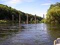 | |
| Hoarwithy Bridge | - | 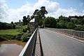 | |||||
| Sellack Suspension Bridge | II | 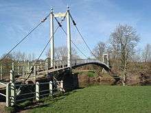 | |||||
| Foy Bridge | - | 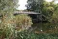 | |||||
| Strangford Railway Bridge | - | Currently closed Hereford, Ross and Gloucester Railway line. Decking spanning the river demolished. | 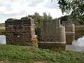 | ||||
| Backney Railway Bridge | - | Currently closed Hereford, Ross and Gloucester Railway line. |  | ||||
| Bridstow Bridge | - | Bridstow bridge, completed in 1960, carries the A40 trunk road over the river Wye near Ross-on-Wye. It is 353 feet/108 m long, and comprises two cantilever sets and a suspended span. |  | ||||
| Wilton Bridge | I | An exceptionally fine stone bridge. In 1597 an Act was passed authorising its construction. It was completed within the next 2 years. 5 semicircular arches each with 3 ribs. Massive cutwaters on each side carried up and splayed back from the outer angle at parapet level forming semi-hexagonal refuges. At the point where the splay dies out is a moulded string which is mitred and carried up to the angle against the spandrils of the arches and then mitred and carried across to form a label above the arches. The voussoirs of the arches are chamfered and joggled and have various masons' marks. On upstream side the bridge has been widened but now the parapet has gone and been replaced by a wooden handrail. South East approach to bridge has been rebuilt in ashlar with 2 flights of stone steps to the river bank. The sundial, formerly in one of the refuges has gone and only the base of the pedestal remains. |  | ||||
| Kerne Bridge | II | Road bridge. 1828 by B D Jones. Ashlar. Five-span bridge with large central arch flanked by graded arches each separated by triangular shaped cutwaters rising to pilaster buttresses, solid parapet. | 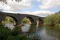 | ||||
| Welsh Bicknor Railway Bridge | - | On the currently closed Ross and Monmouth Railway. | 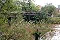 | ||||
| Huntsham Bridge | II | 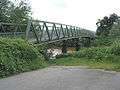 | |||||
| Hand ferry at the Ye Old Ferrie Inn | - | Symonds Yat |  | ||||
| Hand ferry at the Saracens Head Inn | - | Symonds Yat |  | ||||
| Biblins Bridge | - | Site of Biblins Youth Campsite | 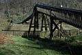 | ||||
| Wye Bridge (Monmouth) | II | Built in 1617 | 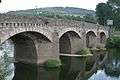 | ||||
| Duke of Beaufort Bridge | II | Monmouth Troy | Built in 1874. It is listed (as a historic structure) simply as the Railway Bridge, Monmouth. It carried the Ross and Monmouth Railway line. Still in use as a footpath. | 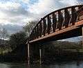 | |||
| Monmouth Viaduct | 51.804475°N 2.707872°W | - | Monmouth Troy | Bridge dismantled in 1967. It carried the Coleford, Monmouth, Usk & Pontypool Railway line. Part of the currently closed Wye Valley Railway line. | 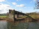 | ||
| Penallt Viaduct | II | Also known as, and listed as Redbrook Railway Bridge. Previously carried the Wye Valley Railway. Still in use as a footpath. |  | ||||
| Bigsweir Bridge | II* | Carries the A466 road. | 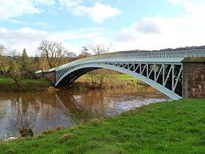 | ||||
| Brockweir Bridge | 51.707029°N 2.668972°W | 1906 | II | Brockweir | Designed by S.W. & A.L. Yockney of Victoria Street, Westminster. The contractors were E. Finch and Company of Chepstow. | [5] | 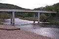 |
| Tintern Railway Bridge | 51.700334°N 2.673260°W | Tintern station | Demolished. On the currently closed Wye Valley Railway south of Tintern railway station. | 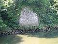 | |||
| Old Tramway Bridge | 51.699424°N 2.681343°W | 1875 | II | Tintern | Listed as the Old Tramway Bridge (formerly Wireworks Bridge), but also known as the Tintern Footbridge. Previously carried the Tintern Wireworks Branch, now a footbridge. | [6] | 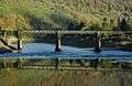 |
| Old Wye Bridge, Chepstow | 52.48855°N 3.72676°W | I | Chepstow | Carries the B4228 road. |  | ||
| A48 bridge | 52.48681°N 3.72227°W | - | Chepstow | Carries the A48 road. | 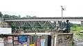 | ||
| Chepstow Railway Bridge | 52.48151°N 3.71618°W | II | Chepstow | Built in 1852 as part of the South Wales Railway. It also brought the currently closed Wye Valley Railway into Chepstow station. It now carries the Gloucester to Newport Line. | 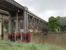 | ||
| M48 Wye Bridge | 52.47276°N 3.70141°W | II | Tidenham and Chepstow | Built in 1966, it carries the M4 motorway between England and Wales. | 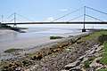 | ||
| Severn-Wye Cable Tunnel | 51.61098°N 2.66921°W | - | Newhouse (Mathern) – Aust | The tunnel is 47.5 m deep, with a diameter of 3.05 m and a total length of 3,678 m.[7] The tunnel carries two 400 kV circuits, each with three cables.[8] The tunnel is owned by National Grid plc. The image to the right shows the cables on pylons entering the Aust (eastern) end of the tunnel before going underground. |  | ||
| Aust Severn Powerline Crossing | 51.60578°N 2.64136°W | - | Longest powerline span in the UK at 1 mile (1,618 metres). |  |
Notes
- "Natural England information on AONBs and map". Natural England. Retrieved 5 October 2012.
- "Natural England information on Wye Valley AONB". Natural England. Archived from the original on 30 August 2014. Retrieved 5 October 2012.
- Listed Buildings, English Heritage, archived from the original on 27 December 2012, retrieved 22 April 2011
- Crow, Alan (1995). Bridges on the River Wye. Hereford: Lapridge Publications. ISBN 0-9518589-9-8.
- Historic England. "Brockweir Bridge (Grade II) (1393683)". National Heritage List for England. Retrieved 7 December 2019.
- Historic England. "Old Tramway Bridge (Formerly Wireworks Bridge) (Grade II) (1393682)". National Heritage List for England. Retrieved 7 December 2019.
- "Mono Severn Wye Tunnel Project wins award". HighBeam. Archived from the original on 11 October 2012. Retrieved 10 May 2011.
- "Severn-Wye Cable Tunnel refurb". Global Trade Media. Archived from the original on 28 July 2011. Retrieved 10 May 2011.
External links
| Wikimedia Commons has media related to Bridges across the River Wye. |
Transport in Monmouthshire | ||
|---|---|---|
| Road | 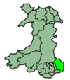 | |
| Bus | ||
| National Cycle Network |
| |
| Railway lines | ||
| Railway stations | ||
| Waterways | ||
Transport in Powys | |||||||
|---|---|---|---|---|---|---|---|
| Road | 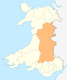 | ||||||
| Footpaths | |||||||
| Cycle routes | |||||||
| Railway stations |
| ||||||
This article is issued from Wikipedia. The text is licensed under Creative Commons - Attribution - Sharealike. Additional terms may apply for the media files.