List of crossings of the Pasig River
This is a list of bridges and other crossings of the Pasig River in Metro Manila, Philippines.
The crossings are listed in order starting from its mouth at Manila Bay and proceeding upstream to its source at Laguna de Bay.
As of 2015, there are a total of nineteen bridge spans in Metro Manila that cross the Pasig River, including three rail bridges, the Line 1, Line 3 and the Philippine National Railways track.
A bridge connecting Sta. Monica Street in Kapitolyo, Pasig to Lawton Avenue, Taguig is being planned by the Department of Public Works and Highways (DPWH) as part of the Bonifacio Global City–Ortigas Link Bridge.[1]
The planned Metro Manila Subway Line 9 will also cross the Pasig River between Pasig and Makati, making it the first tunnel to cross the river.
Crossings
| # | Crossing | Carries | Image | Location | Built | Coordinates |
|---|---|---|---|---|---|---|
Manila | ||||||
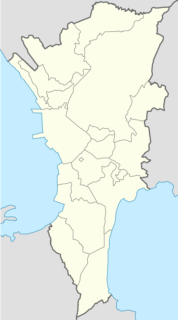
| 1 | Roxas Bridge Del Pan Bridge |
Four lanes of |
 |
Port Area/Intramuros and San Nicolas | 14.595°N 120.965°E | |
| 2 | Jones Bridge | Four lanes between Padre Burgos Avenue and Quintin Paredes Street | 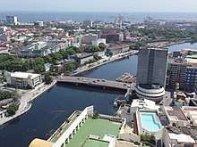 |
Ermita and Binondo | 1946 | 14.595°N 120.972°E |
| 3 | MacArthur Bridge (former Santa Cruz Bridge) | Four lanes of |
 |
Ermita and Santa Cruz | 1952 | 14.596°N 120.980°E |
| Line 1 Bridge | Line 1 |  |
Ermita and Quiapo | 1984 | 14.596°N 120.980°E | |
| 4 | Quezon Bridge (former Puente Colgante) | Four lanes of |
 |
Ermita and Quiapo | 1939 | 14.595°N 120.990°E |
| 5 | Ayala Bridge | Four lanes of |
 |
Ermita and San Miguel | 1908 | 14.591°N 120.999°E |
| 6 | Mabini Bridge Nagtahan Bridge |
Six lanes of |
Paco and Santa Mesa | 1945 | 14.595°N 121.005°E | |
| 7 | Pandacan Bridge Padre Zamora Bridge |
Four lanes of |
 |
Pandacan and Santa Mesa | 14.594°N 121.012°E | |
| PNR Bridge | Philippine National Railways Metro Commuter Line (PNR South Rail) |  |
Pandacan and Santa Mesa | 14.594°N 121.012°E | ||
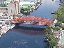
| 8 | Lambingan Bridge | Six lanes of New Panaderos Street |  |
Santa Ana | 14.586°N 121.025°E | |
Makati–Mandaluyong | ||||||
| 9 | Makati–Mandaluyong Bridge | Four lanes between Makati Avenue and Coronado Street |  |
Makati Poblacion and Hulo | 14.569°N 121.030°E | |
| 10 | Estrella–Pantaleon Bridge Rockwell Bridge |
Estrella Street to Pantaleon Street |  |
Makati Poblacion and Hulo/Barangka Ibaba | 2011[2] | 14.567°N 121.037°E |
| 11 | Guadalupe Bridge | Ten lanes of |
 |
Guadalupe Nuevo/Viejo and Barangka Ilaya | 1979 | 14.568°N 121.045°E |
| Line 3 Bridge | Line 3 |  |
Guadalupe Nuevo/Viejo and Barangka Ilaya | 1998 | 14.568°N 121.045°E | |
Makati–Pasig | ||||||
| 12 | Bagong Ilog Bridge C-5 Bridge |
Six lanes of C-5 and |
 |
West Rembo and Bagong Ilog | 14.560°N 121.066°E | |
Pasig | ||||||
| 13 | Kaunlaran Bridge | Two lanes between F. Flores Street and Lopez Jaena Street | Buting and Sumilang | 2015[3] | 14.553°N 121.076°E | |
| 14 | Bambang Bridge | Two lanes of |
 |
Sumilang/San Joaquin and Bambang | 14.553°N 121.076°E | |
| 15 | Arsenio Jimenez Bridge Kalawaan Bridge |
Two lanes of M. Jimenez Street |  |
Kalawaan and Bambang | 14.554°N 121.081°E | |
Taguig–Pasig | ||||||
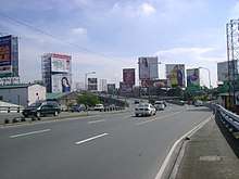
| 16 | Napindan Bridge | Four lanes of Laguna Lake Highway (C-6) | Napindan and Pinagbuhatan | 14.535°N 121.095°E | ||
Planned crossings
| Crossing | Carries | Location | Projected completion |
Coordinates |
|---|---|---|---|---|
| Binondo–Intramuros Bridge[4][5] | San Fernando Street to Solana Street and Riverside Drive | Binondo and Intramuros | ||
| New Estrella–Pantaleon Bridge[4][5] | Estrella Street to Pantaleon Street | Makati Poblacion and Hulo/Barangka Ibaba | ||
| North–South Harbor Bridge[5] | Manila North Harbor and Manila South Harbor | |||
| Ayala Bridge II[5] | Carlos Palanca Sr. Street to San Marcelino Street | Ermita and San Miguel | ||
| Metro Manila Skyway Bridge | Skyway Stage 3 | Pandacan, Santa Mesa, Santa Ana, and San Juan River | 2020 | |
| Beata–F.Y. Manalo Bridge[5] | Pandacan and Santa Ana | |||
| F. Blumentritt–Antipolo Bridge[5] | F. Blumentritt Street to Antipolo Street | Makati Poblacion and Hulo | ||
| Santa Monica–Lawton Bridge | Four lanes between Santa Monica Street and Lawton Avenue | Cembo/West Rembo and Kapitolyo | ||
| Line 9 Subway Tunnel | Metro Manila Subway Line 9 | Kapitolyo and West Rembo | ||
References
- "Neda: Duterte admin pushing BGC-Ortigas bridge project". Philippine Daily Inquirer. August 24, 2016. Retrieved October 17, 2016.
- "New bridge connecting Makati, Mandaluyong opened". GMA Network News. Retrieved 27 June 2015.
- "Blessing and inauguration of Kaunlaran Bridge at Brgy. Sumilang and Buting". Local government of Pasig. Archived from the original on 24 September 2015. Retrieved 27 June 2015.
- Placido, Dharel (29 June 2017). "Construction of two China-sponsored bridges to begin this year". ABS-CBN News. Retrieved 29 June 2017.
- Lamentillo, Anna Mae Yu (4 November 2017). "Build Build Build: Metro Manila Logistics Infrastructure Network". Manila Bulletin. Retrieved 11 June 2020.