Lake Lenore Caves State Park
Lake Lenore Caves State Park is a Washington State Park in the Lenore Canyon extending into the hills from the shore of Lake Lenore. It is part of the Ice Age Floods National Geologic Trail. Lake Lenore and the rock shelter "caves" were caused by basalt coulee cliffs underscoured by the Missoula floods, the same floods that created the Channeled Scablands.[2][3]
| Lake Lenore Caves State Park | |
|---|---|
 A rock shelter in the park | |
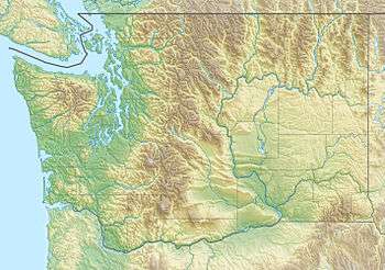 Location in the state of Washington | |
| Location | Grant, Washington, United States |
| Coordinates | 47°28′N 119°31′W |
| Area | 155 acres (63 ha) |
| Operator | Washington State Parks and Recreation Commission |
| Property information from Grant County assessor[1] | |
There are indications that Native Americans used the caves for shelter.[4][5][6] Some petroglyphs are in the caves.[7]
References
- Grant County Assessor, parcels 161066000 and 161061000 via MapSifter
- Soennichsen 2012, p. 133.
- Lillquist 2015, p. 27.
- Sinotte & DeLay 1996, p. 205.
- Lillquist 2015, p. 31.
- Brian J. Cantwell (July 27, 2013), "Water, warmth and wonders at Sun Lakes/Dry Falls State Park", The Seattle Times
- Kruse 2009, p. 338.
Sources
- Sinotte, B.; DeLay, P. (1996). Oregon and Washington Parks Guide. Hunter Publishing. ISBN 978-1-55650-736-6. Retrieved 2018-06-13.CS1 maint: ref=harv (link)
- Soennichsen, John (2012), Washington's Channeled Scablands Guide: Explore and Recreate Along the Ice Age Floods National Geologic Trail, The Mountaineers Books, ISBN 9781594854842
- Kruse, J. (2009). Great Places Washington: A Recreational Guide to Washington's Public Lands and Historic Places for Birding, Hiking, Photography, Fishing, Hunting, and Camping. Great Places Series. Wilderness Adventures Press, Incorporated. ISBN 978-1-932098-69-3.CS1 maint: ref=harv (link)
- Lillquist, Karl (November 8, 2015), Lower Grand Coulee Field Trip Guide, Ice Age Floods Institute, pp. 25–31
External links
- Official website (covered with Dry Falls Visitor Center)
- Lake Lenore Caves, Washington Trails Association
This article is issued from Wikipedia. The text is licensed under Creative Commons - Attribution - Sharealike. Additional terms may apply for the media files.