Lah, Victoria
Lah (/ˈlɑː/ LAH) is a town in the Wimmera region of Victoria, situated between Warracknabeal and Brim on the Henty Highway. At the 2016 census, Lah had a population of 48.[1]
| Lah Victoria | |||||||||
|---|---|---|---|---|---|---|---|---|---|
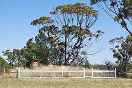 The site of the former Lah school, 2010 | |||||||||
 Lah | |||||||||
| Coordinates | 36°12′0″S 142°28′0″E | ||||||||
| Population | 48 (2016 census)[1] | ||||||||
| Postcode(s) | 3393 | ||||||||
| Elevation | 147[2] m (482 ft) | ||||||||
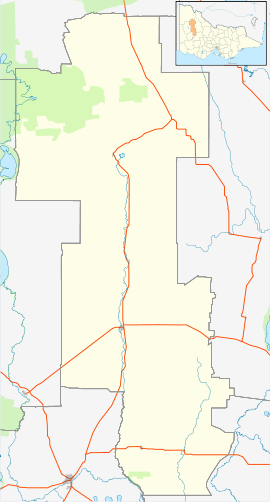
| Location |
| ||||||||
| LGA(s) | Shire of Yarriambiack | ||||||||
| State electorate(s) | Lowan | ||||||||
| Federal Division(s) | Mallee | ||||||||
| |||||||||
References
- Australian Bureau of Statistics (27 June 2017). "Lah". 2016 Census QuickStats. Retrieved 29 July 2017.

- "Sheep Hills climate, averages and extreme weather record - Meat & Livestock Australia".
This article is issued from Wikipedia. The text is licensed under Creative Commons - Attribution - Sharealike. Additional terms may apply for the media files.