Willenabrina, Victoria
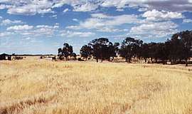
Willenabrina is a small farming district located midway between the towns of Warracknabeal and Rainbow in the Wimmera region of northwest Victoria, Australia. The population at the 2016 census was 9.[1]
| Willenabrina Victoria | |
|---|---|
 Willenabrina | |
 Willenabrina | |
| Coordinates | 36°04′S 142°12′E |
| Population | 9 (2016 census)[1] |
| Postcode(s) | 3393 |
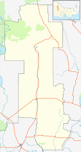
| Location |
|
| LGA(s) | Shire of Yarriambiack |
| State electorate(s) | Lowan |
| Federal Division(s) | Mallee |
History
Originally gazetted as a railway township in the late 1880s (the Post Office opened on June 14, 1889 (closed in 1942),[2] Willenabrina failed to develop when the railway line route beyond Warracknabeal was redirected. A few small shops, a school, a community hall, and a couple of churches, existed around the time of the First World War, along with a sports oval and tennis courts, however none of these facilities remain today.
References
- Australian Bureau of Statistics (27 June 2017). "Willenabrina (State Suburb)". 2016 Census QuickStats. Retrieved 4 October 2018.

- Premier Postal History, Post Office List, retrieved 11 April 2008
External links
This article is issued from Wikipedia. The text is licensed under Creative Commons - Attribution - Sharealike. Additional terms may apply for the media files.