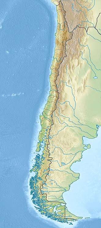
Laguna del Maule (volcano)
Laguna del Maule is a volcanic field in the Andes mountain range of Chile, close to, and partly overlapping, the Chile-Argentina frontier. The bulk of the volcanic field is in the Talca province of Chile's Maule Region. It is a segment of the Southern Volcanic Zone, part of the Andean Volcanic Belt. Many of the volcanic centres in the Laguna del Maule volcanic field formed during postglacial times, after glaciers had retreated from the area. Volcanic activity has generated cones, lava domes, lava coulees and lava flows which surround Laguna del Maule lake.
| Laguna del Maule | |
|---|---|
 False colour image of Laguna del Maule | |
| Highest point | |
| Elevation | 2,160 m (7,090 ft) |
| Coordinates | 36°3′40″S 70°29′45″W GNS |
| Geography | |
 Laguna del Maule | |
| Parent range | Andes |
| Geology | |
| Mountain type | Volcanic field |
| Volcanic arc/belt | Southern Volcanic Zone |
| Last eruption | 2,000 years ago |
About 130 volcanic vents belong to the field, whose activity began 1.5 million years ago and continued into the Holocene. Three major caldera-forming eruptions took place in the volcanic field during pre-last glacial times, 1.5, 990,000-950,000 and 336,000 years ago. Postglacial volcanic activity has included eruptions with simultaneous explosive and effusive components and eruptions where only one component was present. The last eruptions in the volcanic field took place 2,500 ± 700, 1,400 ± 600 and 800 ± 600 years ago and generated lava flows; today geothermal phenomena occur at Laguna del Maule. Volcanic rocks in the field vary from basalt over andesite and dacite to rhyolite; the latter along with rhyodacite makes up most of the Holocene rocks. The field was a source of obsidian with regional importance. The field gets its name from the lake which is also the source of the Maule river.
Between 2004 and 2007, ground inflation began in the volcanic field, indicating the intrusion of a sill beneath it. The rate of inflation is faster than those measured on other inflating volcanoes such as Uturunku in Bolivia and Yellowstone in the United States and has been accompanied by anomalies in soil gas emission and seismic activity. This pattern has created concern about the potential for impending large-scale eruptive activity.
Geography and structure
The Laguna del Maule volcanic field is centred around 36.1°S 70.5°W, straddling the Chilean-Argentine frontier with most of the complex on the Chilean side. The locality belongs to the Maule Region,[1] of Talca province in the Andes mountain range, close to the confluence of the Maule and Campanario rivers in the Maule's valley.[2] The city of Talca lies about 150 kilometres (93 mi) west.[3] The Argentine section of the field is in the Mendoza and Neuquén provinces[4] and the city of Malargüe is located about 140 kilometres (87 mi) east from the volcanic field.[5] Highway 115 passes through the northern part of the volcanic field,[6] and the Paso Pehuenche mountain pass is a few kilometres northeast of the lake;[7] other than this the region is sparsely inhabited[8] and economic activity in the region is limited to oil prospecting, pastures and tourism.[9]
The subduction of the Nazca plate beneath the South America plate has formed a volcanic arc about 4,000 kilometres (2,500 mi) long, which is subdivided into several segments distinguished by varying angles of subduction of the Nazca plate.[10] The part of the volcanic belt named the Southern Volcanic Zone alone contains at least 60 volcanoes with historical activity and three major caldera systems.[11] Major volcanoes of the Southern Volcanic Zone include from north to south: Maipo, Cerro Azul, Calabozos, Tatara-San Pedro, Laguna del Maule, Antuco, Villarrica, Puyehue-Cordon Caulle, Osorno, and Chaiten.[12] Laguna del Maule is located within a segment known as the Transitional Southern Volcanic Zone,[13] 330 kilometres (210 mi) west of the Peru-Chile trench.[5] Volcanoes in this segment are typically located on basement blocks that have been uplifted between extensional basins.[11]
The Laguna del Maule lake lies on the crest of the Andes, within a depression with a diameter of 20 kilometres (12 mi).[14] The lake has a depth of 50 metres (160 ft),[15] a surface area of 54 square kilometres (21 sq mi),[16] and the surface is at an altitude of 2,160 metres (7,090 ft).[6][17] The name of the volcanic field comes from the lake;[2] the Maule river originates there[18] and the Barrancas River has its headwaters in the volcanic field as well.[19] Terraces around the lake indicate that water levels have fluctuated in the past;[20] it is regulated by a dam at the outlet[5] that was built in 1950.[21] An eruption dated between 19,000 ± 700[22] and 23,300 ± 400 years ago dammed the lake 200 metres (660 ft) higher than its present level. When the dam broke[23][22] 9,400 years ago,[24] a lake outburst flood occurred that was 12 cubic kilometres (2.9 cu mi) long and left traces, such as scour, in the down-valley gorge.[23][22] Benches and beach bars developed on the lake,[22] which has left a shoreline around Laguna del Maule.[25] Additionally, tephra fallout has impacted the lake through the Holocene and affected life in the lake waters.[26]
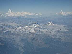
The lake is surrounded by a number of Quaternary volcanic systems of various ages,[3] including about fourteen shield volcanoes and stratovolcanoes that have been degraded by glaciation.[23] The Laguna del Maule volcanic field covers a surface area of 500 square kilometres (190 sq mi)[1] and contains 130 volcanic vents[12] including cones, lava domes, lava flows, and shield volcanoes;[1] 36 silicic coulees and lava domes surround the lake.[12] Over 100 square kilometres (39 sq mi) of the field is covered by these volcanic rocks, and volcanic ash and pumice produced by the eruptions has been found in Argentina.[7] The volcanic field lies at an average height of 2,400 metres (7,900 ft),[27] some summits around Laguna del Maule reach altitudes of 3,900 metres (12,800 ft).[28]
Among the various structures in the volcanic field, Domo del Maule lava dome is of rhyolitic composition and generated a lava flow to the north that dammed the Laguna del Maule. This lava flow is joined by other lava flows from the Crater Negro, a small cone in the southwestern sector of the volcanic field; the lavas of this cone however are andesitic and basaltic. Loma de Los Espejos is a large lava flow of acidic rocks that is 4 kilometres (2.5 mi) long in the northern sector of the volcanic field, close to the outlet of Laguna del Maule.[29] It consists of two lobes with a total volume of about 0.82 cubic kilometres (0.20 cu mi).[30] This flow contains obsidian and vitrophyre and crystals within the flow reflect the sunlight. The well-preserved Colada de las Nieblas lava flow is in the extreme southwestern sector of the volcanic field. This lava flow is 300 metres (980 ft) thick, with length that varies from 6 kilometres (3.7 mi)[29] to 5 kilometres (3.1 mi), and is about 3 kilometres (1.9 mi) wide with a tuff cone at its source.[31] The Barrancas centre has a total volume of 5.5 cubic kilometres (1.3 cu mi) and reaches an elevation of 3,092 metres (10,144 ft).[32]
Past glaciation of this part of the Andes left traces in adjacent valleys.[3] These valleys are U-shaped or have the form of a trench, shapes associated with glacial action,[29] and the older volcanics of Laguna del Maule have been disproportionately eroded by glacial action. Slopes around Laguna del Maule are covered by colluvium including talus slopes.[20]
Besides Laguna del Maule, other lakes in the field are Laguna Cari Launa on the Chilean side in the northeastern sector of the field, and Laguna Fea in the south[6] at 2,492 metres (8,176 ft) elevation[17] and Laguna Negra lake both on the Argentine side.[33][17] The Laguna Sin Salida (so named because it lacks a river running out of it) is in the northeastern sector of the volcanic field and it formed within a glacial cirque.[20]
Geology
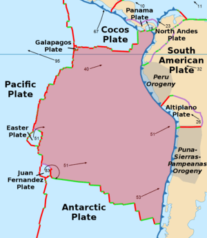
Subduction of the eastern part of Nazca plate beneath the western margin of the South America Plate occurs at a rate of about 74 ± 2 millimetres per year (2.913 ± 0.079 in/year), a process which is responsible for events such as the 1960 Valdivia earthquake and the 2010 Chile earthquake.[14] This subduction process is responsible for the growth of the Chilean Andes and the volcanic and geothermal manifestations therein,[34] including Laguna del Maule which formed 25 kilometres (16 mi) behind the volcanic arc.[35]
Probably due to increased convergence rates of the Nazca and South America plates for the past 28 million years, a phase of strong volcanic activity commenced in the Andes 25 million years ago. It is likely that this phase persisted without interruption until today.[5]
In the area of Laguna del Maule, the subducting Nazca plate reaches a depth of 130 kilometres (81 mi) and is 37 million years old. During the Late Miocene, the convergence rate was higher than today and the Malargüe fold belt formed east of the main chain in response.[13] The Moho is found at depths of 40–50 kilometres (25–31 mi) beneath the volcanic field.[5]
Local
The Campanario Formation is 15.3 to 7 million years old and forms much of the basement in the Laguna del Maule area; this geological formation contains andesitic-dacitic ignimbrites and tuffs with later dacitic dykes that were emplaced 3.6–2.0 million years ago.[3] An older unit, of Jurassic-Cretaceous age, crops out northwest of the volcanic field.[36] Other units include an Oligocene-Miocene group[37] of lacustrine and fluvial formations named Cura-Mallín, and another intermediary formation named Trapa-Trapa which is of volcanic origin and between 19 and 10 million years old.[5] Remnants of Quaternary ignimbrites and Pliocene, early Quaternary volcanic centres, are also found around the field;[5] they form the Cola del Zoro Formation which is in part covered by the eruption products of Laguna del Maule.[38] Faults lie within the volcanic field, such as the Troncoso Fault in its southwestern sector, which is alternatively described as a strike-slip[39] or as a normal fault and which separates distinct regimes of tectonic[40] and volcanic activity within the Laguna del Maule volcanic field;[41] and various north-south cutting faults are found within the Campanario Formation.[3]
Northeast of Laguna del Maule is the Cerro Campanario, a mafic stratovolcano that is 3,943 metres (12,936 ft) high and was active 150,000–160,000 years ago.[42] Nevado de Longavi volcano is located west of Laguna del Maule. The local volcanoes are in a segment of the crust where the Wadati-Benioff zone is 90 kilometres (56 mi) deep.[36] Also west of Laguna del Maule lies the Tatara-San Pedro and Rio Colorado caldera;[43] they may be part of a volcano alignment with Laguna del Maule.[44] More distant are the Calabozos caldera and a late Pleistocene system with domes and flows south of Cerro San Francisquito, which are both silicic volcanic systems.[45] The activity of Tatara-San Pedro and Laguna del Maule with the presence of rhyolite may be influenced by the subduction of the Mocha Fracture Zone, which projects in the direction of these volcanic centres.[46] Nearby are the Risco Bayo and Huemul plutons, which are about 6.2 million years old and may have formed through volcanism similar to that of Laguna del Maule.[47]
Composition of erupted lavas and pyroclasts
Laguna del Maule has erupted andesite, basaltic andesite,[12] basalt,[39] dacite,[2] rhyodacite and rhyolite,[39] the andesites and basaltic andesites having medium K contents[48] and in the Loma de Los Espejos rocks a SiO
2 content of 75.6–76.7% per weight has been noted.[49] Several silicic rocks are known from the Quaternary. After deglaciation, the composition of Laguna del Maule volcanic rocks has grown more silicic, with andesite eruptions being limited to the edges of the volcanic field since 19,000 years ago. Generally, the postglacial phase of activity has generated about 6.4 cubic kilometres (1.5 cu mi) of rhyolite and 1.0 cubic kilometre (0.24 cu mi) of rhyodacite.[12] The total volume of volcanic rocks that are part of the Laguna del Maule volcanic field is over 350 cubic kilometres (84 cu mi),[50][7] of which about 40 cubic kilometres (9.6 cu mi) were emplaced postglacially.[51]
Several stratigraphic units have been distinguished at the volcanic field, including the Valley unit exposed in the Maule valley and the Lake unit found around the lake.[36] The Valley unit's rocks are basaltic andesite. Plagioclase and, in lesser measure, clinopyroxene and olivine form its phenocrysts.[52] The mostly postglacial Lake unit includes glassy rhyolite,[53] which is poor in crystals. Phenocrysts in the postglacial rocks are biotite, plagioclase and quartz.[54] Microlites in the Lake unit rocks include biotite, plagioclase and spinel.[53] Variable vesicular texture has been noted on rocks erupted during different eruptions.[49] Temperatures of the postglacial magmas have been estimated at 820–950 °C (1,510–1,740 °F).[55] The Holocene rhyolites are glassy and contain few crystals.[56]
The postglacial rocks have very similar element compositions.[12] High Al and low Ti are present in the basaltic andesite and basalt, a typical pattern for basic rocks in zones where plates converge.[57] The rocks overall belong to the calc-alkaline series,[2] although some Fe-rich rocks have been attributed to the tholeiitic series.[58] Sr isotope ratios have been compared to the ones of Tronador volcano;[59] additional compositional similarity is found to other volcanoes close to Laguna del Maule such as Cerro Azul and Calabozos.[60] Laguna del Maule stands out for the frequency of rhyolitic rocks, compared to volcanoes farther south in the chain.[61] There are compositional trends in the region of the volcanic arc between 33° and 42°, with more northerly volcanoes being more andesitic in composition while to the south basalts are more frequent.[10]
Magma genesis
All the postglacial activity appears to originate from a shallow silicic magma chamber beneath the caldera.[12] Research published in 2017 indicates that this system is somewhat heterogeneous with distinct compositions of magmas erupted in the northwesterly and southeasterly parts of the volcanic field.[62] The early post-glacial rhyodacites contain mafic inclusions[63] implying that mafic lavas exist but do not reach the surface.[22] From Sr isotope ratios it has been inferred that the magma is of deep origin,[59] and the rare-earth element composition shows no evidence of crustal contamination.[64] Nd and Sr isotope ratios indicate all rocks are derived from the same parent source,[61] with the rhyolites forming by fractional crystallization of the basic magma,[55] similar to the postulated origins of rocks from the Central Volcanic Zone.[60] Partial melting may also be the source of the rhyolites.[65] Overall the environment where the rocks formed appears to be an oxidized 760–850 °C (1,400–1,560 °F) hot system that formed over 100,000 to 200,000 years, and was influenced by the injection of basaltic magma.[66] The rhyolitic melts may originate in a crystal rich mush beneath the volcanic field[67] and probably in at least two magma chambers.[22] A minimum long term magma supply rate of 0.0005 cubic kilometres per year (0.00012 cu mi/a) has been estimated.[68]
Use of obsidian
Laguna del Maule was an important source of obsidian for the region, on both sides of the Andes. Finds have been made from the Pacific to Mendoza 400 kilometres (250 mi) away from the coast,[33] as well as at archaeological sites of Neuquén province.[69] Obsidian forms sharp edges and was used by ancient societies for the production of projectiles as well as cutting instruments. In South America, obsidian was traded over large distances.[33] Obsidian has been found in the Arroyo El Pehuenche[lower-alpha 1], Laguna Negra[lower-alpha 2] and Laguna del Maule[lower-alpha 3] localities.[71] These sites yield obsidians with varying properties, from large blocks at Laguna del Maule to smaller pebbles probably carried by water at Arroyo El Pehuenche.[27]
Climate and vegetation

Laguna del Maule lies at the interface between a semi-arid, temperate climate and a colder montane climate. Average yearly temperatures from 2007 to 2013 ranged 8.1–10.3 °C (46.6–50.5 °F). Precipitation related to cold fronts falls during autumn and winter, although occasional summer storms also contribute to rainfall.[72] Laguna del Maule is subject to the rain shadow effect of mountains farther west, which is the reason why the numerous summits exceeding 3,000 metres (9,800 ft) in altitude around the lake presently are not glaciated.[18] Most of the lake water comes from snowmelt;[15] for much of the year the landscape around the lake is covered with snow.[5]
The area of Laguna del Maule was glaciated during the last ice age, with a maximum occurring between 25,600±1,200 and 23,300±600 years ago.[73] During this time a 80 kilometres (50 mi) wide ice cap covered the volcano and the surrounding valleys.[24] Probably due to changes in the position of the Westerlies, after c. 23,000 years ago the glaciers retreated above Laguna del Maule.[73] The glaciation has left moraines and terraces in the area,[74] with undulating hills lying close to the outlet of the lake.[20] Poorly developed moraines with the appearance of tiny hills lie downstream of Laguna del Maule, and such moraines form small hills around the lake rising about 10–20 metres (33–66 ft) above the lake level.[18] Other climate changes in the Holocene such as the Little Ice Age are also recorded from sediments in Laguna del Maule,[26] such as a humid period in the 15th–19th century.[75]
The landscape around Laguna del Maule is mostly desertic without trees.[5] Vegetation around Laguna del Maule is principally formed by cushion plants and sub-shrubs, with higher altitudes displaying more scattered vegetation.[15] The rocks around Laguna del Maule host a plant named Leucheria graui which has not been found elsewhere.[76]
Eruptive history
Laguna del Maule has been active since 1.5 million years ago.[50][7] Three caldera forming events occurred during the system's lifespan.[12] The first took place 1.5 million years ago and produced the dacitic Laguna Sin Puerto ignimbrite, which is exposed northwest of Laguna del Maule lake.[7] The second occurred 990,000[38]-950,000 years ago and produced the Bobadilla caldera and a rhyodacitic ignimbrite[17][7] also known as the Cajones de Bobadilla ignimbrite. This ignimbrite reaches a thickness of 500 metres (1,600 ft)[40] and borders Laguna del Maule lake in the north.[17][7] The Bobadilla caldera is centred beneath the northern shore of the Laguna del Maule,[7] and has dimensions of 12 by 8 kilometres (7.5 mi × 5.0 mi).[23] The third took place 336,000 years ago and produced the welded[12] Cordon Constanza ignimbrite.[77] In total, volcanic output at Laguna del Maule has been estimated to be 200,000 cubic metres per year (7,100,000 cu ft/a), comparable to other volcanic arc systems,[78] with eruptions occurring about every 1000 years.[68] It has been inferred that each eruption lasted between 100 and more than 3000 days.[79]
Aside from the caldera activity,[12] pre-postglacial eruptions include the rhyolitic Cajon Atravesado 712,000 years ago north of the lake,[7] the rhyodacitic Cerro Negro 468,000–447,000 years ago in the northeastern parts of the field,[7][12] the rhyodacitic Arroyo Cabeceras de Troncoso 203,000 years ago northwest of the lake,[7] and the unit known as "Valley unit" with basic rocks of a volume of 5 cubic kilometres (1.2 cu mi). This unit was erupted 240,000±50,000 to 200,000±70,000 years ago and in the Maule valley outcrops it appears as lava flows thinning to the top.[36] A unit of basalt pyroclastic cones and lava flows in the northwest of the field has been dated 100,000±20,000 to 170,000±20,000 years ago from two samples.[52] Other volcanic activity took place 154,000 years ago, forming the basaltic Bobadilla Chica vent and lava north of the lake, and 152,000 years ago forming the andesitic Volcan de la Calle vent and lava straddling the Chile-Argentina border in the eastern sector.[7] Later eruptive activity formed the rhyodacite Domo del Maule[lower-alpha 4] 114,000 years ago northwest of Laguna del Maule, a neighbouring rhyodacite west of Laguna del Maule dam, basaltic El Candado[lower-alpha 5] 63,000–62,000 years ago near the outlet of Laguna del Maule,[7][12] a rhyolite east of the outlet 38,000 ± 29,000 years ago,[81] and andesites also west of the dam 27,000–26,000 years ago named Arroyo Los Mellicos.[7][12]
The 36 rhyodacitic lava domes and flows which surround the lake were erupted from about 24 individual vents from 25,000 years ago forwards, after the onset of deglaciation, until the last such eruption approximately 2,000 years ago.[12][82] After deglaciation 23,000 – 19,000 years ago, two pulses of volcanism occurred at Laguna del Maule, the first 22,500 – 19,000 years ago and the second in the middle-late Holocene.[83] A first, large Plinian eruption formed the 20 cubic kilometres (4.8 cu mi) Rhyolite of Laguna del Maule from a vent presumably located below the northern part of the lake.[83] Beyond this, silicic volcanic units erupted after 25,000 include young andesites on the western coast of Laguna del Maule 24,000 years ago, rhyodacitic Arroyo de la Calle 21,000 years ago southeast of Laguna del Maule and rhyolitic Loma de Los Espejos[lower-alpha 6] (unit rle) 19,000 years ago in the northern part of the field,[6] the latter of which dammed the Maule River and thus increased the size of the lake.[22][17] These units have a volume of 1.7 cubic kilometres (0.41 cu mi).[66] The Cerro Barrancas[lower-alpha 7] centre started being active around 14,500 ± 1,500 years before present[84] and was the main site of volcanic activity between 14,500 and about 8,000 years ago.[83] After that point activity shifted and the volume output increased, with the subsequent units having a volume of 4.8 cubic kilometres (1.2 cu mi).[66] These two phases of volcanic activity occurred within 9,000 years of each other and the magmas involved may have been sourced from different magma reservoirs.[54] This phase includes the rhyolitic Cerro Barrancas (unit rcb[85]) 7,000 years ago in the southeastern part of the field,[6] whose tephra and pyroclastic emissions are among the largest of the volcanic field[19] including an associated 15 kilometres (9.3 mi)[16]-13 kilometres (8.1 mi) long pyroclastic flow that filled a pre-existing valley, forming the Pampa del Rayo,[32] rhyolitic Cari Launa[lower-alpha 8][7][63] which is in part flooded by the Cari Launa lake;[31] unit rcl[85]) <3,300[86]-3,500 years ago in the northeastern part of the field,[7][63] as well as rhyolitic Colada Divisoria (unit rcd[85]) and Colada Las Nieblas [lower-alpha 9] 2,000 years ago in the eastern and southwestern parts of the field, respectively.[6] The first three of these volcanic units straddle the border between Argentina and Chile.[19] Other proposed dates are 23,000 years ago for the Espejos rhyolite, 14,500 years ago for the Cari Launa rhyolite, 6,400 and 3,900 years ago for the Barrancas complex and 2,200 years ago for the Colada Divisoria.[87] In addition, the unit rcb might be a compound unit of various ages.[88]
Undated postglacial units are andesitic Crater Negro[lower-alpha 10] scoria cone and lava flow just west of Laguna del Maule,[89] andesitic Playa Oriental on the southeastern shore of Laguna del Maule,[90] rhyolitic Arroyo de Sepulveda at Laguna del Maule and rhyodacitic Colada Dendriforme (unit rcd[24]) in the western part of the field.[6] This rhyolitic flare up has no precedents in the history of the volcanic field,[87] and it is the largest such structure in the southern Andes.[17] Three mafic volcanic vents named Arroyo Cabeceras de Troncoso, Crater 2657 and Hoyo Colorado are also considered postglacial. The former two are andesitic, while the latter is a pyroclastic cone.[91] Mafic volcanism appears to have decreased after glacial times at Laguna del Maule, probably because such magmas were hindered from ascending by a more silicic magma system,[92] and the post-glacial volcanism has a mainly silicic composition.[83] The magma chamber acts as a trap for mafic magma,[12] preventing it from rising to the surface[87] and thus explaining the absence of postglacial mafic volcanism.[83]
Explosive eruptions and far-field effects
Explosive activity including ash and pumice has accompanied a number of the postglacial eruptions, the largest is associated with Los Espejos and has been dated 23,000 years ago.[16] The deposit of this Plinian eruption reaches 4 metres (13 ft) of thickness at a distance of 40 kilometres (25 mi).[93] White ash and pumice form layered deposits east of the Loma de Los Espejos;[29] another explosive eruption is linked to the Barrancas centre.[66] Other such explosive events have been dated at 7,000, 4,000 and 3,200 years ago by radiocarbon dating.[93] In total about three Plinian eruptions and three smaller explosive eruptions have been identified at Laguna del Maule, most of them took place between 7,000 and 3,000 years ago;[94] it has been estimated that the ash and pumice deposits have a volume comparable with that of the lava flows.[7]
A tephra layer in the Argentine Caverna de las Brujas cave dated 7,780 ± 600 years ago has been tentatively linked to Laguna del Maule,[95] and another with a thickness of 80 centimetres (31 in) 65 kilometres (40 mi) away from Laguna del Maule is dated 765 ± 200 years ago and appears to coincide with a time with no archaeological findings in the high cordillera. Other tephras which possibly were erupted at Laguna del Maule have been found in Argentinian archaeological sites, one 7,195 ± 200 years ago at El Manzano and another 2,580 ± 250 to 3,060 ± 300 years old at Cañada de Cachi. The El Manzano tephra reaches a thickness of 3 metres (9.8 ft) about 60 kilometres (37 mi) away from Laguna del Maule and would have had a severe impact on Holocene human communities south of Mendoza.[96]
Most recent activity and geothermal system
The most recent dates for eruptions are ages of 2,500 ± 700, 1,400 ± 600 and 800 ± 600 for rhyolitic lava flows,[22] with the last eruption forming the Las Nieblas flow.[62] No eruptions have occurred during historical time, but petroglyphs in Valle Hermoso may depict volcanic activity at Laguna del Maule.[19]
Laguna del Maule is geothermally active,[97] featuring bubbling pools, fumaroles and hot springs. Temperatures in these systems range between 93–120 °C (199–248 °F)[98] but fumarolic activity in general is small.[25] The Baños Campanario hydrothermal springs lie northwest from Laguna del Maule[39] and their waters together with these from the Termas del Medano springs appear to form through a mixing of magmatic and precipitation water.[62] The field has been evaluated as a potential source of geothermal energy.[99] It and the neighbouring Tatara-San Pedro volcano form the so-called Mariposa geothermal system discovered in 2009, whose temperature has been estimated on the basis of gas chemistry to be 200–290 °C (392–554 °F).[34] One estimate puts the potential productivity of Laguna del Maule as an energy source at 50–200 megawatts (67,000–268,000 hp).[100]
Present day threat
Laguna del Maule is a volcanic system that is undergoing strong deformation;[12] between 2004 and 2007 the ground in the volcanic field has been uplifting.[101] This deformation attracted the attention of the global scientific community after it was detected by radar interferometry.[1] Between January 2006 and January 2007 uplift of 18 centimetres per year (7.1 in/year) was measured,[12] with uplift during 2012 amounting to about 28 centimetres per year (11 in/year).[78] Between 2007 and 2011 the uplift reached close to 1 metre (3 ft 3 in).[97] A change in the deformation pattern occurred in 2013 related to an earthquake swarm in January 2013,[102] with deformation slowing through to mid-2014.[103] Measurements in 2016 indicated that the uplift rate was 25 centimetres per year (9.8 in/year);[104] uplift has continued into 2018[83] and the total deformation has reached 1.8 metres (5 ft 11 in)[105]->2.5 metres (8 ft 2 in).[106] This uplift is one of the largest in all volcanoes which are not in eruption; the strongest uplift worldwide was recorded during 1982–84 at Campi Flegrei in Italy with an end change of 1.8 metres (5 ft 11 in). Other actively deforming dormant volcanoes in the world are Lazufre also in Chile, Santorini in Greece during 2011–12, and Yellowstone in the United States at a rate of 1/7th that of Laguna del Maule.[78] Another South American volcano, Uturunku in Bolivia has been inflating at a pace 1/10th that of Laguna del Maule's.[107] There is evidence that earlier deformations occurred at Laguna del Maule,[78] with the lake shores having risen by about 67 metres (220 ft) during the Holocene[108] possibly as a consequence of about 20 cubic kilometres (4.8 cu mi) entering the magmatic system.[25]
The current uplift has its centre beneath the western segment of the ring of post-glacial lava domes,[109] more specifically beneath the southwestern sector of the lake.[102] The source of the deformation has been traced to an inflation of a sill, with dimensions of 9.0 by 5.3 kilometres (5.6 mi × 3.3 mi) 5.2 kilometres (3.2 mi) deep beneath the volcanic field.[107] This sill has been inflating at an average pace of 31,000,000 ± 1,000,000 cubic metres per year (1.095×10⁹ ± 35,000,000 cu ft/a) between 2007 and 2010. The rate of volume change has changed between 2011 and 2012, with an increase in the volume change rate.[110] As of July 2016, 2,000,000 cubic metres per year (71,000,000 cu ft/a) of magma are estimated to enter the magma chamber.[104] The average recharge rate required to explain the inflation is about 0.03–0.04 cubic kilometres per year (0.0072–0.0096 cu mi/a).[51] This volume change is approximately 10 to 100 times as large as the field's long term magma supply rate.[78] Gravimetric analysis has indicated that between April 2013 and January 2014, approximately 0.044 cubic kilometres (0.011 cu mi) of magma intruded beneath the field.[111] The presence of a sill is also supported by magnetotelluric measurements indicating conductivity anomalies at depths of 4–5 kilometres (2.5–3.1 mi) beneath the western side of the volcanic field[112] and at 8–9 kilometres (5.0–5.6 mi) depth beneath its northern part,[113] indicating the presence of rhyolitic melt,[107] but they do not show a magmatic system associated with the southeastern vents, leaving their magma supply route uncertain.[114] The existence of a Bouguer gravity anomaly also indicates the existence of a low-density body 2–5 kilometres (1.2–3.1 mi) beneath the volcano.[39] A volume of 115 cubic kilometres (28 cu mi) of crystal-rich mush with about 30 cubic kilometres (7.2 cu mi) magma embedded within the mush have been estimated. This reservoir may have moved away from the old vents towards its present-day position[115][22] and is being resupplied by more crystal-poor deeper magmas.[39]
Strong seismic activity has accompanied the deformation at Laguna del Maule, with seismic swarms recorded above the depth of the deforming sill south of the ring of lava domes, with a particular focus around Colada Las Nieblas. A further magnitude 5.5 earthquake occurred south of the volcanic field on June 2012.[78] A major volcano-tectonic earthquake swarm occurred in January 2013,[102] possibly due to faults and underground liquids being pressurized by the intrusion of magma.[67] Swarms of earthquakes occur every two or three months and can last from half an hour to three hours.[116] Most earthquake activity appears to be of volcano-tectonic origin, with fluid flow inducing a subordinate amount of earthquakes;[117] two intersecting lineaments on the southwest corner of the lake appear to be involved.[116] The 2010 Maule earthquake, 230 kilometres (140 mi) west of Laguna del Maule,[7] did not affect the volcanic field, with the rate of uplift remaining unchanged,[97] while other measurements indicate a change in the uplift rates at that point.[103][118] Some shallow earthquakes have been interpreted as reflecting diking and faulting on the magma chamber; the pressure within the chamber however appears to be insufficient to trigger a rupture all the way between the surface and the chamber and thus no eruption has occurred yet.[119]
Several mechanism have been proposed for the inflation, including the movement of magma underground, the injection of new magma, or the action of volcanic gases and volatiles which are released by the magma.[120] Another proposal is that the inflation may be situated in a hydrothermal system[121] although there is little evidence for the existence of such a system at Laguna del Maule, unless the Baños Campanario 15 kilometres (9.3 mi) away are part of one.[122] CO
2 anomalies have also been found around Laguna del Maule,[111] possibly triggered by the stress of the inflation activating old faults.[121] These anomalies are concentrated on the northern lakeshore. Such CO
2 may indicate that the inflation is of mafic composition, as rhyolite only poorly dissolves CO
2.[63] Gravity change measurements also show an interaction between magma source, faults and the hydrothermal system.[123]
This uplift has been a cause of concern in light of the history of explosive activity of the volcanic field,[16] with 50 eruptions in the last 20,000 years;[124] the current uplift may be the prelude of a large rhyolitic eruption.[125] In particular, the scarce fumarolic activity implies that a large amount of gas is trapped within the magma reservoir, increasing the hazard of an explosive eruption.[126] It is not clear if such an eruption would fit the pattern set by Holocene eruptions or would be a larger event.[66] The prospect of renewed volcanic activity at Laguna del Maule has caused concerns among the authorities and inhabitants of the region[125] as a major eruption would have a serious impact on Argentina and Chile,[93] including the formation of lava domes, lava flows, pyroclastic flows near the lake, ash fall at larger distances[124] and lahars;[8] the international road across Paso Pehuenche and air traffic in the region could be endangered by renewed eruptions.[9] Laguna del Maule is considered to be one of the most dangerous volcanoes of the Southern Andean volcanic belt.[50] In March 2013, the Southern Andean Volcano Observatory declared a "yellow alert" for the volcano in light of the deformation and earthquake activity,[56] and was later supplemented with an "early" warning later withdrawn in January 2017.[127] The Chilean National Geology and Mining Service monitors the volcano[128] and a preliminary hazard map has been published.[9]
Notes
References
- Amigo et al. 2012, p.463
- Munizaga et al. 1976, p.146
- Figueroa 1988, p.7
- Google (3 August 2016). "Laguna del Maule" (Map). Google Maps. Google. Retrieved 3 August 2016.
- Hildreth et al., 2009–2010, p.11
- Feigl et al. 2013, p.887
- Singer et al. 2014, p.5
- Cáceres, Castruccio and Parada 2018, p.30
- Sruoga et al. 2015, p.51
- Frey et al. 1984, p.133
- Stern, Charles R. (December 2004). "Active Andean volcanism: its geologic and tectonic setting". Revista geológica de Chile. 31 (2). doi:10.4067/S0716-02082004000200001.
- Feigl et al. 2013, p.886
- Holm et al. 2014, p.3
- Feigl et al. 2013, p.885
- Carrevedo et al. 2015, p.958
- Fierstein, J.; Sruoga, P.; Amigo, A.; Elissondo, M.; Rosas, M. (December 2012). "Postglacial eruptive history of Laguna del Maule volcanic field in Chile, from fallout stratigraphy in Argentina". AGU Fall Meeting Abstracts. 2012: V31F–03. Bibcode:2012AGUFM.V31F..03F.
- Miller et al. 2017, p.15
- Brüggen 1929, p.17
- Sruoga et al. 2015, p.49
- Figueroa 1988, p.10
- Martel-Cea et al. 2016, p.51
- Feigl et al. 2018, p.2
- Hildreth et al., 2009–2010, p.5
- Feigl et al. 2018, p.4
- Andersen et al. 2018, p.59
- Valero-Garces, B. L.; Frugone Alvarez, M.; Barreiro-Lostres, F.; Carrevedo, M. L.; Latorre Hidalgo, C.; Giralt, S.; Maldonado, A.; Bernárdez, P.; Prego, R.; Moreno-Caballud, A. (1 December 2014). "A Holocene Lake Record from Laguna Del Maule (LdM) in the Chilean Andes: Climatic and Volcanic Controls on Lake Depositional Dynamics". AGU Fall Meeting Abstracts. 33: 33E–06. Bibcode:2014AGUFMPP33E..06V.
- Giesso et al. 2011, p.6
- Singer, Brad; Hildreth, Wes; Vincze, Yann (1 June 2000). "Ar/Ar evidence for early deglaciation of the central Chilean Andes". Geophysical Research Letters. 27 (11): 1664. Bibcode:2000GeoRL..27.1663S. doi:10.1029/1999GL011065.
- Figueroa 1988, p.8
- Cáceres, Castruccio and Parada 2018, p.12
- Cáceres, Castruccio and Parada 2018, p.11
- Sruoga et al. 2015, p.50
- Durán, Víctor; Giesso, Martín; Glascock, Michael; Neme, Gustavo; Gil, Adolfo; Sanhueza R, Lorena (2004). "Estudio de fuentes de aprovisionamiento y redes de distribución de obsidiana durante el Holoceno Tardío en el sur de Mendoza (Argentina)" [Study of supply sources and distribution networks of obsidian during the Late Holocene in southern Mendoza (Argentina)]. Estudios Atacameños (in Spanish) (28). doi:10.4067/S0718-10432004002800004. ISSN 0718-1043.
- Hickson, Catherine; Rodríguez, Carolina; Sielfeld, Gerd; Selters, John; Ferraris, Fernando; Henriquez, Rene (2012). "Mariposa Geothermal System: A Large Geothermal Resource in Central Chile (320MWe inferred)" (PDF). SERNAGEOMIN. Antofagasta: 8th Chilean Geological Congress. p. 583. Retrieved 7 July 2016.
- Cordell, Unsworth and Díaz 2018, pp.169–170
- Frey et al. 1984, p.134
- Pedroza, Viviana; Le Roux, Jacobus P.; Gutiérrez, Néstor M.; Vicencio, Vladimir E. (2017). "Stratigraphy, sedimentology, and geothermal reservoir potential of the volcaniclastic Cura-Mallín succession at Lonquimay, Chile". Journal of South American Earth Sciences. 77: 1–20. Bibcode:2017JSAES..77....1P. doi:10.1016/j.jsames.2017.04.011.
- Cáceres, Castruccio and Parada 2018, p.4
- Cordell, Unsworth and Díaz 2018, p.169
- Garibaldi et al. 2020, p.2
- Garibaldi et al. 2020, p.12
- Hildreth, Wes; Singer, Brad; Godoy, Estanislao; Munizaga, Francisco (July 1998). "The age and constitution of Cerro Campanario, a mafic stratovolcano in the Andes of Central Chile". Revista Geológica de Chile. 25 (1). doi:10.4067/S0716-02081998000100002.
- Davidson, Jon P.; Dungan, Michael A.; Ferguson, Kurt M.; Colucci, Michael T. (1987). "Crust-magma interactions and the evolution of arc magmas: The San Pedro–Pellado volcanic complex, southern Chilean Andes". Geology. 15 (5): 443. Bibcode:1987Geo....15..443D. doi:10.1130/0091-7613(1987)15<443:CIATEO>2.0.CO;2.
- Sielfeld, G.; Cembrano, J.M. (December 2013). "Oblique-to-the-orogen fault systems and it causal relationship with volcanism and geothermal activity in Central Southern Chile: Insights on ENE and NW regional lineaments". AGU Fall Meeting Abstracts. 2013: T23E–2642. Bibcode:2013AGUFM.T23E2642S.
- Hildreth, Wes; Grunder, Anita L.; Drake, Robert E. (1984). "The Loma Seca Tuff and the Calabozos caldera: A major ash-flow and caldera complex in the southern Andes of central Chile". Geological Society of America Bulletin. 95 (1): 48. Bibcode:1984GSAB...95...45H. doi:10.1130/0016-7606(1984)95<45:TLSTAT>2.0.CO;2.
- Dungan, D.A.; Langmuir, C.H.; Spikings, R.; Leeman, W.P.; Goldstein, S.; Davidson, J.P.; Costa, F.; Selles, D.; Bachmann, O. (2015). "Assimilative recycling of the plutonic roots of Andean arc volcanoes: Rates, physical mechanisms, and geochemical consequences". Researchgate. Barcelona: 6th International Symposium on Andean Geodynamic. p. 240. Retrieved 7 July 2016.
- Schaen, A. J.; Garibaldi, N.; Singer, B. S.; Schoene, B.; Cottle, J. M.; Tikoff, B.; Gutiérrez, F. J.; Jicha, B. R.; Payacán, I. J. (December 2015). "4-Dimensional Insights into Silicic Magma Reservoir Assembly from Late Miocene Southern Andean Plutons". AGU Fall Meeting Abstracts. 2015: V51G–3118.
- Romeuf, Natalie; Aguirre, Luis; Soler, Pierre; Feraud, Gilbert; Jaillard, Etienne; Ruffet, Gilles (1995). "Middle Jurassic volcanism in the Northern and Central Andes". Revista Geológica de Chile. 22 (2): 256. Retrieved 6 July 2016.
- Wright, H.M.N.; Fierstein, J.; Amigo, A.; Miranda, J. (December 2014). "Vesicularity variation to pyroclasts from silicic eruptions at Laguna del Maule volcanic complex, Chile". AGU Fall Meeting Abstracts. 2014: V21B–4753. Bibcode:2014AGUFM.V21B4753W.
- Cardona et al. 2018, p.1
- Feigl et al. 2018, p.1
- Frey et al. 1984, p.135
- Frey et al. 1984, p.136
- Andersen, N.; Costa Rodriguez, F.; Singer, B.S. (December 2014). "Timescales of Magmatic Processes Preceding Eruption in a Large, Extraordinarily Restless, Silicic Magma System". AGU Fall Meeting Abstracts. 2014: V31F–07. Bibcode:2014AGUFM.V31F..07A.
- Frey et al. 1984, p.144
- Singer et al. 2014, p.4
- Frey et al. 1984, p.139
- Holm et al. 2014, p.9
- Munizaga et al. 1976, p.148
- Frey et al. 1984, p.146
- Frey et al. 1984, p.142
- Cordell, Unsworth and Díaz 2018, p.170
- Singer et al. 2014, p.6
- Munizaga et al. 1976, p.149
- Frey et al. 1984, p.145
- Andersen, N.; Singer, B.S.; Jicha, B.R.; Fierstein, J.; Vasquez, J.A. (December 2013). "The Development of a Restless Rhyolite Magma Chamber at Laguna del Maule, Chile". AGU Fall Meeting Abstracts. 2013: V51C–2676. Bibcode:2013AGUFM.V51C2676A.
- Singer et al. 2014, p.8
- Singer et al. 2014, p.9
- Barberena, Ramiro; Borrazzo, Karen; Rughini, Agustina A; Romero, Guadalupe; Pompei, M. Paz; Llano, Carina; de Porras, M. Eugenia; Durán, Víctor; Stern, Charles R; Re, Anahí; Estrella, Diego; Forasiepe, Analía; Fernández, Fernándo J; Chidiak, Manuel; Acuña, Luis; Gasco, Alejandra; Quiroga, María Nella (2015). "Perspectivas arqueológicas para Patagonia Septentrional: Sitio Cueva Huenul 1 (Provincia del Neuquén, Argentina)" [Archaeological perspectives for Northern Patagonia: Huenul 1 Cave Site (Neuquén Province, Argentina)]. Magallania (Punta Arenas). 43 (1): 137–163. doi:10.4067/S0718-22442015000100009.
- Giesso et al. 2011, p.10
- Giesso et al. 2011, p.5
- Carrevedo et al. 2015, p.957
- Kaplan, Michael R.; Ackert, Robert P.; Singer, Brad S.; Douglass, Daniel C.; Kurz, Mark D. (2004). "Cosmogenic nuclide chronology of millennial-scale glacial advances during O-isotope stage 2 in Patagonia". Geological Society of America Bulletin. 116 (3): 319. Bibcode:2004GSAB..116..308K. doi:10.1130/B25178.1.
- Mourgues, F. Amaro; Schilling, Manuel; Castro, Consuelo (2012). "Propuesta de definición de los Contextos Geológicos Chilenos para la caracterización del patrimonio geológico nacional" [Proposal for the definition of the Chilean Geological Contexts for the characterization of the national geological heritage] (PDF). SERNAGEOMIN (in Spanish). p. 891. Retrieved 8 July 2016.
- Martel-Cea et al. 2016, p.52
- Katinas, Liliana; Tellería, María Cristina; Crisci, Jorge V. (2 September 2008). "A New Species of Leucheria (Asteraceae, Mutisieae) from Chile". Novon: A Journal for Botanical Nomenclature. 18 (3): 368. doi:10.3417/2006108.
- Hildreth et al., 2009–2010, p.37
- Feigl et al. 2013, p.898
- Cáceres, Castruccio and Parada 2018, p.26
- "Global Volcanism Program". Smithsonian Institution., Synonyms & Subfeatures
- Hildreth et al., 2009–2010, p.60
- Cáceres, Castruccio and Parada 2018, p.3
- Andersen et al. 2018, p.58
- Andersen, Nathan L.; Singer, Brad S.; Jicha, Brian R.; Beard, Brian L.; Johnson, Clark M.; Licciardi, Joseph M. (1 January 2017). "Pleistocene to Holocene Growth of a Large Upper Crustal Rhyolitic Magma Reservoir beneath the Active Laguna del Maule Volcanic Field, Central Chile". Journal of Petrology. 58 (1): 85–114. Bibcode:2017JPet...58...85A. doi:10.1093/petrology/egx006. ISSN 0022-3530.
- Cáceres, Castruccio and Parada 2018, p.5
- Cáceres, Castruccio and Parada 2018, p.13
- Andersen, N.L.; Singer, B.S.; Jicha, B.R.; Hildreth, E.W.; Fierstein, J.; Rogers, N.W. (December 2012). "Evolution of Rhyolite at Laguna del Maule, a Rapidly Inflating Volcanic Field in the Southern Andes". AGU Fall Meeting Abstracts. 2012: V31C–2804. Bibcode:2012AGUFM.V31C2804A.
- Cáceres, Castruccio and Parada 2018, p.14
- Hildreth et al., 2009–2010, p.61
- Hildreth et al., 2009–2010, p.65
- Salas, Pablo A.; Rabbia, Osvaldo M.; Hernández, Laura B.; Ruprecht, Philipp (27 June 2016). "Mafic monogenetic vents at the Descabezado Grande volcanic field (35.5°S–70.8°W): the northernmost evidence of regional primitive volcanism in the Southern Volcanic Zone of Chile". International Journal of Earth Sciences. 106 (3): 1107. Bibcode:2017IJEaS.106.1107S. doi:10.1007/s00531-016-1357-5.
- Miller et al. 2017, p.16
- Amigo et al. 2012, p.464
- Fierstein, Judy; Sruoga, Patricia; Amigo, Alvaro; Elissondo, Manuela; Rosas, Mario (2013). Tephra in Argentina establishes postglacial eruptive history of Laguna del Maule volcanic field in Chile (PDF). IAVCEI 2013 Scientific Assembly. Kagoshima, Japan.
- Peña-Monné, José Luis; Sancho-Marcén, Carlos; Durán, Víctor; Mikkan, Raúl (October 2013). "Geoarchaeological reconstruction of the Caverna de las Brujas (Mendoza, Argentina) for the planning of an archaeological intervention". Quaternary International. 308–309: 268. Bibcode:2013QuInt.308..265P. doi:10.1016/j.quaint.2012.06.025.
- Durán, Victor; Mikkan, Raúl (December 2009). "Impacto del volcanismo holocénico sobre el poblamiento humano del sur de Mendoza (Argentina)" [Impact of the holocene volcanism on the human population of southern Mendoza (Argentina)]. Intersecciones en Antropología (in Spanish). 10 (2). ISSN 1850-373X. Retrieved 9 July 2016.
- Pritchard, M. E.; Jay, J. A.; Aron, F.; Henderson, S. T.; Lara, L. E. (1 July 2013). "Subsidence at southern Andes volcanoes induced by the 2010 Maule, Chile earthquake". Nature Geoscience. 6 (8): 634. Bibcode:2013NatGe...6..632P. doi:10.1038/ngeo1855.
- Sanchez-Alfaro, Pablo; Sielfeld, Gerd; Campen, Bart Van; Dobson, Patrick; Fuentes, Víctor; Reed, Andy; Palma-Behnke, Rodrigo; Morata, Diego (November 2015). "Geothermal barriers, policies and economics in Chile – Lessons for the Andes" (PDF). Renewable and Sustainable Energy Reviews. 51: 1395. doi:10.1016/j.rser.2015.07.001.
- Lahsen, Alfredo; Muñoz, Nelson; Parada, Miguel Angel (29 April 2010). "Geothermal Development in Chile" (PDF). geothermal-energy.org. Bali: Proceedings World Geothermal Congress 2010. p. 2. Retrieved 7 July 2016.
- Valenzuela Fuentes, Francisca Noemi (2011). "Energía geotérmica y su implementación en Chile" [Geothermal energy and its implementation in Chile]. Revista Interamericana de Ambiente y Turismo (in Spanish). 7 (1): 7. Archived from the original on 23 April 2018. Retrieved 8 July 2016.
- Le Mével et al. 2015, p.6593
- Le Mével et al. 2015, p.6594
- Cardona et al. 2018, p.2
- Reyes, J.; Morales-Esteban, A.; González, E.; Martínez-Álvarez, F. (July 2016). "Comparison between Utsu's and Vere-Jones' aftershocks model by means of a computer simulation based on the acceptance–rejection sampling of von Neumann". Tectonophysics. 682: 113. Bibcode:2016Tectp.682..108R. doi:10.1016/j.tecto.2016.06.005.
- Gerbault et al. 2018, p.18
- Delgado, Francisco; Pritchard, Matthew; Samsonov, Sergey; Córdova, Loreto (2018). "Renewed Posteruptive Uplift Following the 2011–2012 Rhyolitic Eruption of Cordón Caulle (Southern Andes, Chile): Evidence for Transient Episodes of Magma Reservoir Recharge During 2012–2018". Journal of Geophysical Research: Solid Earth. 123 (11): 19. doi:10.1029/2018JB016240. ISSN 2169-9356.
- Singer et al. 2014, p.7
- Perkins, Jonathan P.; Finnegan, Noah J.; Henderson, Scott T.; Rittenour, Tammy M. (16 June 2016). "Topographic constraints on magma accumulation below the actively uplifting Uturuncu and Lazufre volcanic centers in the Central Andes". Geosphere. 12 (4): 16. Bibcode:2016Geosp..12.1078P. doi:10.1130/GES01278.1.
- Le Mevel, H.; Feigl, K.; Ali, T.; Cordova V., M.L.; De Mets, C.; Singer, B.S. (December 2012). "Rapid uplift during 2007–2012 at Laguna del Maule volcanic field, Andean Southern Volcanic Zone, Chile". AGU Fall Meeting Abstracts. 2012: V31B–2786. Bibcode:2012AGUFM.V31B2786L.
- Feigl et al. 2013, p.894
- Miller, C.A.; Williams-Jones, G.; Le Mevel, H.; Tikoff, B. (December 2014). "Widespread Gravity Changes and CO2 Degassing at Laguna Del Maule, Chile, Accompanying Rapid Uplift". AGU Fall Meeting Abstracts. 2014: V41B–4811. Bibcode:2014AGUFM.V41B4811M.
- Feigl et al. 2013, p.897
- Cordell, Unsworth and Díaz 2018, p.173
- Cordell, Unsworth and Díaz 2018, p.178
- Miller et al. 2017, p.25
- Cardona et al. 2018, p.9
- Cardona et al. 2018, p.4
- Le Mével et al. 2015, p.6595
- Gerbault et al. 2018, p.19
- Feigl et al. 2013, p.899
- Le Mevel, H.; Cordova, L.; Ali, S.T.; Feigl, K.L.; DeMets, C.; Williams-Jones, G.; Tikoff, B.; Singer, B.S. (December 2013). "Unrest within a large rhyolitic magma system at Laguna del Maule volcanic field (Chile) from 2007 through 2013: geodetic measurements and numerical models". AGU Fall Meeting Abstracts. 2013: V51E–2728. Bibcode:2013AGUFM.V51E2728L.
- Pritchard, M. E.; Mather, T. A.; McNutt, S. R.; Delgado, F. J.; Reath, K. (25 February 2019). "Thoughts on the criteria to determine the origin of volcanic unrest as magmatic or non-magmatic". Philosophical Transactions of the Royal Society A: Mathematical, Physical and Engineering Sciences. 377 (2139): 20180008. doi:10.1098/rsta.2018.0008. PMC 6335482. PMID 30966934.
- Miller, C. A.; Le Mével, H.; Currenti, G.; Williams-Jones, G.; Tikoff, B. (1 April 2017). "Microgravity changes at the Laguna del Maule volcanic field: Magma-induced stress changes facilitate mass addition". Journal of Geophysical Research: Solid Earth. 122 (4): 2017JB014048. Bibcode:2017JGRB..122.3179M. doi:10.1002/2017jb014048. ISSN 2169-9356.
- Sruoga, P.; Elissondo, M. (2016). "Complejo Volcánico Laguna del Maule (36° 05' S, 70° 30' O): Historia eruptiva postglacial y evaluación preliminar de su peligroisdad en Argentina" [Laguna del Maule Volcanic Complex (36 ° 05 'S, 70 ° 30' W): Postglacial eruptive history and preliminary evaluation of its danger in Argentina] (PDF). cnea.gov.ar (in Spanish). Malargue: Comisión Nacional de Energía Atómica. p. 97. Retrieved 12 July 2016.
- Cáceres, Castruccio and Parada 2018, p.2
- Andersen et al. 2018, p.68
- "Se cancela Alerta Temprana Preventiva para la comuna de San Clemente por actividad del complejo volcánico Laguna del Maule". ONEMI. 13 January 2017. Retrieved 19 February 2018.
- "Complejo Volcánico Laguna del Maule" [Laguna del Maule Volcanic Complex]. SERNAGEOMIN (in Spanish). Retrieved 19 February 2018.
Bibliography
- Andersen, Nathan L.; Singer, Brad S.; Costa, Fidel; Fournelle, John; Herrin, Jason S.; Fabbro, Gareth N. (1 July 2018). "Petrochronologic perspective on rhyolite volcano unrest at Laguna del Maule, Chile". Earth and Planetary Science Letters. 493: 57–70. doi:10.1016/j.epsl.2018.03.043. ISSN 0012-821X.
- Amigo, Álvaro; Fierstein, Judy; Sruoga, Patricia (2012). "Avances en el estudio tefrocronológico post-glacial del complejo volcánico Laguna del Maule" [Advances in the post-glacial tephrochronological study of the Laguna del Maule volcanic complex] (PDF). SERNAGEOMIN (in Spanish). Retrieved 8 July 2016.
- Brüggen, J. (April 1929). "Zur Glazialgeologie der chilenischen Anden". Geologische Rundschau. 20 (1): 1–35. Bibcode:1929GeoRu..20....1B. doi:10.1007/BF01805072.
- Cáceres, Francisco; Castruccio, Ángelo; Parada, Miguel A. (2018). "Morphology, Effusion Rates, and Petrology of Postglacial Lavas of Laguna del Maule Volcanic Field, Chilean Andes, and Implications for Their Plumbing System". Geochemistry, Geophysics, Geosystems. 19 (12). doi:10.1029/2018GC007817. ISSN 1525-2027.
- Cardona, Carlos; Tassara, Andrés; Gil-Cruz, Fernando; Lara, Luis; Morales, Sergio; Kohler, Paulina; Franco, Luis (January 2018). "Crustal seismicity associated to rpid surface uplift at Laguna del Maule Volcanic Complex, Southern Volcanic Zone of the Andes". Journal of Volcanology and Geothermal Research. 353: 83–94. Bibcode:2018JVGR..353...83C. doi:10.1016/j.jvolgeores.2018.01.009. ISSN 0377-0273.
- Carrevedo, M. L.; Frugone, M.; Latorre, C.; Maldonado, A.; Bernardez, P.; Prego, R.; Cardenas, D.; Valero-Garces, B. (16 March 2015). "A 700-year record of climate and environmental change from a high Andean lake: Laguna del Maule, central Chile (36 S)". The Holocene. 25 (6): 956–972. Bibcode:2015Holoc..25..956C. doi:10.1177/0959683615574584. hdl:10261/117688.
- Cordell, Darcy; Unsworth, Martyn J.; Díaz, Daniel (15 April 2018). "Imaging the Laguna del Maule Volcanic Field, central Chile using magnetotellurics: Evidence for crustal melt regions laterally-offset from surface vents and lava flows". Earth and Planetary Science Letters. 488: 168–180. doi:10.1016/j.epsl.2018.01.007. ISSN 0012-821X.
- Feigl, K. L.; Le Mevel, H.; Tabrez Ali, S.; Cordova, L.; Andersen, N. L.; DeMets, C.; Singer, B. S. (6 December 2013). "Rapid uplift in Laguna del Maule volcanic field of the Andean Southern Volcanic zone (Chile) 2007–2012". Geophysical Journal International. 196 (2): 885–901. Bibcode:2014GeoJI.196..885F. doi:10.1093/gji/ggt438.
- Feigl, Kurt L.; Diefenbach, Angela K.; Andersen, Nathan L.; Garibaldi, Nicolas; Tikoff, Basil; Córdova, Loreto; Licciardi, Joseph M.; Mével, Hélène Le; Singer, Brad S. (1 June 2018). "Geomorphic expression of rapid Holocene silicic magma reservoir growth beneath Laguna del Maule, Chile". Science Advances. 4 (6): eaat1513. doi:10.1126/sciadv.aat1513. ISSN 2375-2548. PMC 6021144. PMID 29963632.
- Figueroa, Luis Velozo (1988). "Características Geomorfológicas del Area de la Laguna del Maule, VII Región" [Geomorphological Characteristics of the Maule Lagoon Area, VII Region] (PDF). Revista de Geografía Norte Grande (in Spanish). 15: 7–10. Archived from the original (PDF) on 19 August 2016. Retrieved 12 July 2016.
- Frey, Frederick A.; Gerlach, David C.; Hickey, Rosemary L.; Lopez-Escobar, Leopoldo; Munizaga-Villavicencio, Francisco (November 1984). "Petrogenesis of the Laguna del Maule volcanic complex, Chile (36° S)". Contributions to Mineralogy and Petrology. 88 (1–2): 133–149. Bibcode:1984CoMP...88..133F. doi:10.1007/BF00371418.
- Garibaldi, N.; Tikoff, B.; Peterson, D.; Davis, J. R.; Keranen, K. (1 January 2020). "Statistical separation of tectonic and inflation-driven components of deformation on silicic reservoirs, Laguna del Maule volcanic field, Chile". Journal of Volcanology and Geothermal Research. 389: 106744. doi:10.1016/j.jvolgeores.2019.106744. ISSN 0377-0273.
- Gerbault, Muriel; Hassani, Riad; Lizama, Camila Novoa; Souche, Alban (2018). "Three-Dimensional Failure Patterns Around an Inflating Magmatic Chamber" (PDF). Geochemistry, Geophysics, Geosystems. 19 (3): 749–771. doi:10.1002/2017GC007174. ISSN 1525-2027.
- Giesso, M.; Durán, V.; Neme, G.; Glascock, M. D.; Cortegoso, V.; Gil, A.; Sanhueza, L. (February 2011). "A study of obsidian source usage in the Central Andes of Argentina and Chile". Archaeometry. 53 (1): 1–21. doi:10.1111/j.1475-4754.2010.00555.x.
- Hildreth, Wes; Godoy, Estanislao; Fierstein, Judy; Singer, Brad (2009–2010). "Laguna del Maule Volcanic Field, Eruptive history of a Quaternary basalt-to-rhyolite distributed volcanic field on the Andean rangecrest in central Chile" (PDF). Department of Geoscience, University of Wisconsin, Madison. Servicia Nacional de Geologia y Mineria Boletin 63. p. 145. Archived from the original (PDF) on 22 December 2015. Retrieved 12 July 2016.
- Holm, Paul Martin; Søager, Nina; Dyhr, Charlotte Thorup; Nielsen, Mia Rohde (11 May 2014). "Enrichments of the mantle sources beneath the Southern Volcanic Zone (Andes) by fluids and melts derived from abraded upper continental crust". Contributions to Mineralogy and Petrology. 167 (5). Bibcode:2014CoMP..167.1004H. doi:10.1007/s00410-014-1004-8.
- Le Mével, Hélène; Feigl, Kurt L.; Córdova, Loreto; DeMets, Charles; Lundgren, Paul (28 August 2015). "Evolution of unrest at Laguna del Maule volcanic field (Chile) from InSAR and GPS measurements, 2003 to 2014". Geophysical Research Letters. 42 (16): 6590–6598. Bibcode:2015GeoRL..42.6590L. doi:10.1002/2015GL064665.
- Martel-Cea, Alejandra; Maldonado, Antonio; Grosjean, Martin; Alvial, Ingrid; de Jong, Rixt; Fritz, Sherilyn C.; von Gunten, Lucien (1 November 2016). "Late Holocene environmental changes as recorded in the sediments of high Andean Laguna Chepical, Central Chile (32°S; 3050ma.s.l.)". Palaeogeography, Palaeoclimatology, Palaeoecology. 461: 44–54. doi:10.1016/j.palaeo.2016.08.003. ISSN 0031-0182.
- Miller, Craig A.; Williams-Jones, Glyn; Fournier, Dominique; Witter, Jeff (February 2017). "3D gravity inversion and thermodynamic modelling reveal properties of shallow silicic magma reservoir beneath Laguna del Maule, Chile". Earth and Planetary Science Letters. 459: 14–27. Bibcode:2017E&PSL.459...14M. doi:10.1016/j.epsl.2016.11.007. ISSN 0012-821X.
- Munizaga, Francisco; Mantovani, Marta (7 August 1976). "Razones iniciales Sr-87/Sr-86 de rocas volcanicas pertenecientes al complejo "Laguna del Maule", Chile central" [Initial reasons Sr-87 / Sr-86 of volcanic rocks belonging to the "Laguna del Maule" complex, central Chile] (PDF). SERNAGEOMIN (in Spanish). Santiago: First Chilean Geological Congress. Retrieved 4 July 2016.
- Singer, Brad S.; Andersen, Nathan L.; Le Mével, Hélène; Feigl, Kurt L.; DeMets, Charles; Tikoff, Basil; Thurber, Clifford H.; Jicha, Brian R.; Cardona, Carlos; Córdova, Loreto; Gil, Fernando; Unsworth, Martyn J.; Williams-Jones, Glyn; Miller, Craig; Fierstein, Judy; Hildreth, Wes; Vazquez, Jorge (1 December 2014). "Dynamics of a large, restless, rhyolitic magma system at Laguna del Maule, southern Andes, Chile" (PDF). GSA Today: 4–10. doi:10.1130/GSATG216A.1. Retrieved 9 July 2016.
- Sruoga, Patricia; Elissondo, Manuela; Fierstein, Judy; García, Sebastián; González, Rafael; Rosas, Mario (October 2015). Actividad explosive postglacial del Centro Barrancas, Complejo Volcánico Laguna del Maule (36° 05' S, 70° 30'O). Peligrosidad en Argentina [Postglacial explosive activity of the Barrancas Center, Laguna del Maule Volcanic Complex (36 ° 05 'S, 70 ° 30'W). Dangerousness in Argentina] (PDF). XIV Chilean Geological Congress (in Spanish). La Serena, Colombia. Retrieved 30 October 2019.
External links
| Wikimedia Commons has media related to Laguna del Maule (volcano). |
- Laguna del Maule by Chile's Servicio Nacional de Geología (in Spanish)
- Article about Laguna del Maule in the journal Andean Geology
- "Evolution of a large, hot, restless rhyolitic magma system at Laguna del Maule", IAVCEI Assembly 2013