Lagangilang
Lagangilang, officially the Municipality of Lagangilang (Ilocano: Ili ti Lagangilang; Tagalog: Bayan ng Lagangilang), is a 5th class municipality in the province of Abra, Philippines. According to the 2015 census, it has a population of 14,255 people.[4]
Lagangilang | |
|---|---|
| Municipality of Lagangilang | |
 Holy Cross Parish Church of Lagangilang | |
 Seal | |
 Map of Abra with Lagangilang highlighted | |
OpenStreetMap 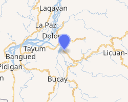
| |
.svg.png) Lagangilang Location within the Philippines | |
| Coordinates: 17°37′N 120°44′E | |
| Country | |
| Region | Cordillera Administrative Region (CAR) |
| Province | Abra |
| District | Lone District |
| Barangays | 17 (see Barangays) |
| Government | |
| • Type | Sangguniang Bayan |
| • Mayor | Rovelyn E. Villamor |
| • Vice Mayor | Roderick T. Atmosfera |
| • Congressman | Joseph Santo Niño B. Bernos |
| • Electorate | 10,001 voters (2019) |
| Area | |
| • Total | 101.44 km2 (39.17 sq mi) |
| Elevation | 71.8 m (235.6 ft) |
| Population (2015 census)[4] | |
| • Total | 14,255 |
| • Density | 140/km2 (360/sq mi) |
| • Households | 3,048 |
| Economy | |
| • Income class | 5th municipal income class |
| • Poverty incidence | 22.36% (2015)[5] |
| • Revenue (₱) | 57,634,585.51 (2016) |
| Time zone | UTC+8 (PST) |
| ZIP code | 2802 |
| PSGC | |
| IDD : area code | +63 (0)74 |
| Climate type | tropical rainforest climate |
| Native languages | Itneg language Ilocano Tagalog |
Geography
Lagangilang is located at 17°37′N 120°44′E.
According to the Philippine Statistics Authority, the municipality has a land area of 101.44 square kilometres (39.17 sq mi) [2] constituting 2.44% of the 4,165.25-square-kilometre- (1,608.21 sq mi) total area of Abra.
Barangays
Lagangilang is politically subdivided into 17 barangays.[6]
| PSGC | Barangay | Population | ±% p.a. | |||
|---|---|---|---|---|---|---|
| 2015[4] | 2010[7] | |||||
| 140110001 | Aguet | 1.9% | 268 | 288 | −1.36% | |
| 140110002 | Bacooc | 2.6% | 369 | 379 | −0.51% | |
| 140110003 | Balais | 3.1% | 448 | 533 | −3.25% | |
| 140110004 | Cayapa | 6.3% | 899 | 992 | −1.86% | |
| 140110005 | Dalaguisen | 5.9% | 835 | 840 | −0.11% | |
| 140110006 | Laang | 5.3% | 753 | 797 | −1.08% | |
| 140110007 | Lagben | 3.2% | 452 | 397 | 2.50% | |
| 140110008 | Laguiben | 6.6% | 947 | 944 | 0.06% | |
| 140110009 | Nagtipulan | 8.8% | 1,258 | 1,209 | 0.76% | |
| 140110010 | Nagtupacan | 8.3% | 1,177 | 1,059 | 2.03% | |
| 140110011 | Paganao | 2.6% | 376 | 342 | 1.82% | |
| 140110012 | Pawa | 2.5% | 358 | 360 | −0.11% | |
| 140110013 | Poblacion | 10.4% | 1,488 | 1,473 | 0.19% | |
| 140110014 | Presentar | 5.5% | 783 | 725 | 1.48% | |
| 140110015 | San Isidro | 10.5% | 1,501 | 1,415 | 1.13% | |
| 140110016 | Tagodtod | 13.1% | 1,863 | 1,617 | 2.73% | |
| 140110017 | Taping | 3.4% | 480 | 454 | 1.07% | |
| Total | 14,255 | 13,824 | 0.59% | |||
Climate
| Climate data for Lagangilang, Abra | |||||||||||||
|---|---|---|---|---|---|---|---|---|---|---|---|---|---|
| Month | Jan | Feb | Mar | Apr | May | Jun | Jul | Aug | Sep | Oct | Nov | Dec | Year |
| Average high °C (°F) | 27 (81) |
28 (82) |
30 (86) |
32 (90) |
31 (88) |
31 (88) |
30 (86) |
30 (86) |
30 (86) |
29 (84) |
29 (84) |
27 (81) |
30 (85) |
| Average low °C (°F) | 19 (66) |
20 (68) |
21 (70) |
23 (73) |
24 (75) |
25 (77) |
24 (75) |
25 (77) |
24 (75) |
22 (72) |
22 (72) |
20 (68) |
22 (72) |
| Average precipitation mm (inches) | 24 (0.9) |
26 (1.0) |
25 (1.0) |
43 (1.7) |
159 (6.3) |
180 (7.1) |
204 (8.0) |
207 (8.1) |
183 (7.2) |
185 (7.3) |
91 (3.6) |
67 (2.6) |
1,394 (54.8) |
| Average rainy days | 8.2 | 8.7 | 10.1 | 13.7 | 22.3 | 24.3 | 25.3 | 23.5 | 22.2 | 16.4 | 14.1 | 12.7 | 201.5 |
| Source: Meteoblue [8] | |||||||||||||
Demographics
| Population census of Lagangilang | ||
|---|---|---|
| Year | Pop. | ±% p.a. |
| 1918 | 4,851 | — |
| 1939 | 5,135 | +0.27% |
| 1948 | 5,450 | +0.66% |
| 1960 | 6,762 | +1.81% |
| 1970 | 8,905 | +2.79% |
| 1975 | 8,532 | −0.85% |
| 1980 | 9,466 | +2.10% |
| 1990 | 11,248 | +1.74% |
| 1995 | 12,023 | +1.26% |
| 2000 | 12,073 | +0.09% |
| 2007 | 13,490 | +1.54% |
| 2010 | 13,824 | +0.89% |
| 2015 | 14,255 | +0.59% |
| Source: Philippine Statistics Authority[4][7][9][10] | ||
In the 2015 census, Lagangilang had a population of 14,255.[4] The population density was 140 inhabitants per square kilometre (360/sq mi).
References
- "Municipality". Quezon City, Philippines: Department of the Interior and Local Government. Retrieved 31 May 2013.
- "Province: Abra". PSGC Interactive. Quezon City, Philippines: Philippine Statistics Authority. Retrieved 12 November 2016.
- "Lagangilang, Abra Profile". PhilAtlas.com. Retrieved 15 June 2020.
- Census of Population (2015). "Cordillera Administrative Region (CAR)". Total Population by Province, City, Municipality and Barangay. PSA. Retrieved 20 June 2016.
- "PSA releases the 2015 Municipal and City Level Poverty Estimates". Quezon City, Philippines. Retrieved 12 October 2019.
- "Municipal: Lagangilang". PSGC Interactive. Quezon City, Philippines: Philippine Statistics Authority. Retrieved 8 January 2016.
- Census of Population and Housing (2010). "Cordillera Administrative Region (CAR)". Total Population by Province, City, Municipality and Barangay. NSO. Retrieved 29 June 2016.
- "Lacub: Average Temperatures and Rainfall". Meteoblue. Retrieved 25 April 2020.
- Censuses of Population (1903–2007). "Cordillera Administrative Region (CAR)". Table 1. Population Enumerated in Various Censuses by Province/Highly Urbanized City: 1903 to 2007. NSO.
- "Province of Abra". Municipality Population Data. Local Water Utilities Administration Research Division. Retrieved 17 December 2016.
External links
| Wikimedia Commons has media related to Lagangilang, Abra. |
Bangued' (capital) | |
| Municipalities | |
| Barangays | See: List of barangays in Abra |
This article is issued from Wikipedia. The text is licensed under Creative Commons - Attribution - Sharealike. Additional terms may apply for the media files.