Dolores, Abra
Dolores, officially the Municipality of Dolores (Ilocano: Ili ti Dolores; Tagalog: Bayan ng Dolores), is a 5th class municipality in the province of Abra, Philippines. According to the 2015 census, it has a population of 11,315 people.[4]
Dolores | |
|---|---|
| Municipality of Dolores | |
 Seal | |
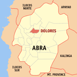 Map of Abra with Dolores highlighted | |
OpenStreetMap 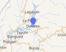
| |
.svg.png) Dolores Location within the Philippines | |
| Coordinates: 17°39′N 120°43′E | |
| Country | |
| Region | Cordillera Administrative Region (CAR) |
| Province | Abra |
| District | Lone District |
| Barangays | 15 (see Barangays) |
| Government | |
| • Type | Sangguniang Bayan |
| • Mayor | Conde T. Turqueza |
| • Vice Mayor | Eduardo R. Balmaceda |
| • Congressman | Joseph Santo Niño B. Bernos |
| • Electorate | 8,365 voters (2019) |
| Area | |
| • Total | 47.45 km2 (18.32 sq mi) |
| Elevation | 77.3 m (253.6 ft) |
| Population (2015 census)[4] | |
| • Total | 11,315 |
| • Density | 240/km2 (620/sq mi) |
| • Households | 2,484 |
| Economy | |
| • Income class | 5th municipal income class |
| • Poverty incidence | 16.34 (2015)[5] |
| • Revenue (₱) | 64,617,816.10 (2016) |
| Time zone | UTC+8 (PST) |
| ZIP code | 2801 |
| PSGC | |
| IDD : area code | +63 (0)74 |
| Climate type | tropical rainforest climate |
| Native languages | Itneg language Ilocano Tagalog |
| Website | doloresonline |
History
The place was called Bucao, named after the first Tingguian (Itneg) chieftain who settled in the place long before Spanish colonization. It used to be part of the Municipality of Tayum. In 1882, upon the recommendation of the parish priest of Tayum, Fr. Pío Mercado, and the Teniente Bazar of Bucao, Don Ignacio Eduarte, Bucao was created as a separate pueblo. In 1885, Bucao was renamed Dolores, to honor its patron saint, Nuestra Señora de los Dolores (Our Lady Of Sorrows). The first gobernadorcillo of the town was Don Rosalio Eduarte.
Geography
Dolores is located at 17°39′N 120°43′E.
According to the Philippine Statistics Authority, the municipality has a land area of 47.45 square kilometres (18.32 sq mi) [2] constituting 1.14% of the 4,165.25-square-kilometre- (1,608.21 sq mi) total area of Abra.
Barangays
Dolores is politically subdivided into 15 barangays.[6]
| PSGC | Barangay | Population | ±% p.a. | |||
|---|---|---|---|---|---|---|
| 2015[4] | 2010[7] | |||||
| 140107001 | Bayaan | 4.2% | 478 | 437 | 1.72% | |
| 140107002 | Cabaroan | 4.2% | 478 | 561 | −3.00% | |
| 140107003 | Calumbaya | 4.0% | 458 | 434 | 1.03% | |
| 140107004 | Cardona | 4.9% | 553 | 463 | 3.44% | |
| 140107005 | Isit | 6.7% | 757 | 726 | 0.80% | |
| 140107006 | Kimmalaba | 7.9% | 894 | 889 | 0.11% | |
| 140107007 | Libtec | 5.9% | 665 | 638 | 0.79% | |
| 140107008 | Lub-lubba | 2.8% | 313 | 295 | 1.13% | |
| 140107009 | Mudiit | 12.9% | 1,465 | 1,439 | 0.34% | |
| 140107010 | Namit-ingan | 4.1% | 462 | 617 | −5.36% | |
| 140107011 | Pacac | 5.7% | 642 | 605 | 1.14% | |
| 140107012 | Poblacion | 19.3% | 2,185 | 2,257 | −0.62% | |
| 140107013 | Salucag | 3.5% | 397 | 551 | −6.05% | |
| 140107014 | Talogtog | 10.4% | 1,175 | 1,162 | 0.21% | |
| 140107015 | Taping | 3.5% | 393 | 425 | −1.48% | |
| Total | 11,315 | 11,499 | −0.31% | |||
Climate
| Climate data for Dolores, Abra | |||||||||||||
|---|---|---|---|---|---|---|---|---|---|---|---|---|---|
| Month | Jan | Feb | Mar | Apr | May | Jun | Jul | Aug | Sep | Oct | Nov | Dec | Year |
| Average high °C (°F) | 27 (81) |
28 (82) |
30 (86) |
32 (90) |
31 (88) |
31 (88) |
30 (86) |
30 (86) |
30 (86) |
29 (84) |
29 (84) |
27 (81) |
30 (85) |
| Average low °C (°F) | 19 (66) |
20 (68) |
21 (70) |
23 (73) |
24 (75) |
25 (77) |
24 (75) |
24 (75) |
24 (75) |
22 (72) |
22 (72) |
20 (68) |
22 (72) |
| Average precipitation mm (inches) | 24 (0.9) |
26 (1.0) |
25 (1.0) |
43 (1.7) |
159 (6.3) |
180 (7.1) |
204 (8.0) |
207 (8.1) |
183 (7.2) |
185 (7.3) |
91 (3.6) |
67 (2.6) |
1,394 (54.8) |
| Average rainy days | 8.2 | 8.7 | 10.1 | 13.7 | 22.3 | 24.3 | 25.3 | 23.5 | 22.2 | 16.4 | 14.1 | 12.7 | 201.5 |
| Source: Meteoblue [8] | |||||||||||||
Demographics
| Population census of Dolores | ||
|---|---|---|
| Year | Pop. | ±% p.a. |
| 1903 | 4,379 | — |
| 1918 | 7,061 | +3.24% |
| 1939 | 4,845 | −1.78% |
| 1948 | 4,065 | −1.93% |
| 1960 | 5,065 | +1.85% |
| 1970 | 6,751 | +2.91% |
| 1975 | 6,767 | +0.05% |
| 1980 | 7,615 | +2.39% |
| 1990 | 8,577 | +1.20% |
| 1995 | 9,560 | +2.05% |
| 2000 | 9,949 | +0.86% |
| 2007 | 10,787 | +1.12% |
| 2010 | 11,499 | +2.35% |
| 2015 | 11,315 | −0.31% |
| Source: Philippine Statistics Authority[4][7][9][10] | ||
In the 2015 census, Dolores had a population of 11,315.[4] The population density was 240 inhabitants per square kilometre (620/sq mi).
References
- "Municipality". Quezon City, Philippines: Department of the Interior and Local Government. Retrieved 31 May 2013.
- "Province: Abra". PSGC Interactive. Quezon City, Philippines: Philippine Statistics Authority. Retrieved 12 November 2016.
- "Dolores, Abra Profile". PhilAtlas.com. Retrieved 15 June 2020.
- Census of Population (2015). "Cordillera Administrative Region (CAR)". Total Population by Province, City, Municipality and Barangay. PSA. Retrieved 20 June 2016.
- "PSA releases the 2015 Municipal and City Level Poverty Estimates". Quezon City, Philippines. Retrieved 12 October 2019.
- "Municipal: Dolores, Abra". PSGC Interactive. Quezon City, Philippines: Philippine Statistics Authority. Retrieved 8 January 2016.
- Census of Population and Housing (2010). "Cordillera Administrative Region (CAR)". Total Population by Province, City, Municipality and Barangay. NSO. Retrieved 29 June 2016.
- "Dolores: Average Temperatures and Rainfall". Meteoblue. Retrieved 25 April 2020.
- Censuses of Population (1903–2007). "Cordillera Administrative Region (CAR)". Table 1. Population Enumerated in Various Censuses by Province/Highly Urbanized City: 1903 to 2007. NSO.
- "Province of Abra". Municipality Population Data. Local Water Utilities Administration Research Division. Retrieved 17 December 2016.
External links
| Wikimedia Commons has media related to Dolores, Abra. |
- Official website of the municipal government of Dolores

- Dolores Profile at PhilAtlas.com
- Philippine Standard Geographic Code
Bangued' (capital) | |
| Municipalities | |
| Barangays | See: List of barangays in Abra |