Ladonia, Alabama
Ladonia is an unincorporated community and census-designated place (CDP) in Russell County, Alabama, United States. At the 2010 census the population was 3,142.[3] It is part of the Columbus, Georgia-Alabama, Metropolitan Statistical Area.
Ladonia, Alabama | |
|---|---|
 Ladonia Volunteer Fire Department | |
 Location in Russell County and the state of Alabama | |
| Coordinates: 32°27′56″N 85°5′20″W | |
| Country | United States |
| State | Alabama |
| County | Russell |
| Area | |
| • Total | 3.14 sq mi (8.13 km2) |
| • Land | 3.13 sq mi (8.12 km2) |
| • Water | 0.00 sq mi (0.01 km2) |
| Elevation | 469 ft (143 m) |
| Population (2010) | |
| • Total | 3,142 |
| • Estimate (2016)[2] | N/A |
| Time zone | UTC-6 (Central (CST)) |
| • Summer (DST) | UTC-5 (CDT) |
| FIPS code | 01-40648 |
| GNIS feature ID | 0121309 |
Geography
Ladonia is located at 32°27′56″N 85°5′21″W (32.465666, -85.089046).[4]
According to the U.S. Census Bureau, the community has a total area of 3.1 square miles (8.0 km2), all land.
Demographics
| Historical population | |||
|---|---|---|---|
| Census | Pop. | %± | |
| 1990 | 2,905 | — | |
| 2000 | 3,229 | 11.2% | |
| 2010 | 3,142 | −2.7% | |
| source:[5] | |||
At the 2000 census there were 3,229 people, 1,258 households, and 904 families living in the community. The population density was 1,008.6 people per square mile (389.6/km²). There were 1,407 housing units at an average density of 439.5 per square mile (169.8/km²). The racial makeup of the community was 91.82% White, 5.23% Black or African American, 0.65% Native American, 0.22% Asian, 0.31% from other races, and 1.77% from two or more races. 1.46% of the population were Hispanic or Latino of any race.[6] Of the 1,258 households 34.2% had children under the age of 18 living with them, 56.4% were married couples living together, 10.2% had a female householder with no husband present, and 28.1% were non-families. 23.0% of households were one person and 7.8% were one person aged 65 or older. The average household size was 2.57 and the average family size was 3.02.
The age distribution was 25.8% under the age of 18, 9.1% from 18 to 24, 31.9% from 25 to 44, 23.0% from 45 to 64, and 10.2% 65 or older. The median age was 35 years. For every 100 females, there were 101.2 males. For every 100 females age 18 and over, there were 99.9 males.
The median household income was $34,214 and the median family income was $37,035. Males had a median income of $30,694 versus $20,227 for females. The per capita income for the community was $16,671. About 15.6% of families and 16.1% of the population were below the poverty line, including 20.2% of those under age 18 and 8.7% of those age 65 or over.
2010 census
At the 2010 census there were 3,142 people, 1,262 households, and 877 families living in the community. The population density was 1,000 people per square mile (390/km²). There were 1,392 housing units at an average density of 449.0 per square mile (171.9/km²). The racial makeup of the community was 86.5% White, 9.8% Black or African American, 0.7% Native American, 0.3% Asian, 1.2% from other races, and 1.5% from two or more races. 2.7% of the population were Hispanic or Latino of any race.[7] Of the 1,262 households 28.3% had children under the age of 18 living with them, 44.3% were married couples living together, 17.9% had a female householder with no husband present, and 30.5% were non-families. 24.7% of households were one person and 8.2% were one person aged 65 or older. The average household size was 2.49 and the average family size was 2.91.
The age distribution was 23.7% under the age of 18, 8.8% from 18 to 24, 24.8% from 25 to 44, 30.1% from 45 to 64, and 12.7% 65 or older. The median age was 39.3 years. For every 100 females, there were 99.2 males. For every 100 females age 18 and over, there were 97.8 males.
The median household income was $36,333 and the median family income was $34,889. Males had a median income of $42,667 versus $27,075 for females. The per capita income for the community was $15,479. About 19.2% of families and 23.5% of the population were below the poverty line, including 19.2% of those under age 18 and 14.6% of those age 65 or over.
References
- "2016 U.S. Gazetteer Files". United States Census Bureau. Retrieved Jul 17, 2017.
- "Population and Housing Unit Estimates". Retrieved June 9, 2017.
- "U.S. Census website". United States Census Bureau. Retrieved 2011-05-14.
- "US Gazetteer files: 2010, 2000, and 1990". United States Census Bureau. 2011-02-12. Retrieved 2011-04-23.
- "CENSUS OF POPULATION AND HOUSING (1790-2000)". U.S. Census Bureau. Retrieved 2010-07-17.
- "U.S. Census website". United States Census Bureau. Retrieved 2008-01-31.
- "U.S. Census website". United States Census Bureau. Retrieved 2015-08-07.
Municipalities and communities of Russell County, Alabama, United States | ||
|---|---|---|
| City |  Map of Alabama highlighting Russell County | |
| Town | ||
| CDP | ||
| Unincorporated communities | ||
| Former city | ||
| Footnotes | ‡This populated place also has portions in an adjacent county or counties | |
Greater Columbus, Georgia | ||
|---|---|---|
| Central cities/Largest cities | 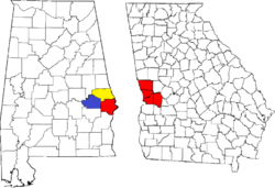 Location of the Columbus, Georgia-Auburn, Alabama CSA and its counties:
Columbus, Georgia Metropolitan Statistical Area
Auburn, Alabama Metropolitan Statistical Area
Tuskegee, Alabama Micropolitan Statistical Area (defunct) | |
| Cities in Georgia | ||
| Cities in Alabama | ||
| Counties in Georgia | ||
| Counties in Alabama | ||