Kuttoor (Thiruvalla)
Kuttoor is a village in Pathanamthitta district in the Indian state of Kerala.Kuttoor panchayathu which is under Thiruvalla assembly constituency and Pulikkizhu block panchayathu.
Kuttoor | |
|---|---|
Village | |
 | |
| Coordinates: 9.385°N 76.575°E | |
| State | Kerala |
| Population (2001) | |
| • Total | 18,433 |
| Languages | |
| • Official | Malayalam, English |
| Time zone | UTC+5:30 (IST) |
| PIN | 689106 |
| Telephone code | 91-469 |
| Vehicle registration | KL-27 |
| Nearest city | Thiruvalla |
| Lok Sabha constituency | Pathanamthitta |
| Nearest Airport | Cochin International Airport Limited |
| Website | lsgkerala |
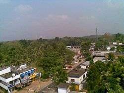
Location
This village has 12.16 square kilometer consist of 14 wards. Boundaries are Eraviperoor Panchayathu, Kadalimangalam River, Manimalayar and Varattar.Early years Kuttoor was in Kollam district and later Alappuzha District and now it under Pathanamthitta.

Demographics
Total area is 1203 hectors and total population 18433 as per 2001 census.[1]
History
Kuttoor was a capital of Thekkumkoor Kingdom. Dritharashramala (known as Pottanmala ), Kottappuram, Bhoothakkuzhi,Chakrashalanakkadavu are the historically relevant places which were in Kuttoor.The name Kuttoor came from Kottayoor-Kottoor.
Transportation
Kerala State Road Transport Corporation has a depot at Tiruvalla (station code: TVLA) which is one among the 29 major depots in the state.Its 4 km from Kuttoor. KSRTC operates long distance and interstate bus services from the Tiruvalla depot. KSRTC operates daily Interstate Airbus service to Bangalore from Tiruvalla. Tiruvalla railway station (station code: TRVL)and Chenagannur ( station code: CGNR ) railway station are near to Kuttoor.Thiruvalla railway station is the sole railway station in Pathanamthitta district. Both stations are only 4 km from Kuttoor. Most trains stop here. Another major railway station is Kottayam railway station which is 25 km from Kuttoor. The nearest airports are Cochin International Airport (105 km) and Trivandrum airport (126 km).

Geography
The topography of Kuttoor comprises plains, paddy fields, and small ranges. There are paddy fields in Ottam Etukadavu and Kothavithiruthi. Main crops are paddy, coconut, cassava, sugarcane, banana, and pepper. The main water source of the village is Manamalayar. There are smaller sources of water like Varattar, Madhurampuzha, Kadhalimangalathar and Ettukadavu stream.
Politics
The current Panchayathu President is Sreelekha Reghunath and panchayathu under control of Bharatiya Janata Party. Cheriyan C Thomas is the Vice-President. Out of 14 wards, 6 seat won by BJP, Communist Party of India (Marxist) 3, Left Independent 2, Congress 1, KC(M) 1
Current MLA is Adv.Mathew T Thomas. He is currently the minister for water resources in Government of Kerala, State President and Legislature Party Leader of the Janata Dal (Secular). Current MP Pathanamthitta (Lok Sabha constituency) is Anto Antony
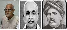
Notable personalities

Temples
- Vanchimoottil Devi Temple , Thalayar
- Sankara Narayana Darma Sastra Kshetram, Kuttoor
- Sree Kailasa Nadha Uma Maheswara Kshetram , Thengeli
- Puthoorkavu Kshetram , Kuttoor
- Valliyilkavu devi Kshetram, Thengeli
- Dritharashramala Kshetram , Pottanmala
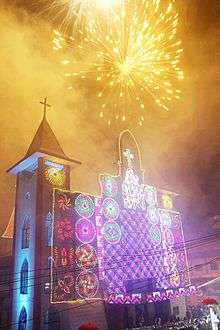
Churches
- St'Mary'Orthodox Syrian Church, Venpala
- St'Mary's Knanaya Church, Thengali
- St'George Orthodox Church Thengali
- St'Mary's Knanaya Catholic Church Thengali
- St'Mary's Knanaya Church Kuttoor
- St'George Orthodox Church, Kallumkal Venpala
- New India Church of God, Thengali
- New India Church of God, Kuttoor
- Bretheran Assembly Hall,Kuttoor
- All Saint's CSI Church, Kuttoor
- Salem Marthoma Church Thymaravumkara
Hospitals
- Pushpagiri Medical College Hospital 3.1 km
- Thiruvalla Medical Mission Hospital 4.8 km
- Believers Church Medical College Hospital 7.0 km
- Saint Gregorious Mission Hospital, Parumala 12.0 km
References
- Registrar General & Census Commissioner, India. "Census of India : Villages with population 5000 & above". Archived from the original on 8 December 2008. Retrieved 10 December 2008.