Kogarah, New South Wales
Kogarah is a suburb of southern Sydney, in the state of New South Wales, Australia. Kogarah is located 14 kilometres (9 miles) south of the Sydney central business district and is considered to be the centre of the St George area.
| Kogarah Sydney, New South Wales | |||||||||||||||
|---|---|---|---|---|---|---|---|---|---|---|---|---|---|---|---|
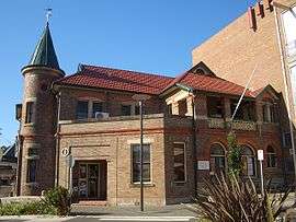 Kogarah Community Centre | |||||||||||||||
| Population | 15,124 (2016 census)[1] | ||||||||||||||
| • Density | 5,820/km2 (15,070/sq mi) | ||||||||||||||
| Established | 1885 | ||||||||||||||
| Postcode(s) | 2217 | ||||||||||||||
| Area | 2.6 km2 (1.0 sq mi) | ||||||||||||||
| Location | 14 km (9 mi) south of Sydney CBD | ||||||||||||||
| LGA(s) | |||||||||||||||
| State electorate(s) | Kogarah | ||||||||||||||
| Federal Division(s) | |||||||||||||||
| |||||||||||||||
Location
Kogarah took its name from Kogarah Bay, a small bay on the northern shore of the Georges River. The suburb originally stretched to the bay but has since been divided up to form the separate suburbs of Kogarah Bay and Beverley Park.
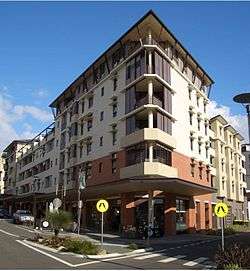
Kogarah has a mixture of residential, commercial and light industrial areas. It is also known for its large number of schools (including primary school, high school and tertiary education) and health care services (including two hospitals and many medical centres). The NRL side, St George Illawarra Dragons have their Sydney office based at nearby Jubilee Oval, often referred to as Kogarah Oval. Kogarah features all types of residential developments from low density detached houses, to medium density flats and high density high-rise apartments.
History

Kogarah is derived from an Aboriginal word meaning rushes or place of reeds.[2] It had also been written as 'Coggera', 'Cogerah' and 'Kuggerah' but the current spelling was settled when the railway line came through the area in the 1880s.
Early land grants in the area were made to John Townson (1760–1835) who received 910 hectares (2,250 acres) from 1808 to 1810, centred on Hurstville and James Chandler, whose neighbouring estate was centred on Bexley. The district provided fruit, vegetables and oysters for Sydney. In 1869, St Paul's Church of England opened on Rocky Point Road (now Princes Highway). It was built on 0.81 hectares (2 acres) of land given to the church by William Wolfen the Swedish Consul to Sydney, who owned 320 hectares (800 acres) in Kogarah. The suburb grew around the church and the Gardeners Arms Hotel. Kogarah became a municipality in 1885.[3]
The former neighbourhood of Moorefield is now part of Kogarah. It was originally a 24-hectare (60-acre) land grant from Governor Lachlan Macquarie in 1812 to Patrick Moore, who built a fine house there. The Moorefield racecourse built by a descendant opened in 1888. Brigadier General John Lamrock CB VD was appointed secretary of the Moorefield Race Club in 1912 and remained in that position until early in 1935.[4] The Moorefield estate was subdivided in the 1950s and the Department of Education purchased 7.7 hectares (19 acres), where it built two high schools and college of further education. Moorefields Girls High School was erected there in 1955 on the former site of Moore's farm.[5]
Heritage listings
Kogarah has a number of heritage-listed sites, including:
- Toomevara Lane: Toomevara Lane Chinese Market Gardens[6]
Commercial area


Kogarah's main shopping area is located around Kogarah railway station on Railway Parade, Regent Street and on the opposite side of the railway line on Station Street. The commercial area also extends to surrounding streets such as Montgomery and Belgrave Streets. Kogarah Town Centre is a shopping centre on Railway Parade. This commercial area includes the St. George Bank national headquarters in a large office building in Montgomery Street, which is a large employer in the area. Many high rise apartment buildings have also been built around the commercial area in recent years. The noted builder, James Goyen, had his works depot at 18 Montgomery Street, and later at 4 Montgomery Street. He built the original building of what was, for many years, the St George Technical College (now a campus of the Sydney Institute of TAFE).
Commercial and light industrial developments are also located along the Princes Highway and Rocky Point Road. The Darrell Lea Chocolate factory is located in Rocky Point Road. Surrounding streets feature more industrial developments. A small group of shops is located on President Avenue, sometimes referred to as Moorefield.
St George Hospital is a major regional hospital, that serves the whole St George area but also accepts patients from other regions in New South Wales. St George Private Hospital is located nearby. Many medical centres, doctor's surgeries and specialists’ rooms and related services are located in the surrounding area.
Kogarah Police Station and Kogarah Local Court are located on Montgomery Street. The local court serves the whole of the St George area and as such many barristers and solicitors have their offices in Kogarah. A historic fire station is located in Gray Street and another heritage building, the Kogarah School of the Arts is in Bowns Road.
The Kogarah Mecca cinema was a landmark building, located opposite the railway station in Station Street. The cinema was often used by local schools for important events such as Speech Day. The cinema complex was closed for business in 2004 and its proprietor later sentenced, on appeal, to nine years jail[7] for sexual offences upon boys in its candy bar store room, projection room, and toilets among other places in the period since 1980.[8]
The Kogarah Hotel is located on Railway Parade. Previously it was the Railway Parade Hotel to 1954, and the Kogarah Rex Hotel to 1964.[9]
Kogarah Town Centre
The Kogarah Town Centre is Kogarah's largest shopping centre. It includes a post office, two supermarkets (Woolworths and Aldi), a tavern, along with a multitude of specialty stores. It provides easy access to Kogarah railway station.
Kogarah Town Centre was recently under a complete overhaul, with renovations of the whole complex. It was completed in mid-2012, with the supermarket chain, Aldi, opening on the ground floor, along with fast-food chain Oporto (restaurant). An expansion of Kogarah Tavern & Woolworths was also included in this overhaul. The Coffee Club was added onto level one.
Transport
The entire City of Kogarah and surrounding areas rely on bus, train and taxi services that operate from the centre of Kogarah's shopping district. Bus and train services accommodate the large population within Kogarah, as well as the large number of schools in the area.
Kogarah railway station is located on the Illawarra line of the Sydney Trains network. The station sits below a concourse and a small shopping complex called the Kogarah Town Centre. In the late 1990s, the station underwent extensive renovations which added easy access facilities such as elevators from the concourse onto each of the four platforms.
Buses from Kogarah service surrounding suburbs, particularly those along the beach such as Brighton-Le-Sands, Monterey, Ramsgate Beach, Sans Souci etc. which rely heavily on bus services since they are far from railway stations. Until 1937, a steam tramway operated between Kogarah and Sans Souci via Rocky Point Road. This was replaced by an electric trolleybus service, one of only two such services to operate in Sydney. This was subsequently replaced in the 1950s with the gas powered diesel [Transit systems routes that formerly operate. The majority of public transportation in Kogarah departs and arrives close to Kogarah Town Centre.
Kogarah is also serviced by St George Community Transport, a HACC funded transport service for the Frail Aged, people with disability and their carers.[10]
Friendship cities
- Shunde District, Guangdong
Parks
The Kogarah area also features many parks and reserves, with no shortage of sports playing fields. These include Hogben Park, Frys Reserve, Scarborough Park, Kogarah Park and Jubilee Oval.
Culture and events
St George Illawarra Dragons have played rugby league at Jubilee Oval since 1935 and following a merger with the Illawarra Steelers also has WIN Stadium as a home ground.
Population
Demographics
According to the 2016 Australian Bureau of Statistics Census of Population, there were 15,124 people in Kogarah. 33.3% of people were born in Australia. The next most common countries of birth were China 11.1%, Nepal 10.2%, India 5.9%, Bangladesh 4.5% and Philippines 3.6%. 26.8% of people only spoke English at home. Other languages spoken at home included Nepali 10.8%, Mandarin 10.5%, Cantonese 5.7%, Bengali 5.6% and Greek 5.4%. The most common responses for religious affiliation were No Religion 20.8%, Catholic 18.3%, Hinduism 15.6% and Eastern Orthodox 10.0%.[1]
Notable residents
- Dave Brown – rugby league star of the 1930s was born in Kogarah
- Ray Burton – an internationally acclaimed musician, singer and songwriter
- Rev Dr Rowland Croucher – theologian and author, lived in Warialda Street in the early years of married life while he was a staffworker with the InterVarsity Fellowship. His wife Jan taught at Kogarah High School
- Reg Gasnier – rugby league legend lived in Kogarah
- Clive James – writer, poet, essayist, critic and commentator on popular culture was raised in Kogarah
- Ronald Sharp – a notable Australian organ builder was born in Kogarah
- Kenneth Slessor – one of Australia's greatest poets, attended Kogarah Primary School, in the early 20th century. The family lived in Belgrave Street, according to his biographer, Geoffrey Dutton
- Steve Smith – former captain of Australia national cricket team, was born and raised in Kogarah[11]
Schools and churches


- Schools
- Kogarah Public School
- Kogarah High School
- James Cook Boys Technology High School
- Moorefield Girls High School
- St Declan’s Catholic Primary School
- St George Girls High School
- St Patrick's Primary School (co-ed)
- Marist College Kogarah (boys, secondary)
- Sydney Institute of TAFE: St. George Campus
- Churches
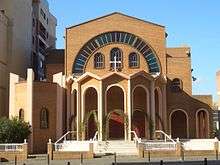
- Resurrection of Christ Greek Orthodox Church
- Grace Chinese Christian Church
- Kogarah Soldiers' Memorial Presbyterian Church (Kirkplace)
- St Patrick's Catholic Church
- St Paul's Anglican Church
- Christ Church St George (Anglican), and Church in the Bank (Anglican)
- Christ Living Church (Indonesian Church)
- Kogarah Uniting Church
References
- Australian Bureau of Statistics (27 June 2017). "Kogarah (State Suburb)". 2016 Census QuickStats. Retrieved 28 January 2018.

- "History of Kogarah". Kogarah City Council. Retrieved 6 December 2013.
- The Book of Sydney Suburbs, Compiled by Frances Pollon, Angus & Robertson Publishers, 1990, Published in Australia ISBN 0-207-14495-8, page 142
- "OBITUARY". The Northern Standard. Darwin, NT: National Library of Australia. 23 July 1935. p. 10. Retrieved 2 September 2012.
- Pictorial Memories. ST. GEORGE: Rockdale, Kogarah, Hurstville Joan Lawrence, Kingsclear Books, 1996, Published in Australia ISBN 0-908272-45-6
- "Toomevara Lane Chinese Market Gardens". New South Wales State Heritage Register. Office of Environment and Heritage. H01394. Retrieved 18 May 2018.
- https://aussiesexoffenders.wordpress.com/2012/10/23/philip-william-doyle/ 2014 Appeal outcome for buggery etc convictions of former Kogarah Mecca proprietor Philip Doyle
- http://www.abc.net.au/news/2012-09-04/cinema-paedophile-sentence/4242132 Sentencing of Phil Doyle (2012)
- Noel Butlin Archives Centre. Australian National University Archives. Retrieved 9 December 2017.
- "Community Transport, Transport, Mortdale, St George Community Transport, Car, Bus". www.stgct.org.au.
- "Steve Smith". Wisden. Retrieved 8 April 2020.
External links
| Wikimedia Commons has media related to Kogarah, New South Wales. |
- Georges River Council website
- Bayside Council website
- Kogarah Marist High School
- St George Girls High School
- 2001 Census Information
- Christ Living Church (Indonesian church) website