Killa Abdullah District
Killa Abdullah or Qilla Abdullah or Abdullah Qilla (Pashto: قلعه عبدالله ولسوالی) is a district in the north west of Balochistan province of Pakistan. Killa Abdullah was separated from Pishin District and made a new district in June 1993.[2]
Killa Abdullah District | |
|---|---|
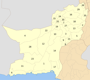
 Map of with Qilla Abdullah District highlighted | |
| Country | Pakistan |
| Province | Balochistan |
| Division | Quetta Division |
| Established | 1993 |
| Headquarters | Chaman |
| Government | |
| • Deputy Commissioner | Muhammad Asghar Harifal |
| Area | |
| • Total | 3,293 km2 (1,271 sq mi) |
| Population (2017)[1] | |
| • Total | 757,578 |
| • Density | 230/km2 (600/sq mi) |
| Time zone | UTC+5 (PST) |
| Number of Tehsils | 4 |
The district is located within the heartland of the Achakzai tribe of Durrani Pashtuns. The population of Qilla Abdullah District was estimated to be over 120,000 in 2012, the vast majority being Pashtuns. 99.5% of the people of the area are Muslims.[3] Pashto is the first language of 97.5% of the population.[4]
Topography
Qilla Abdullah district lies between 30–04' to 31–17' North Longitude in the foothills of the Shela Bagh Mountain range. It is bordered by Pishin District in the east, Quetta District in the South and by Afghanistan in the west. The geographical area of the district is 5,264 km2. It is composed of two sub-divisions; Gulistan and Chaman. The general character of the district is mountainous. Its northern area is covered by the Toba Plateau. The hill ranges are fairly uniform in character. They consist of long central ridges with numerous spurs. These spurs vary in elevation from 1,500 to 3,300 metres.
Soil
Qilla Abdullah is a small valley bordered by mountains. The valley floor is covered with unconsolidated alluvial sediments that are mostly composed of clay, silt, silty clay and clayey silt. All these sediments were deposited in the valley by the seasonal streams that flow across the valley (generally north to south). The soil is of loamy nature in the Gulistan area, while the soil of Tehsil Chaman is sandy clay—gravel (admixture). The sandy fraction increases towards the mountain ranges. The scarcity of water in the area and the semi-desert climatic conditions have limited trees and shrubs to grow.
Climate
The climate of the district Killa Abdullah is generally dry and temperate. The adjoining districts have somewhat deviating temperatures, owing to different elevations. The climatic conditions of the district are particularly suitable for horticulture/ agriculture. The climate is especially suitable for the growth of fruits e.g. apples, apricots, peaches, plums, grapes, cherries and vegetables such as potatoes, onions, tomatoes.
History
In 1839, this area along with Quetta and Pishin region became a part of British India as a result of the First Anglo Afghan War.[5] However, in 1842, the Afghans reoccupied the entire Pishin Valley, losing it again in 1879.[5] Four years later, Pishin and the surrounding areas were merged with Quetta district.[5] In 1993, it was separated from Pishin for administrative reasons and was given the status of a district.
Administrative subdivisions
The district is administratively subdivided into the following tehsils:[6]
Education
According to the Pakistan District Education Rankings 2017, district Killa Abdullah is ranked at number 111 out of the 141 ranked districts in Pakistan on the education score index. This index considers learning, gender parity and retention in the district.
Literacy rate in 2014–15 of population 10 years and older in the district stands at 27% whereas for females it is only 8%.[7]
Post primary access is a major issue in the district with 87% schools being at primary level. Compare this with high schools which constitute only 6% of government schools in the district. This is also reflected in the enrolment figures for 2016–17 with 19,087 students enrolled in class 1 to 5 and only 234 students enrolled in class 9 and 10.
Gender disparity is another issue in the district. Only 15% schools in the district are girls’ schools. Access to education for girls is a major issue in the district and is also reflected in the low literacy rates for females.
Moreover, the schools in the district lack basic facilities. According to Alif Ailaan district education rankings 2017, the district is ranked at number 121 out of the 155 districts of Pakistan for primary school infrastructure. At the middle school level, it is ranked at number 113 out of the 155 districts. These rankings take into account the basic facilities available in schools including drinking water, working toilet, availability of electricity, existence of a boundary wall and general building condition. 7 out of 10 schools do not have electricity in them. 3 out 5 schools lack a toilet and 2 out of 5 schools do not have a boundary wall. 1 out of 2 schools do not have clean drinking water.
The main issues reported on the Taleem Do! App for the district is the unavailability of teachers.
Sites of interest
Notable people
References
- "DISTRICT WISE CENSUS RESULTS CENSUS 2017" (PDF). www.pbscensus.gov.pk. Archived from the original (PDF) on 2017-08-29. Retrieved 2017-09-03.
- PCO 2000, p. 1.
- PCO 2000, p. 18.
- PCO 2000, p. 20.
- PCO 2000, p. 6.
- "Tehsils & Unions in the District of Killa Abdullah - Government of Pakistan". Archived from the original on 2012-03-26. Retrieved 2008-09-14.
- Pakistan Bureau of Statistics (2016). Pakistan Social and Living Standards Measurement Survey 2014-15. [online] Islamabad: Government of Pakistan, p.111. Available at: http://www.pbs.gov.pk/sites/default/files//pslm/publications/PSLM_2014-15_National-Provincial-District_report.pdf [Accessed 6 Aug. 2018].
Bibliography
- 1998 District census report of Killa Abdullah. Census publication. 121. Islamabad: Population Census Organization, Statistics Division, Government of Pakistan. 2000.
External links
| Wikimedia Commons has media related to Killa Abdullah District. |
- Killa Abdullah District at www.balochistan.gov.pk
- Killa Abdullah District at www.balochistanpolice.gov.pk
| Authority control |
|
|---|