Kalat District
Qalat or Kalat (Balochi and Brahui: کلات; Urdo: قلات) is a district in Balochistan, Pakistan. It is one of 26 in that province, and encompasses an area of 6,621 km2 (2,556 sq mi). The population of the district is estimated to be over 400,000 in 2005. The district is governed from the city of Kalat.
Kalat District | |
|---|---|
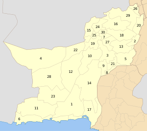
 Map of Balochistan with Kalat District highlighted in maroon | |
| Country | Pakistan |
| Province | Balochistan |
| Established | March 1954 |
| Headquarters | Kalat |
| Government | |
| • Deputy Commissioner | Shayak Baloch |
| • Assistant Commissioner | Zahid Hameed Langove |
| Area | |
| • Total | 6,621 km2 (2,556 sq mi) |
| Population (2017)[1] | |
| • Total | 412,232 |
| • Density | 62/km2 (160/sq mi) |
| Time zone | UTC+5 (PST) |
| Number of Tehsils | 2 |
| Website | http://www.bdd.sdnpk.org/Kalat.html |
Kalat was notified as a district on February 3, 1954. At that time Khuzdar and Mastung districts were sub-divisions of Kalat (which then also included Kachi, Jhal Magsi and Naseerabad (Dera Murad Jamali); these were separated in 1965 as Kachhi District). Khuzdar became a separate district by notification of 1 March 1974, while Mastung was announced to be separate district on 18 February 1992. The district draws its name from the ancient city of Kalat. The old name of the district headquarters was Kahan. The current district consists of two sub-divisions, i.e. Kalat and Manguchar, four tehsils: Kalat Mangochar, Johan, and Gazgz, 81 patwar circles and 614 mauza (villages).
The climate is arid, hot in summer and cold in winter, with most rainfall occurring in the winter. The terrain is mountainous with several valleys and one main river, mount Harboi in Kalat is known for Juniper old trees, the Moro River. The main economic activities are agriculture and livestock farming. The current Khan of Kalat is a ceremonial title held by Mir Suleman Dawood Jan, and efforts have been made by the Pakistani government to reconcile with him, his son Prince Mohammed, who is next in line to be the Khan of Kalat is pro-Pakistan.[2]
Administration
The district is administratively subdivided into the following tehsils:[3]
- Kalat
- Mangocher
Population
According to the census of 1995, 89% of the population speak the Brahui language and 5% the Balochi language.
Education
According to the Pakistan District Education Rankings 2017, district Kalat is ranked at number 66 out of the 141 ranked districts in Pakistan on the education score index. This index considers learning, gender parity and retention in the district.
Literacy rate in 2014–15 of population 10 years and older in the district stood at 54% whereas for females it was only 45%.[4]
Post primary access is a major issue in the district with 83% schools being at primary level. Compare this with high schools which constitute only 9% of government schools in the district. This is also reflected in the enrolment figures for 2016–17 with 20,031 students enrolled in class 1 to 5 and only 658 students enrolled in class 9 and 10.
Gender disparity is another issue in the district. Only 34% schools in the district are girls’ schools. Access to education for girls is a major issue in the district and is also reflected in the low literacy rates for females.
Moreover, the schools in the district lack basic facilities. According to Alif Ailaan Pakistan District Education Rankings 2017, the district is ranked at number 128 out of the 155 districts of Pakistan for primary school infrastructure. At the middle school level, it is ranked at number 136 out of the 155 districts. These rankings take into account the basic facilities available in schools including drinking water, working toilet, availability of electricity, existence of a boundary wall and general building condition. 4 out of 5 schools do not have electricity in them. Approximately 1 out 2 schools lack toilet and a boundary wall. More than 1 out of 3 schools do not have clean drinking water.
The main issues reported in Taleem Do! App for the district is the unavailability of schools especially for girls. The schools available are reported to have a lack of teachers and furniture which is a major hindrance for students.
See also
- Kalat (princely state)
External links
| Wikimedia Commons has media related to Kalat District. |
References
- "DISTRICT WISE CENSUS RESULTS CENSUS 2017" (PDF). www.pbscensus.gov.pk. Archived from the original (PDF) on 2017-08-29.
- Shahid, Saleem (29 June 2015). "Khan of Kalat being persuaded to return home".
- Tehsils & Unions in the District of Kalat Archived 2012-03-26 at the Wayback Machine
- Pakistan Bureau of Statistics (2016). Pakistan Social and Living Standards Measurement Survey 2014-15. [online] Islamabad: Government of Pakistan, p.111. Available at: http://www.pbs.gov.pk/sites/default/files//pslm/publications/PSLM_2014-15_National-Provincial-District_report.pdf [Accessed 6 Aug. 2018].