Kfar Hananya
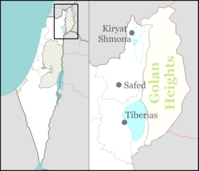
Kfar Hananya (Hebrew: כְּפַר חֲנַנְיָה) is a community settlement in the Galilee in northern Israel. It belongs to the Merom HaGalil Regional Council. In 2018 it had a population of 733.[1]
Kfar Hananya כְּפַר חֲנַנְיָה | |
|---|---|
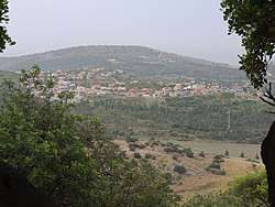 Kfar Hananya as seen from Kh. Abu esh-Sheba (Bersabe) | |
 Kfar Hananya 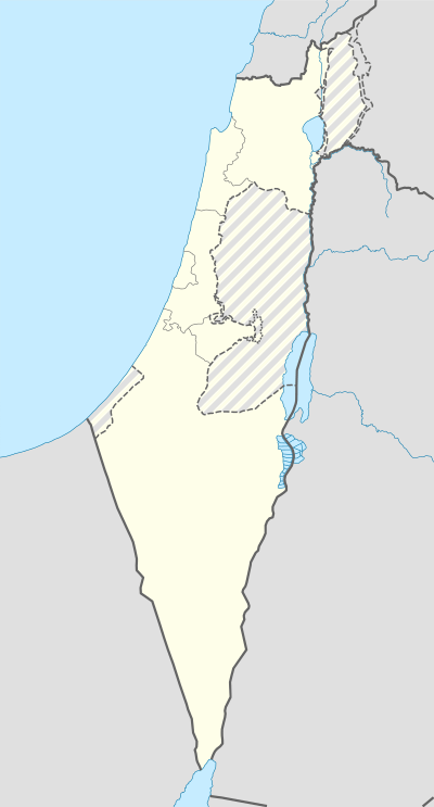 Kfar Hananya | |
| Coordinates: 32°54′56.52″N 35°25′21.36″E | |
| Country | Israel |
| Affiliation | Hapoel HaMizrachi |
| Founded | 1977 |
| Founded by | Hapoel HaMizrachi |
| Population (2018)[1] | 733 |
| Name meaning | Hananya village |
The village marks the border between the historic Upper and Lower Galilee regions. Lower Galilee is defined in the Mishnah (Shevi'it 9:2) as the area south of Kfar Hananya where the Sycamore Fig tree grows (Ficus sycomorus).
Name
The village is named after the ancient village of the same name, a little further to its north, which is mentioned in the Mishnah (now a ruin; see below at Landmarks).[2]
History
Kfar Hananya was founded in 1977 as a moshav of the movement Hapoel HaMizrachi for members of nearby moshavim, built on the land of the depopulated Palestinian village Kafr 'Inan. In 1992 it became a community settlement. A new neighborhood built in the 2000s is called "Maale Hen" (מעלה חן).
Landmarks
Near the community is a burial place attributed to Rabbi Hananya ben Akashya.[3][4]
The ruins of ancient Kefar Hanania are situated about one kilometre north of the modern village.[5] Kefar Hanania is mentioned in the Mishnah as a community on the border between the Lower Galilee and Upper Galilee (see Mishnah Shevi'it 9:2).[2][6]
See also
References
- "Population in the Localities 2018" (XLS). Israel Central Bureau of Statistics. 25 August 2019. Retrieved 26 August 2019.
- Aviam, Mordechai; Richardson, Peter (2003). Josephus' Galilee in Archaeological Perspective. Flavius Josephus: Life of Josephus, translated and commented by Steve Mason, Appendix A. Brill. ISBN 9780391042056. Retrieved 25 May 2018.
The border between Upper and Lower Galilee mentioned by the Mishnah is at Kefar Hananiah, but Josephus locates the border at Bersabe, which he uses as a reference point for his list of border towns (Life 188). The two sites are located side by side within a distance of less than a kilometer, at the eastern end of the Beth Kerem valley.
- Ḥadad, David (2005). Sefer Ma'asei Avoth (in Hebrew). Beer-Sheva. p. (Appendix). OCLC 74311775.
- Encyclopedia of Kivrei Tzadikim
- David Adan-Bayewitz, Kefar Hananya, Israel Exploration Journal 37 (1987), pp 178-179; Adan-Bayewitz, D., "Kefar Hananya", New Encyclopedia of Archaeological Excavations in the Holy Land, (ed. E. Stern), 2008, pp. 1909-1911
- The Mishnah (ed. Herbert Danby), Oxford University Press: Oxford 1933, s.v. Tractate Shebiit 9:2
| Wikimedia Commons has media related to Kfar Hananya. |