Upper Galilee
The Upper Galilee (Hebrew: הגליל העליון, HaGalil Ha'Elyon; Arabic: الجليل الأعلى, Al Jaleel Al A'alaa) is a geographical-political term in use since the end of the Second Temple period, originally referring to a mountainous area straddling present-day northern Israel and southern Lebanon, its boundaries being the Litani River in the north, the Mediterranean Sea in the west, the Lower Galilee in the south, from which it is separated by the Beit HaKerem Valley, and the upper Jordan River and the Hula Valley in the east.[1] According to 1st-century historian, Josephus, the bounds of Upper Galilee stretched from Bersabe in the Beit HaKerem Valley to Baca (Peki'in) in the north.[2] The said region contains approximately 180 square miles.[3]
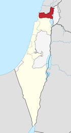
In present-day Israeli terminology, the toponym is mainly used in reference to the northern part of the Galilee situated under Israeli sovereignty, i.e. without the part of Southern Lebanon up to the Litani River, while also excluding the corresponding stretches of the Coastal Plain to the west and Jordan Rift Valley to the east, which are considered separate geographical entities.
History
Following the dissolution of the Ottoman Empire and the Balfour Declaration in which the British Empire promised to create "A Jewish National Home" in Palestine, the Zionist Movement presented to the Versailles Peace Conference a document calling for including in the British Mandate of Palestine the entire territory up to the Litani river — with a view to this becoming eventually part of a future Jewish state.
However, only less than half this area was actually included in British Mandatory Palestine, the final border being influenced both by diplomatic maneuverings and struggles between Britain and France and by fighting on the ground, especially the March 1920 battle of Tel Hai.
For a considerable time after the border was defined so to make the northern portion of the territory concerned part of the French mandated territory that became Lebanon, many Zionist geographers — and Israeli geographers in the state's early years — continued to speak of "The Upper Galilee" as being "the northern sub-area of the Galilee region of Israel and Lebanon".
Under this definition, "The Upper Galilee" covers an area spreading over 1,500 km², about 700 in Israel and the rest in Lebanon. This included the highland region of Belad Bechara in Jabal Amel located in South Lebanon, [4] which was at for some time known in Hebrew as "The Lebanese Galilee".[1] As defined in geographical terms, "it is separated from the Lower Galilee by the Beit HaKerem valley; its mountains are taller and valleys are deeper than those in the Lower Galilee; its tallest peak is Har Meron at 1,208 m above sea level. Safed is one of the major cities in this region".
In recent decades, however, this usage has virtually disappeared from the general Israeli discourse, the term "Upper Galilee" being used solely in reference to the part located in Israel.
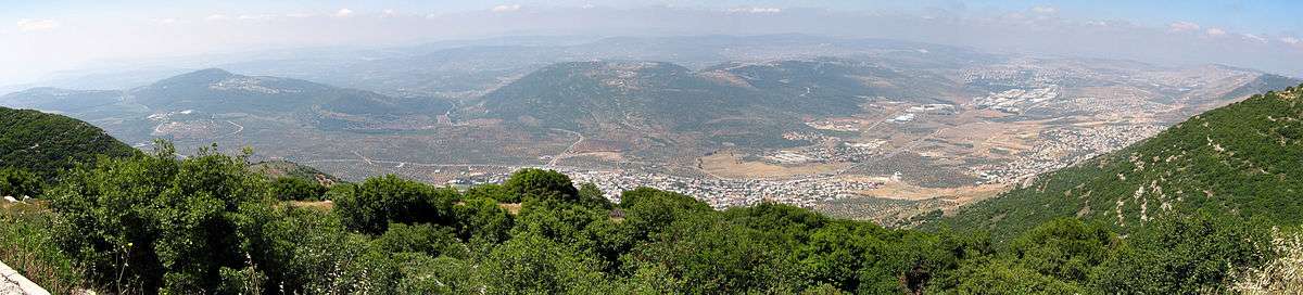
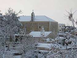
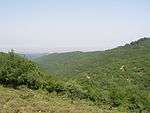
Gallery
 Mountainous area in the Upper Galilee
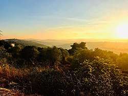 Ain Ebel in the Lebanese Upper Galilee
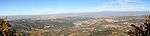 A view looking north from the top of Har Meron in the Upper Galilee. Parts of southern Lebanon are visible in the background
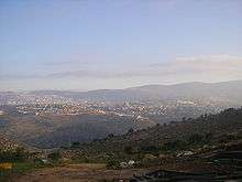
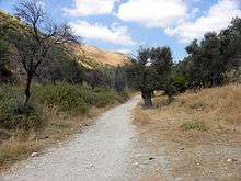 Old road from Rosh Pinna to Safed, Upper Galilee, Israel
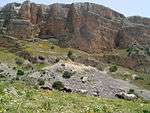
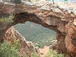 The Keshet cave (a natural arch) located on a ridge near Nahal Betzet
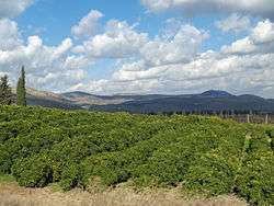 An orchard in Upper Galilee
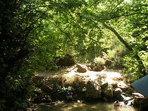 The Amud river
 Horses roam in Amud stream, near the Sea of Galilee
See also
References
- Vilnai, Ze'ev (1976). "Upper Galilee". Ariel Encyclopedia (in Hebrew). Volume 2. Israel: Am Oved. pp. 1364–67.
- M. Aviam & P. Richardson, "Josephus' Galilee in Archaeological Perspective", published in: Mason, Steve, ed. (2001). Life of Josephus. Flavius Josephus: Translation and Commentary. 9. BRILL. pp. 179;182. ISBN 9004117938.; Josephus, De Bello Judaico (Wars of the Jews) II, 577; III, 46 (Wars of the Jews 3.3.1)
- Erich M. Meyers, "Galilean Regionalism as a Factor in Historical Reconstruction," in: Bulletin of the American Schools of Oriental Research (No. 221, 1976), p. 95
- Salibi, Kamal S. (1988). A House of Many Mansions: The History of Lebanon Reconsidered. London: I.B. Tauris. p. 4. ISBN 1-85043-091-8.