Kenhardt
Kenhardt (founded 1868) is a small town in the Northern Cape province of South Africa. This little town is about 120 km from Upington, the largest town in the area.
Kenhardt | |
|---|---|
 Farm in the Kenhardt area. | |
 Kenhardt  Kenhardt | |
| Coordinates: 29°21′00″S 21°09′00″E | |
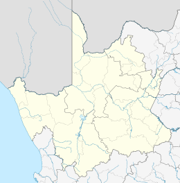
| Country | South Africa |
| Province | Northern Cape |
| District | ZF Mgcawu |
| Municipality | Kai !Garib |
| Established | 1868 |
| Area | |
| • Total | 159.35 km2 (61.53 sq mi) |
| Population (2011)[1] | |
| • Total | 4,843 |
| • Density | 30/km2 (79/sq mi) |
| Racial makeup (2011) | |
| • Black African | 1.9% |
| • Coloured | 92.2% |
| • Indian/Asian | 1.1% |
| • White | 4.3% |
| • Other | 0.5% |
| First languages (2011) | |
| • Afrikaans | 96.5% |
| • Other | 3.5% |
| Time zone | UTC+2 (SAST) |
| Postal code (street) | 8900 |
| PO box | 8900 |
| Area code | 054 |
History
On 27 December 1868, special magistrate Maximillian Jackson with a police contingent, was sent to act against the Griquas in the area. The Griqua's anti-colonial resistance had erupted into an open conflict. Jackson arrived in Kenhardt and set up camp under a giant camelthorn tree.[2]
This has been for a long time the most remote settlement in the North-Western Cape. With time the town developed from under this tree, becoming a municipality in 1909. The Hartbees River, with its many sweet thorn trees, provides a green belt irrigated by the Rooiberg Dam. Kenhardt is famous for being at the heart of the Dorper sheep-farming area.
Geography
This region contains very little vegetation, primarily very low shrubs and yellow grass among a rocky desert kind of landscape. If you travel south from Kenhardt towards Brandvlei, you will pass through a huge landscape of nothingness for the next 200 km and more. During the seasons many birds flock to the pans, when they contain water, after some rainfall. Temperature above 40 °C is not uncommon.
Activities
- Visit the Quiver Tree forest, Kokerboom Woud in Afrikaans, about 8 km south of Kenhardt on the main route to Cape Town. Some of these trees have special formed weaver birds nests. The forest comprises approximately 4,000 to 5,000 trees.
- Walk the geological legendary granite metamorphic outcrops of the area. Along the trail all kind of quartz lie scattered.
- Tours to the pans on the outlying farms where you can view San artwork and enjoy the farm hospitality.
- A hiking trail where Anglo Boer War remains and the beautiful landscape can be experienced.
- Make your own discoveries on fossilized foot impressions and engravings.
Places of interest
- Giant Camelthorn Tree
This tree is about 500–600 years old. It is under this tree which Magistrate Jackson set up his camp in 1868.
- Old Library Building
The old library was built in 1897, and it was used until 1977. In 1978 it was declared a national monument, currently it is used by Sanlam as their office.[3]
A vast dry pan on which Sir Malcolm Campbell tried, in Bluebird 1, to set a new world land-speed record in 1929.[4]
See also
- List of cities and towns in the Northern Cape
- Northern Cape
- Kakamas, Northern Cape
- Upington, Northern Cape
References
- "Main Place Kenhardt". Census 2011.
- "Kenhardt - 115km south of Upington on the R27". Retrieved 2009-02-10.
- "Green Kalahari Accommodation Kenhardt". Retrieved 2009-02-10.
- "Bluebird Supporters Club — Malcolm Campbell". Archived from the original on 2009-05-11. Retrieved 2009-02-10.
External links
| Wikimedia Commons has media related to Kenhardt. |
- Northern Cape - As real as the people who choose to explore it!
- UPINGTON.COM - Kenhardt Accommodation | Kenhardt Hotels...
- History of Kenhardt
Municipalities and communities of ZF Mgcawu District Municipality, Northern Cape | ||
|---|---|---|
District seat: Upington | ||
| Dawid Kruiper | .svg.png) ZF Mgcawu District within South Africa | |
| Kai !Garib | ||
| Kgatelopele | ||
| !Kheis | ||
| Tsantsabane | ||