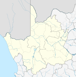
Upington
Upington (Nama: //Khara hais) is a town founded in 1873 and located in the Northern Cape province of South Africa, on the banks of the Orange River. The town was originally called Olijvenhoutsdrift ('Olive wood drift'), due to the abundance of olive wood trees in the area, but later renamed after Sir Thomas Upington, Attorney-General and then Prime Minister of the Cape. It originated as a mission station established in 1871 and run by Reverend Christiaan Schröder. The mission station now houses the town museum, known as the Kalahari Orange Museum. The museum is also the home of a donkey statue, which recognises the enormous contribution that this animal made to the development of the region during the pioneering days of the 19th century.
Upington | |
|---|---|
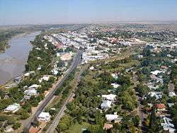 Aerial view of Upington's Central Business District | |
 Upington  Upington | |
| Coordinates: 28°27′22″S 21°14′7″E | |
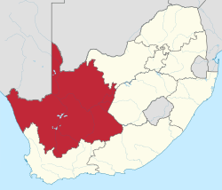
| Country | South Africa |
| Province | Northern Cape |
| District | ZF Mgcawu |
| Municipality | Dawid Kruiper |
| Established | 1873[1] |
| Government | |
| • Type | Local Municipality |
| • Mayor | Limakatso Koloi[2] (ANC) |
| Area | |
| • Total | 580.8 km2 (224.2 sq mi) |
| Elevation | 835 m (2,740 ft) |
| Population (2011)[3] | |
| • Total | 74,834 |
| • Density | 130/km2 (330/sq mi) |
| Racial makeup (2011) | |
| • Black African | 25.6% |
| • Coloured | 62.6% |
| • Indian/Asian | 0.6% |
| • White | 10.1% |
| • Other | 1.1% |
| First languages (2011) | |
| • Afrikaans | 85.5% |
| • Xhosa | 6.1% |
| • Tswana | 3.2% |
| • English | 2.1% |
| • Other | 3.1% |
| Time zone | UTC+2 (SAST) |
| Postal code (street) | 8800 |
| PO box | 8800 |
| Area code | +27 (0)54 |
| Website | www www |
The elevation of Upington is 2,742 feet (835 metres). It is the closest large centre to the Augrabies Falls (arguably the greatest of South African waterfalls) and the Kgalagadi Transfrontier Park. The landscape is very arid but the soil is fertile and crops such as fruit are grown in irrigated fields. The area is best known for its export-quality grapes, raisins and wines, which are cultivated on the rich flood plains of the Orange River.
Wine industry
Upington's most famous wines are produced by an organisation known as Orange River Cellars. The organisation has six depots in the area (all of them on the banks of the Orange River) at Upington, Kanoneiland, Grootdrink, Kakamas, Keimoes and Groblershoop. Their wines are exported, inter alia, to Europe and the USA.
Transportation
Upington has a modern airport (Upington Airport - IATA codename: UTN) with scheduled flights provided by SA Airlink (an affiliate of South African Airways).[4] One of the airport's runways is 4,900 m in length.[5]
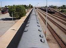
In the first half of the 20th century there was a passenger train service from Cape Town to Upington. Until the 1950s a narrow-gauge railway line (two-foot gauge) ran from Upington to Kakamas and Keimoes, two nearby towns. The trains carried passengers and freight, being mainly dried fruit. The line to Kakamas was still in use during the November 2010 grape harvest season.[6]
Shopping
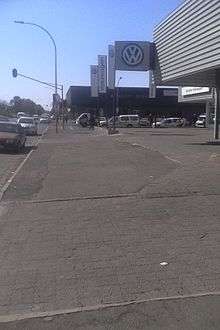
Shopping in Upington is characterised by High Street shopping, with most stores located along Scott, Schroder, Nelson Mandela and Mark Streets. Upington has a mall, which is the area's first super regional mall. The Kalahari mall is anchored by Game, Checkers, Spar, Woolworths, Tiger Wheel & Tyre and clothing stores, banks and restaurants. It is located on the corner of Van Riebeeck and Malherbe Streets.
Geography and climate
| Upington | ||||||||||||||||||||||||||||||||||||||||||||||||||||||||||||
|---|---|---|---|---|---|---|---|---|---|---|---|---|---|---|---|---|---|---|---|---|---|---|---|---|---|---|---|---|---|---|---|---|---|---|---|---|---|---|---|---|---|---|---|---|---|---|---|---|---|---|---|---|---|---|---|---|---|---|---|---|
| Climate chart (explanation) | ||||||||||||||||||||||||||||||||||||||||||||||||||||||||||||
| ||||||||||||||||||||||||||||||||||||||||||||||||||||||||||||
| ||||||||||||||||||||||||||||||||||||||||||||||||||||||||||||
Upington is located on the northern banks of the Orange River and is surrounded by irrigated vineyards.[8] The hottest month of the year is January, with average daily temperatures swinging from 36 °C (97 °F) to 20 °C (68 °F), while in the coolest month of July temperatures range between 21 °C (70 °F) and 4 °C (39 °F).[7] Also the driest month of the year, July sees an average rainfall of only 2 millimetres (0.079 in), while the wettest month of March sees 37 millimetres (1.5 in). Upington has been noted as being the sunniest location on the planet for three months of the year, from November through January. [9]
| Climate data for Upington (1961−1990, extremes 1951–1990) | |||||||||||||
|---|---|---|---|---|---|---|---|---|---|---|---|---|---|
| Month | Jan | Feb | Mar | Apr | May | Jun | Jul | Aug | Sep | Oct | Nov | Dec | Year |
| Record high °C (°F) | 42.3 (108.1) |
42.3 (108.1) |
40.7 (105.3) |
38.1 (100.6) |
33.7 (92.7) |
30.4 (86.7) |
29.5 (85.1) |
33.6 (92.5) |
39.3 (102.7) |
40.5 (104.9) |
42.0 (107.6) |
43.0 (109.4) |
43.0 (109.4) |
| Average high °C (°F) | 35.5 (95.9) |
34.4 (93.9) |
32.1 (89.8) |
27.8 (82.0) |
24.0 (75.2) |
20.5 (68.9) |
20.8 (69.4) |
22.9 (73.2) |
26.8 (80.2) |
29.6 (85.3) |
32.7 (90.9) |
34.7 (94.5) |
28.5 (83.3) |
| Daily mean °C (°F) | 27.8 (82.0) |
26.9 (80.4) |
24.7 (76.5) |
20.2 (68.4) |
15.7 (60.3) |
12.1 (53.8) |
11.9 (53.4) |
14.0 (57.2) |
18.1 (64.6) |
21.4 (70.5) |
24.7 (76.5) |
26.9 (80.4) |
20.4 (68.7) |
| Average low °C (°F) | 19.8 (67.6) |
19.5 (67.1) |
17.8 (64.0) |
13.3 (55.9) |
8.3 (46.9) |
4.8 (40.6) |
4.1 (39.4) |
5.6 (42.1) |
9.4 (48.9) |
12.9 (55.2) |
16.3 (61.3) |
18.6 (65.5) |
12.5 (54.5) |
| Record low °C (°F) | 6.7 (44.1) |
7.6 (45.7) |
4.7 (40.5) |
−1.7 (28.9) |
−5.2 (22.6) |
−7.9 (17.8) |
−7.8 (18.0) |
−7.0 (19.4) |
−3.5 (25.7) |
−1.7 (28.9) |
4.4 (39.9) |
5.7 (42.3) |
−7.9 (17.8) |
| Average precipitation mm (inches) | 24 (0.9) |
35 (1.4) |
37 (1.5) |
26 (1.0) |
10 (0.4) |
4 (0.2) |
2 (0.1) |
4 (0.2) |
4 (0.2) |
9 (0.4) |
17 (0.7) |
17 (0.7) |
189 (7.4) |
| Average precipitation days (≥ 1.0 mm) | 3 | 4 | 4 | 3 | 1 | 1 | 0 | 1 | 1 | 2 | 2 | 2 | 24 |
| Average relative humidity (%) | 33 | 39 | 44 | 49 | 49 | 50 | 45 | 39 | 35 | 33 | 31 | 30 | 40 |
| Mean monthly sunshine hours | 352.9 | 298.7 | 297.5 | 283.5 | 290.5 | 270.3 | 289.8 | 307.3 | 300.2 | 328.9 | 345.2 | 367.0 | 3,731.8 |
| Source 1: NOAA,[10] Deutscher Wetterdienst (extremes)[11] | |||||||||||||
| Source 2: South African Weather Service[7] | |||||||||||||
Notable natives and residents
- Alice Krige – South African actress
- Chris Brink – Vice-chancellor of Newcastle University (former Vice-Chancellor and Rector of Stellenbosch University)
- Ruben Cloete – South African football player
- Shaleen Surtie-Richards - South African actress
Gallery
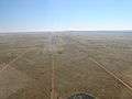 4900 m airport runway
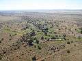 Golf course
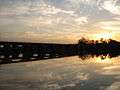 View from "Die Eiland" holiday resort
See also
- Vastrap, South Africa's former nuclear weapons test range.
References
- "Upington". Archived from the original on 14 March 2010. Retrieved 27 March 2009.
- Dawid Kruiper Municipality website
- Sum of the Main Places Upington and Paballelo from Census 2011.
- South African Airways
- "Upington". World Aero Data. Aviation Networks, Inc. Retrieved 26 March 2008.
- http://www.railwaysafrica.com/blog/2011/01/flood-at-upington/
- "Climate data for Upington". South African Weather Service. Archived from the original on 4 March 2012. Retrieved 7 March 2010.
- Pinchuck, Tony; Barbara McCrea; Donald Reid (July 2002). Rough guide to South Africa, Lesotho & Swaziland. Rough Guides. pp. 319, 322. ISBN 978-1-85828-853-6. Retrieved 28 May 2010.
- Osborn, Liz. "Sunniest Places and Countries in the World". Current Results. Retrieved 16 November 2012.
- "Upington Climate Normals 1961−1990". National Oceanic and Atmospheric Administration. Retrieved 21 November 2013.
- "Klimatafel von Upington/Oranjefluß, Kapland / Südafrika" (PDF). Baseline climate means (1961-1990) from stations all over the world (in German). Deutscher Wetterdienst. Retrieved 7 February 2016.
External links
| Wikivoyage has a travel guide for Upington. |
- Additional information about Upington Airport
- The Orange River Wine Cellars Home Page
- Upington Business Directory
- Racially motivated land dispossession in Gordonia: Memorial lecture on the 1913 Natives Land Act
Province of the Northern Cape | ||
|---|---|---|
| ||
| Topics |
|  |
| Government | ||
| Regions |
| |
| Cities and major towns | ||
Municipalities and communities of ZF Mgcawu District Municipality, Northern Cape | ||
|---|---|---|
District seat: Upington | ||
| Dawid Kruiper | .svg.png) ZF Mgcawu District within South Africa | |
| Kai !Garib | ||
| Kgatelopele | ||
| !Kheis | ||
| Tsantsabane | ||