Keg River, Alberta
Keg River is an unincorporated community in northern Alberta, Canada. It is located west of Highway 35 (also known as the Mackenzie Highway) approximately midway between Manning to the south and High Level to the north. It has an elevation of 420 metres (1,380 ft).
Keg River | |
|---|---|
Unincorporated community | |
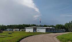 Dr. Mary Jackson School | |
 Keg River Location of Keg River in Alberta | |
| Coordinates: 57.7882°N 117.8584°W | |
| Country | |
| Province | |
| Census division | No. 17 |
| Municipal district | County of Northern Lights |
| Government | |
| • Type | Unincorporated |
| • Governing body | County of Northern Lights Council |
| Elevation | 420 m (1,380 ft) |
| Time zone | UTC-7 (MST) |
The community is located in census division No. 17 and in the federal riding of Peace River. It is administered by the County of Northern Lights.
Climate
| Climate data for Keg River | |||||||||||||
|---|---|---|---|---|---|---|---|---|---|---|---|---|---|
| Month | Jan | Feb | Mar | Apr | May | Jun | Jul | Aug | Sep | Oct | Nov | Dec | Year |
| Record high °C (°F) | 14.5 (58.1) |
16.0 (60.8) |
17.0 (62.6) |
30.0 (86.0) |
33.0 (91.4) |
34.0 (93.2) |
35.0 (95.0) |
32.8 (91.0) |
32.5 (90.5) |
26.5 (79.7) |
16.5 (61.7) |
13.0 (55.4) |
35.0 (95.0) |
| Average high °C (°F) | −12.1 (10.2) |
−7.2 (19.0) |
0.3 (32.5) |
9.9 (49.8) |
16.5 (61.7) |
21.4 (70.5) |
22.8 (73.0) |
20.9 (69.6) |
15.7 (60.3) |
7.2 (45.0) |
−5.9 (21.4) |
−9.3 (15.3) |
6.7 (44.1) |
| Daily mean °C (°F) | −18.4 (−1.1) |
−14.3 (6.3) |
−7.3 (18.9) |
2.9 (37.2) |
9.2 (48.6) |
14.1 (57.4) |
16.0 (60.8) |
14.0 (57.2) |
8.8 (47.8) |
1.5 (34.7) |
−11.2 (11.8) |
−15.4 (4.3) |
0.0 (32.0) |
| Average low °C (°F) | −24.6 (−12.3) |
−21.4 (−6.5) |
−14.9 (5.2) |
−4.1 (24.6) |
2.0 (35.6) |
6.8 (44.2) |
9.2 (48.6) |
7.0 (44.6) |
2.0 (35.6) |
−4.2 (24.4) |
−16.4 (2.5) |
−21.5 (−6.7) |
−6.7 (19.9) |
| Record low °C (°F) | −50.0 (−58.0) |
−47.0 (−52.6) |
−39.0 (−38.2) |
−31.9 (−25.4) |
−14.0 (6.8) |
−5.0 (23.0) |
−2.4 (27.7) |
−4.5 (23.9) |
−17.2 (1.0) |
−33.5 (−28.3) |
−45.0 (−49.0) |
−46.0 (−50.8) |
−50.0 (−58.0) |
| Average precipitation mm (inches) | 24.7 (0.97) |
19.8 (0.78) |
18.4 (0.72) |
21.2 (0.83) |
36.6 (1.44) |
57.1 (2.25) |
89.0 (3.50) |
63.4 (2.50) |
37.5 (1.48) |
28.5 (1.12) |
30.4 (1.20) |
20.6 (0.81) |
447.2 (17.61) |
| Source: Environment Canada[2] | |||||||||||||
See also
References
- "Alberta Private Sewage Systems 2009 Standard of Practice Handbook: Appendix A.3 Alberta Design Data (A.3.A. Alberta Climate Design Data by Town)" (PDF) (PDF). Safety Codes Council. January 2012. pp. 212–215 (PDF pages 226–229). Retrieved 8 October 2013.
- "Canadian Climate Normals 1981-2010". Environment Canada. Government of Canada. 20 July 2018. Archived from the original on 17 February 2019. Retrieved 17 February 2019.
| Subdivisions | |
|---|---|
| Communities | |
| Cities and urban service areas | |
| |
This article is issued from Wikipedia. The text is licensed under Creative Commons - Attribution - Sharealike. Additional terms may apply for the media files.