Kampar River
Kampar River on the island of Sumatra in Indonesia about 800 km northwest of the capital Jakarta.[2]
| Kampar River Sungai Kampar | |
|---|---|
 View of the Kampar River near Muara Takus, a historical Buddhist temple complex thought to belong to the Sriwijaya empire.[1] | |
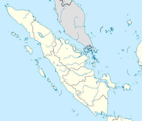 Location of river mouth  Kampar River (Indonesia) | |
| Native name | Batang Kampar |
| Location | |
| Country | Indonesia |
| Province | Riau, West Sumatra |
| District | Pelalawan Regency, Kampar Regency, Kuantan Singingi Regency, Lima Puluh Kota, Sijunjung Regency |
| Physical characteristics | |
| Source | |
| ⁃ location | Lima Puluh Kota and Sijunjung Regency, West Sumatra |
| Mouth | |
⁃ location | Kuala Kampar, Pelalawan Regency, Riau |
⁃ coordinates | 0.469°N 103.145°E |
| Length | 413.5 km (256.9 mi) |
| Basin features | |
| Tributaries | |
| ⁃ left | Kampar Kiri River |
| ⁃ right | Kampar Kanan River |
Hydrology
It originates in the mountainous Bukit Barisan of West Sumatra, and empties into the Malacca Strait on the island's eastern coast. It is a well-known river surfing destination because of its tidal bore known as Bono,[3][4] caused by sea water from a high tide flowing upstream into a wide, shallow, and rapidly narrowing channel against the normal flow of the river water.
Tributaries
The river is the confluence of two tributaries of almost equal size: Kampar Kanan River (or Right Kampar), and Kampar Kiri River (or Left Kampar). Kampar Kanan River passes through Lima Puluh Kota Regency and Kampar Regency, while Kampar Kiri River passes through Sijunjung Regency, Kuantan Singingi Regency, and Kampar Regency. The tributaries meet in the Langgam subdistrict, Pelalawan Regency, before flowing into the Malacca Strait as the Kampar River.[5][6] Koto Panjang, an artificial lake upstream of the river, is used to power a hydroelectric generating plant with a capacity of 114 MW.[7]

Bono tidal bore
Characteristic
The Kampar River widens as it approaches the sea, and its water volume increases as it is joined by various other tributaries.[1] During the rainy season, normally November to December,[8] the volume of river water is greatly increased, and the river's shallow estuary becomes even wider. Upstream the river's cross section changes suddenly, becoming much narrower, which encourages the generation of large tidal bore/waves called Bono, caused by high tides flowing upstream meeting the river water flowing downstream.[9] The waves can travel from the sea at speeds of up to 40 kilometres per hour (25 mph), and when sea water at full tide combines with heavy rain upstream they can reach a height of 4–6 metres (13–20 ft), accompanied by a loud roaring sound and strong winds.[1][10]
Bono waves can persist for four hours or more, and travel as far upstream as Tanjung Pungai, Meranti, Pelalawan Regency, 60 kilometres (37 mi) inland.[7] Bono is not just one wave but a series of many, sometimes on the left and right river banks and at other times in the middle of the river. Surfing the Bono waves is difficult, owing to the quantity of mud in the river.[10]
The large number of ships sunk in the Kampar River's estuary has been attributed to the Bono waves, called by locals as "Seven Ghosts",[11] considered to be the incarnation of the seven evil spirits. Although they still used the river as the ground for boating agility tests.[10]
The river is inhabited by crocodiles,[11] hence the surfers are usually escorted by rescue boats for their safety.[3]
Bono location
Bono wave can be seen in many location of Kampar river, such as: Tanjung Sebayang, Pulau Muda, Teluk Meranti and Tanjung Pungai, all of them in Pelalawan Regency. The location can be reached from Pangkalan Kerinci within 4 hours by car, or 3 hours by speedboat. Pangkalan Kerinci can be reached within 90 minutes by car from Pekanbaru or Pekanbaru international airport.[10] The river can also be reached via nearby Singapore.[12] Bono location is not far from Tesso Nilo National Park and Kerumutan Natural Reserve and local government also planned to extend Bono tourist attraction with ecotourism.[8]
Geography
The river flows in the central area of Sumatra with predominantly tropical rainforest climate (designated as Af in the Köppen-Geiger climate classification).[13] The annual average temperature in the area is 24 °C. The warmest month is October, when the average temperature is around 26 °C, and the coldest is November, at 22 °C.[14] The average annual rainfall is 2667 mm. The wettest month is November, with an average of 402 mm rainfall, and the driest is June, with 104 mm rainfall.[15]
| Kampar River | ||||||||||||||||||||||||||||||||||||||||||||||||||||||||||||
|---|---|---|---|---|---|---|---|---|---|---|---|---|---|---|---|---|---|---|---|---|---|---|---|---|---|---|---|---|---|---|---|---|---|---|---|---|---|---|---|---|---|---|---|---|---|---|---|---|---|---|---|---|---|---|---|---|---|---|---|---|
| Climate chart (explanation) | ||||||||||||||||||||||||||||||||||||||||||||||||||||||||||||
| ||||||||||||||||||||||||||||||||||||||||||||||||||||||||||||
| ||||||||||||||||||||||||||||||||||||||||||||||||||||||||||||
References
- "Tempat tempat Wisata di Kabupaten Pelalawan" (in Indonesian). Riau Tourism Board. 2010-07-24. Archived from the original on 2012-06-23. Retrieved 2012-06-22.
- Sungai Kampar at Geonames.org (cc-by); Last updated 2013-06-04; Database dump downloaded 2015-11-27
- Afriatni, Ami (May 10, 2012). "A Journey to the Heart of the Bono". Jakarta Globe. Archived from the original on July 18, 2012. Retrieved July 7, 2012.
- Howard, Jake (April 11, 2012). "Freshwater perfection". ESPN.
- Ridwan, Adin (2010). Atlas Indonesia (in Indonesian). Tiga Menara.
- McNally, Rand (1993). The New International Atlas.
- "Waduk Koto Panjang". Riau Pos (in Indonesian). 12 June 2012.
- "Portal Situs Berita Riau" (in Indonesian). Riauterkini.com. Retrieved 2012-06-22.
- Kodoatie; Sjarief (2010). Tata Ruang Air (in Indonesian). Penerbit Andi. pp. 126–127. ISBN 978-979-29-1242-5. Retrieved 22 June 2012.
- Mocelies Ullies (30 January 2012). "detikTravel – Bukan Berselancar Biasa di Gelombang Bono, Sungai Kampar" (in Indonesian). Travel.detik.com. Retrieved 2012-06-25.
- Swanton, Will (April 13, 2011). "Nice waves, pity about the crocs". The Australian.
- "Exploring the tidal bores of Indonesia". Surfer Today. May 16, 2011.
- Peel, M C; Finlayson, B L; McMahon, T A (2007). "Updated world map of the Köppen-Geiger climate classification". Hydrology and Earth System Sciences. 11: 1633–1644. doi:10.5194/hess-11-1633-2007. Retrieved 30 January 2016.
- "NASA Earth Observations Data Set Index". NASA. 30 January 2016.
- "NASA Earth Observations: Rainfall (1 month - TRMM)". NASA/Tropical Rainfall Monitoring Mission. 30 January 2016.