Kaapmuiden
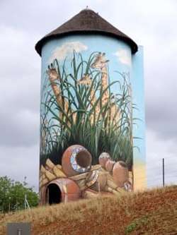
Kaapmuiden (Cape Mouth) is a small farming town situated at the confluence of the Kaap and Crocodile Rivers in Mpumalanga, South Africa. The town lies just off the N4 national highway and is marked by a large abandoned silo visible from the road. The silo has since been repainted to add to tourism appeal. The farms in the region produce sugarcane, subtropical fruit and vegetables. The town began as a junction on the Netherlands-South African Railway Company (NZASM)'s Pretoria - Delagoa Bay railway line.
Kaapmuiden | |
|---|---|
 | |
 Kaapmuiden  Kaapmuiden | |
| Coordinates: 25.532°S 31.333°E | |
| Country | South Africa |
| Province | Mpumalanga |
| District | Ehlanzeni |
| Municipality | Nkomazi |
| Area | |
| • Total | 0.18 km2 (0.07 sq mi) |
| Population (2011)[1] | |
| • Total | 270 |
| • Density | 1,500/km2 (3,900/sq mi) |
| Racial makeup (2011) | |
| • Black African | 98.5% |
| • Coloured | 0.7% |
| • White | 0.7% |
| First languages (2011) | |
| • Swazi | 88.5% |
| • Other | 11.5% |
| Time zone | UTC+2 (SAST) |
| PO box | 1295 |
| Area code | 013 |
Recently the town underwent some development due to the Sasol pipeline and construction and upgrading of the national highway. The Nkomazi Tollgate has subsequently been built on the outskirts of the town.
References
- "Main Place Kaapmuiden". Census 2011.
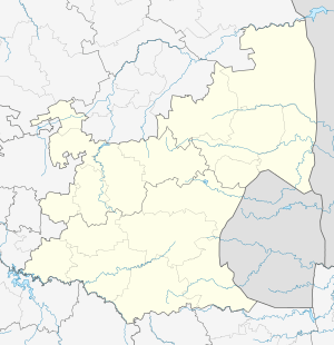
Municipalities and communities of Ehlanzeni District Municipality, Mpumalanga | ||
|---|---|---|
District seat: Mbombela | ||
| Mbombela | .svg.png) Ehlanzeni District within South Africa | |
| Nkomazi | ||
| Thaba Chweu | ||
| Umjindi | ||
| Bushbuckridge | ||
This article is issued from Wikipedia. The text is licensed under Creative Commons - Attribution - Sharealike. Additional terms may apply for the media files.