K-27 (Kansas highway)
K-27 is a 226.241-mile-long (364.100 km) north–south state highway that parallels Kansas' western border with Colorado. It is the western-most north–south state highway in the state. It begins in Elkhart near the Oklahoma state line and travels through the seven counties that border Colorado until reaching its northern terminus in Cheyenne County north of St. Francis, where it ends at the Nebraska state line (effectively becoming like-numbered Nebraska Highway 27). The section from US-40 north to Nebraska, is designated as Land and Sky Scenic Byway.
| ||||
|---|---|---|---|---|
%26groups%3D_2289e7236675471f3c30191783d02835704f1ce4.svg)
K-27 highlighted in red | ||||
| Route information | ||||
| Maintained by KDOT | ||||
| Length | 226.241 mi[1] (364.100 km) | |||
| Existed | 1927[2]–present | |||
| Major junctions | ||||
| South end | ||||
| North end | ||||
| Location | ||||
| Counties | Morton, Stanton, Hamilton, Greeley, Wallace, Sherman, Cheyenne | |||
| Highway system | ||||
| ||||

K-27 was first designated as a state highway in 1927. At that time it ran from the Elkhart, north to the Nebraska border. In 1955, K-27 was extended from Elkart, south to the Oklahoma border. Then in 2004, it was realigned to intersect US-56 northeast of Elkhart.
Route description
K-27 changes time zones not once, but twice, during its trek through Kansas, the only highway in the state to do so. Central Standard Time is observed in Morton and Stanton Counties after entering from Oklahoma, but the time zone changes to Mountain Standard Time when the highway crosses from Stanton into Hamilton County. Hamilton and the next three counties to the north (Greeley, Wallace, and Sherman) observe Mountain time, but clocks revert to Central Time at the Sherman County-Cheyenne County line.
The Kansas Department of Transportation (KDOT) tracks the traffic levels on its highways, and in 2018, they determined that on average the traffic varied from 410 vehicles just north of the southern overlap with K-51 to 4410 vehicles in the city of Goodland.[3][4] The only section of K-27 included in the National Highway System is its overlap with US-50 and US-400.[5] The National Highway System is a system of highways important to the nation's defense, economy, and mobility.[6] K-27 also connects to the National Highway System at its junction with I-70 and US-24.[5]
Morton and Stanton counties
K-27 begins at US-56 northeast of Elkhart, crosses the Cimarron Valley Railroad, and begins travelling westward. After about one mile (1.6 km) it curves to the north, and continues 6.5 miles (10.5 km), then crosses the Cimarron River. From here it continues another 1.5 miles (2.4 km), where it begins an overlap with K-51, the only overlap with another state highway. The two routes continue north for about 5.5 miles (8.9 km), where it crosses the North Fork Cimarron River. Another 2.5 miles (4.0 km) past the river the two routes curve to the east, towards Richfoeld. In Richfield, K-51 continues east, where K-27 turns north onto Main Street. The highway continues north out of the city, for eleven miles (18 km) then enters into Stanton County. From the county line, K-27 continues northward about 7.8 miles (12.6 km), where it crosses Sand Arroyo Creek. From here the highway continues north to the Johnson city line, crosses the Cimarron Valley Railroad, and meets US-160 from the west. The two routes continue north along the west side of the city for one mile (1.6 km), then US-160 leaves to the east. K-27 continues north from here 3.5 miles (5.6 km), then crosses Bear Creek. About 7.5 miles (12.1 km) north from the creek, the highway enters Hamilton County.
Hamilton and Greeley counties
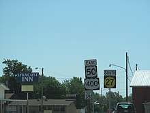
Just inside the county, the roadway crosses Little Bear Creek, and continues north. After about 16 miles (26 km), K-27 enters the city of Syracuse and soon intersects US-50 and US-400. The two routes travel northwest together for 0.5 miles (0.80 km), then K-27 leaves and heads north. From here, the highway continues for about 3.2 miles (5.1 km), where it crosses Syracuse Creek. Then another six miles (9.7 km) later, it crosses Sand Creek, then Mattox Draw nine miles (14 km) later. From here, K-27 continues for one mile (1.6 km) through a s-curve as it enters Greeley County. It enters the county, curves back northward for about 14 miles (23 km), then intersects K-96 as it enters Tribune. Past here, it crosses the Kansas and Oklahoma Railroad and continues northward through Tribune. As it leaves Tribune, the highway crosses White Woman Creek. It then continues northward for about 14 miles (23 km), where it crosses South Ladder Creek. The highway continues northward for another one mile (1.6 km), and enters into Wallace County.
Wallace County
As it enters the county, it soon crosses Middle Ladder Creek. About 4 north from here, it crosses Ladder Creek. About 3.2 miles (5.1 km) past the creek, the highway curves to the west for .5 miles (0.80 km), then back north. K-27 then crosses Rose Creek and North Fork Rose Creek, as it continues north for four miles (6.4 km), then enters Sharon Springs. Within the city, it crosses Eagletail Creek and a Union Pacific Railway before intersecting US-40. The two routes travel east for a brief distance, then K-27 turns to the north as it exits the city. Here the Land and Sky Scenic Byway begins and follows K-27. About 2.5 miles (4.0 km) north of Sharon Springs, the highway crosses the Smoky Hill River. From here, the roadway continues for a brief distance, then shifts to the east for .5 miles (0.80 km) through an s-curve, then crosses Pond Creek. From here it continues for four miles (6.4 km), where it crosses South Fork Lake Creek. Roughly 1.8 miles (2.9 km) north from here, K-27 crosses North Fork Lake Creek, as it shifts east another .5 miles (0.80 km). It continues northward for 1.5 miles (2.4 km) after turning north, where it crosses into Sherman County.
Sherman and Cheyenne counties
About 4.5 miles (7.2 km) north of the county line, K-27 crosses the North Fork Smoky Hill River. It continues northward past the river for 8.5 miles (13.7 km), enters Goodland and reaches I-70 and US-24 at a diamond interchange. Here, K-27 begins to overlap US-24 Business as it continues north. After .5 miles (0.80 km), US-24 Business leaves to the east, as K-27 continues north and crosses the Kyle Railroad System. It continues north another one mile (1.6 km), then exits the city as it curves northeast. It curves back north after one mile (1.6 km), then continues and crosses South Beaver Creek then Middle Beaver Creek. From the creek, K-27 continues northward another eight miles (13 km), curves northwest, and enters Cheyenne County. As the highway enters the county, it curves northward again, and after one mile (1.6 km) crosses Little Beaver Creek. It continues north for another 11.8 miles (19.0 km), where US-36 joins from the east, and the two routes begin to travel west. About 4.5 miles (7.2 km) later, the two highways enter Saint Francis and continue one mile (1.6 km) through the city. They exit the city, cross the South Fork Republican River, then K-27 leaves the overlap and heads north. About six miles (9.7 km) north of US-36, K-27 curves to the west for .5 miles (0.80 km), then back north. About four miles (6.4 km) north from here it crosses Hackberry Creek, then enters into Nebraska 6.3 miles (10.1 km) later, where it continues as Nebraska Highway 27.
History
K-27 was first designated as a state highway in 1927. At that time it ran from the Oklahoma state line, north then east to Richfield. It then turned north and then intersected K-46 then US-50 shortly after in Syracuse. It then continued north to K-96 in Tribune, then reached US-40S in Sharon Springs. It continued north, intersecting US-40N in Goodland, before reaching K-2. K-2 and K-27 then overlapped from Wheeler to St Francis. In St Francis the two routes split, and K-27 headed north and soon crossed into Nebraska.[2]
In a July 23, 1935 resolution, the alignment of K-27 was straightened to eliminate sharp curves, within Sharon Springs.[7] In a June 6, 1936 resolution, K-27 was realigned slightly in Stanton in Stanton County.[8] In a January 26, 1937 resolution, it was realigned where it crosses the Smoky Hill River, in order to eliminate a bad drainage condition caused by several small branches converging with the main river.[9] Between February 1937 and January 1938, US-270 was extended into Kansas, and overlapped K-27 from Johnson north to US-50 in Syracuse, where it terminated.[10][11] This overlap lasted until 1981, and in a May 18, 1981 resolution, the US-270 designation was removed.[12] In a March 20, 1937 resolution, the intersection with K-96 in tribune was reconstructed.[13] In a March 18, 1940 resolution, K-27 was realigned slightly within Richfield and Stanton in Morton County, to eliminate sharp curves.[14] Before 1950, K-27 zigzagged from St. Francis northwestward. Then in an August 10, 1950 resolution, the overlap with US-36 was extended 1.5 miles (2.4 km) west from St Francis then turned north for about six miles (9.7 km) then turned west, which eliminated 13 sharp curves.[15] In a September 27, 1950 resolution, K-27 was realigned in Goodland.[16] Then in an October 14, 1953 resolution, the latter K-27 realignment was moved further northward to run along 8th Street in Goodland. This new alignment was completed by 1954.[17][18] Then by 1970, it was realigned in Goodland again to its modern day alignment.[19] In a June 2, 1954 resolution, the alignment of K-27 was straightened slightly south of the Nebraska border to eliminate several sharp curves.[20] In an April 27, 1955 resolution, K-27 was extended from Elkart, 0.33 miles (0.53 km) south to the Oklahoma border, where it continued as Oklahoma Highway 95.[21] In a November 14, 1956 resolution, a 0.106-mile-long (0.171 km) connector road was built from K-27 east to US-56, and designated as K-127.[22] In a June 7, 1966 resolution, the interchange with I-70 was designated, K-27 Spur was designated, and US-24 was realigned to overlap the new I-70.[23] Then in an April 1, 1981 resolution, K-27 Spur was renumbered to US-24 Business in Goodland.[24] In a May 3, 1996 resolution, US-400 was extended west, and was added to the overlap with US-50 in Syracuse.[25] Before 2004, K-27 travelled through the west side of Elkhart to the Oklahoma border. Then in a May 21, 2004 resolution, it was approved to realign K-27 north of Elkhart. The new 1.902-mile-long (3.061 km) realignment intersected US-56 northeast of Elkhart.[26] In a December 22, 2015 resolution, the highway was realigned south of Sharon Springs, where it crossed Rose Creek and North Fork Rose Creek.[27]
Major intersections
| County | Location | mi[1] | km | Destinations | Notes |
|---|---|---|---|---|---|
| Morton | Elkhart | 0.000 | 0.000 | Southern terminus | |
| Westola Township | 9.413 | 15.149 | Southern end of K-51 conccurrency | ||
| Richfield | 23.708 | 38.154 | Northern end of K-51 overlap | ||
| Stanton | Johnson City | 45.207 | 72.754 | Southern end of US-160 overlap | |
| 46.214 | 74.374 | Northern end of US-160 overlap | |||
| Hamilton | Syracuse | 74.087 | 119.231 | Southern end of US-50/US-400 overlap | |
| 74.617 | 120.084 | Northern end of US-50/US-400 overlap | |||
| Greeley | Tribune | 108.181 | 174.100 | ||
| Wallace | Sharon Springs | 138.426 | 222.775 | Southern end of US-40 overlap | |
| 138.526 | 222.936 | Northern end of US-40 overlap | |||
| Sherman | Goodland | 168.300 | 270.853 | Southern end of US-24 Bus. concurrency; I-70 exit 17 | |
| 168.883 | 271.791 | Northern end of US-24 Bus. concurrency | |||
| Cheyenne | Wheeler | 198.454 | 319.381 | Southern end of US-36 overlap | |
| Wano Township | 205.135 | 330.133 | Northern end of US-36 overlap | ||
| Haigler | 226.241 | 364.100 | Continuation into Nebraska | ||
1.000 mi = 1.609 km; 1.000 km = 0.621 mi
| |||||
Related route
| |
|---|---|
| Location | Near Goodland |
| Length | 2.902 mi[24] (4.670 km) |
| Existed | June 7, 1966[23]–April 1, 1981[24] |
K-27 Spur was a 2.902-mile-long (4.670 km) connection between K-27 and I-70 / US 24 in Goodland. In a June 7, 1966 resolution, when US-24 was moved onto I-70, and K-27 Spur was designated along the old alignment of US-24.[23] K-27 Spur was decommissioned in an April 1, 1981 resolution, and became a part of US-24 Business.[24]
Major junctions
The entire route is in Goodland, Sherman County.
| mi[24] | km | Destinations | Notes | ||
|---|---|---|---|---|---|
| 0.000 | 0.000 | Western terminus | |||
| 2.902 | 4.670 | Eastern terminus | |||
| 1.000 mi = 1.609 km; 1.000 km = 0.621 mi | |||||
References
- Staff (2016). "Pavement Management Information System". Kansas Department of Transportation. Retrieved April 21, 2017.
- Rand McNally and Company (1927). "Kansas" (Map). Rand McNally Auto Road Atlas of the United States and Ontario, Quebece, and the Maritime Provinces of Canada, with a Brief Description of the National Parks and Monuments. 1:1,600,000. Chicago: Rand McNally and Company. pp. 54–55. OCLC 2078375 – via Rumsey Collection.
- Bureau of Transportation Planning (2018). Traffic Flow Map Kansas State Highway System (PDF) (Map). [c. 1:1,584,000]. Topeka: Kansas Department of Transportation. Retrieved April 25, 2020.
- Bureau of Transportation Planning (2018). Traffic Flow Inset Map Kansas State Highway System (PDF) (Map). [c. 1:1,584,000]. Topeka: Kansas Department of Transportation. Retrieved April 25, 2020.
- Federal Highway Administration (May 8, 2019). National Highway System: Kansas (PDF) (Map). Scale not given. Washington, DC: Federal Highway Administration. Retrieved April 25, 2020.
- Natzke, Stefan; Neathery, Mike; Adderly, Kevin (September 26, 2012). "What is the National Highway System?". National Highway System. Federal Highway Administration. Retrieved April 25, 2020.
- State Highway Commission of Kansas (July 23, 1935). "Resolution for relocation and redesignation of road in Wallace County". Topeka: State Highway Commission of Kansas. Retrieved April 24, 2020.
- State Highway Commission of Kansas (March 18, 1940). "Resolution for relocation and redesignation of road in Stanton County". Topeka: State Highway Commission of Kansas. Retrieved April 24, 2020.
- State Highway Commission of Kansas (January 26, 1937). "Resolution for relocation and redesignation of road in Sherman County". Topeka: State Highway Commission of Kansas. Retrieved April 24, 2020.
- State Highway Commission of Kansas (1937). Kansas State Highway System (PDF) (Map). Scale not given. Topeka: State Highway Commission of Kansas. Retrieved April 24, 2020.
- State Highway Commission of Kansas (1938). Kansas State Highway System (PDF) (Map). Scale not given. Topeka: State Highway Commission of Kansas. Retrieved April 24, 2020.
- State Highway Commission of Kansas (January 4, 1939). "Resolution to withdraw a US Numbered Route from the State Highway System in several counties in Kansas". Topeka: State Highway Commission of Kansas. Retrieved April 24, 2020.
- State Highway Commission of Kansas (March 20, 1937). "Resolution for addition of curves to the State Highway System". Topeka: State Highway Commission of Kansas. Retrieved April 24, 2020.
- State Highway Commission of Kansas (March 18, 1940). "Resolution for relocation and redesignation of road in Morton County". Topeka: State Highway Commission of Kansas. Retrieved April 24, 2020.
- State Highway Commission of Kansas (August 10, 1950). "Resolution for relocation and redesignation of road in Sherman County". Topeka: State Highway Commission of Kansas. Retrieved April 24, 2020.
- State Highway Commission of Kansas (September 27, 1950). "Resolution for relocation and redesignation of road in Sherman County". Topeka: State Highway Commission of Kansas. Retrieved April 24, 2020.
- Kansas State Highway Department (1954). Sherman County (PDF) (Map). Scale not given. Highway & Transportation Map. Topeka: Kansas State Highway Department. Retrieved August 2, 2019.
- State Highway Commission of Kansas (October 14, 1953). "Resolution for relocation and redesignation of road in Sherman County". Topeka: State Highway Commission of Kansas. Retrieved April 24, 2020.
- Kansas State Highway Department (1970). Sherman County (PDF) (Map). Scale not given. Highway & Transportation Map. Topeka: Kansas State Highway Department. Retrieved April 25, 2020.
- State Highway Commission of Kansas (June 2, 1954). "Resolution for relocation and redesignation of road in Cheyenne County". Topeka: State Highway Commission of Kansas. Retrieved April 24, 2020.
- State Highway Commission of Kansas (April 27, 1955). "Resolution for addition to State Highway System". Topeka: State Highway Commission of Kansas. Retrieved April 24, 2020.
- State Highway Commission of Kansas (November 14, 1956). "Resolution for relocation and redesignation of road in Morton County". Topeka: State Highway Commission of Kansas. Retrieved April 24, 2020.
- State Highway Commission of Kansas (April 1, 1981). "Resolution for location, relocation and redesignation of road to be financed with Statewide Funds in Sherman and Thomas counties". Topeka: State Highway Commission of Kansas. Retrieved April 24, 2020.
- State Highway Commission of Kansas (April 1, 1981). "Resolution to redesignate a road in Sherman County". Topeka: State Highway Commission of Kansas. Retrieved April 24, 2020.
- Kansas Department of Transportation (May 3, 1996). "Resolution to establish Highway U.S. 400 in Hamilton, Kearny, and Finney counties". Topeka: Kansas Department of Transportation. Retrieved April 24, 2020.
- Kansas Department of Transportation (May 21, 2004). "Rural Resolution to relocate a segment of Highway K-27 in Morton County". Topeka: Kansas Department of Transportation. Retrieved April 24, 2020.
- Kansas Department of Transportation (December 22, 2015). "Rural Resolution to realign a portion of K-27 on the State Highway System in Wallace County". Topeka: Kansas Department of Transportation. Retrieved April 24, 2020.