Oakley, Kansas
Oakley is a city in Gove, Logan, and Thomas counties in the U.S. state of Kansas. It is the county seat of Logan County.[6] As of the 2010 census, the city population was 2,045.[7]
Oakley, Kansas | |
|---|---|
City and County seat | |
 Gas station on US Route 40 near I-70 (2011) | |
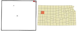 Location within Logan County and Kansas | |
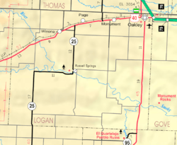 KDOT map of Logan County (legend) | |
| Coordinates: 39°7′41″N 100°51′16″W | |
| Country | United States |
| State | Kansas |
| Counties | Logan, Thomas, Gove |
| Founded | 1884 |
| Incorporated | 1887 |
| Named for | Elizabeth Oakley Gardner Hoag |
| Government | |
| • Mayor | Timothy Whyte |
| Area | |
| • Total | 1.94 sq mi (5.02 km2) |
| • Land | 1.94 sq mi (5.02 km2) |
| • Water | 0 sq mi (0 km2) |
| Elevation | 3,064 ft (934 m) |
| Population | |
| • Total | 2,045 |
| • Estimate (2018)[3] | 2,108 |
| • Density | 1,100/sq mi (410/km2) |
| Time zone | UTC-6 (CST) |
| • Summer (DST) | UTC-5 (CDT) |
| ZIP code | 67748 |
| Area code | 785 |
| FIPS code | 20-51825 [4] |
| GNIS ID | 485446 [5] |
| Website | discoveroakley.com |
History
The area that would later become Oakley was initially settled in the 1870s and 1880s by travelers from the Smoky Hill Trail. Oakley was founded in 1884 by Judge Fredman and David D. Hoag. Originally named Carlyle, its name was changed to Cleveland, before settling on its final name of Oakley in 1885, named after Hoag's mother, Elizabeth Oakley Gardner Hoag.[8]
Geography
Oakley is located at 39°7′41″N 100°51′16″W (39.128023, -100.854490) at an elevation of 3,064 feet (934 m).[5][9] It lies roughly 1 mile (1.6 km) south of the South Fork of the Saline River in the High Plains region of the Great Plains.
The city is located at the intersection of Interstate 70, U.S. Route 40, and U.S. Route 83 in northwest Kansas. It is in the northeast corner of Logan County, and portions of it extend into Gove County and Thomas County. Oakley is approximately 211 miles (340 km) northwest of Wichita, 227 miles east-southeast of Denver, and 335 miles (539 km) west of Kansas City.[10]
According to the United States Census Bureau, the city has a total area of 1.94 square miles (5.02 km2), all of it land.[1]
Climate
The climate in this area is characterized by hot, humid summers and generally mild to cool winters. According to the Köppen Climate Classification system, Oakley has a humid continental climate, abbreviated "Dfa" on climate maps.[11]
Demographics
| Historical population | |||
|---|---|---|---|
| Census | Pop. | %± | |
| 1890 | 176 | — | |
| 1900 | 269 | 52.8% | |
| 1910 | 681 | 153.2% | |
| 1920 | 768 | 12.8% | |
| 1930 | 1,159 | 50.9% | |
| 1940 | 1,138 | −1.8% | |
| 1950 | 1,915 | 68.3% | |
| 1960 | 2,190 | 14.4% | |
| 1970 | 2,327 | 6.3% | |
| 1980 | 2,343 | 0.7% | |
| 1990 | 2,045 | −12.7% | |
| 2000 | 2,173 | 6.3% | |
| 2010 | 2,045 | −5.9% | |
| Est. 2018 | 2,108 | [3] | 3.1% |
| U.S. Decennial Census | |||
2010 census
As of the census[2] of 2010, there were 2,045 people, 920 households, and 562 families residing in the city. The population density was 1,054.1 inhabitants per square mile (407.0/km2). There were 1,035 housing units at an average density of 533.5 per square mile (206.0/km2). The racial makeup of the city was 96.6% White, 0.4% African American, 0.6% Native American, 0.4% Asian, 0.7% from other races, and 1.4% from two or more races. Hispanic or Latino of any race were 2.8% of the population.
There were 920 households of which 25.9% had children under the age of 18 living with them, 49.9% were married couples living together, 7.6% had a female householder with no husband present, 3.6% had a male householder with no wife present, and 38.9% were non-families. 35.0% of all households were made up of individuals and 16.7% had someone living alone who was 65 years of age or older. The average household size was 2.18 and the average family size was 2.78.
The median age in the city was 44.8 years. 22.1% of residents were under the age of 18; 6.3% were between the ages of 18 and 24; 21.8% were from 25 to 44; 27.3% were from 45 to 64; and 22.6% were 65 years of age or older. The gender makeup of the city was 48.0% male and 52.0% female.
2000 census
As of the census[4] of 2000, there were 2,173 people, 904 households, and 603 families residing in the city. The population density was 1,149.9 people per square mile (443.9/km²). There were 1,009 housing units at an average density of 533.9 per square mile (206.1/km²). The racial makeup of the city was 96.59% White, 0.55% African American, 0.14% Native American, 0.14% Asian, 0.46% from other races, and 2.12% from two or more races. Hispanic or Latino of any race were 1.24% of the population.
There were 904 households out of which 27.5% had children under the age of 18 living with them, 56.4% were married couples living together, 7.1% had a female householder with no husband present, and 33.2% were non-families. 30.4% of all households were made up of individuals and 15.9% had someone living alone who was 65 years of age or older. The average household size was 2.34 and the average family size was 2.94.
In the city, the population was spread out with 24.3% under the age of 18, 7.0% from 18 to 24, 23.7% from 25 to 44, 22.2% from 45 to 64, and 22.8% who were 65 years of age or older. The median age was 42 years. For every 100 females, there were 88.6 males. For every 100 females age 18 and over, there were 88.1 males.
The median income for a household in the city was $30,781, and the median income for a family was $41,066. Males had a median income of $30,179 versus $19,886 for females. The per capita income for the city was $16,882. About 3.1% of families and 7.2% of the population were below the poverty line, including 7.1% of those under age 18 and 9.6% of those age 65 or over.
Museums
The Fick Fossil and History Museum is a museum that displays large dinosaur fossils from Kansas, many old tools, mineral specimens, and shell and mineral folk art. The museum is free (donations) and open seven days a week in the summer, with shorter hours during the winter.[12]
Education
Oakley School District (USD 274) operates three public schools in the city:[13]
- Oakley Elementary School (Grades Pre-K-5)
- Oakley Middle School (6-8)
- Oakley High School (9-12)
There is also one Catholic school in Oakley, St. Joseph School (Pre-K-5).[14]
The Oakley Plainsmen have won the following Kansas State High School championships:
- 1974 Wrestling - Class 2-1A [15]
- 1970, 1971 Cross Country Boys - Class 2-1A
- 1976 Boys Basketball - Class 2A [16]
- 2005 Girls Cross Country - Class 2A
- 2007 Girls Basketball - Class 2A
- 1981, 1982, 1983, 1984, 1993 Volleyball - Class 3A [17]
- 2000 Speech and Drama - Class 3A [18]
- 1998 Two Speaker Debate - Class 3-2-1A [19]
Transportation
U.S. Route 40 runs east–west along the southern edge of the city. U.S. Route 83, which runs north–south, intersects U.S. 40 south of the city, runs concurrently with it for one mile going west, then turns north, running along the western edge of the city. East of the city, U.S. 40 merges with Interstate 70, which approaches from the northwest, and continues east.
Oakley Municipal Airport, located southeast of the city, hosts general aviation.[20]
The Kansas Pacific (KP) Line of the Union Pacific Railroad runs east–west through town. A branch line splits off to the northwest toward Colby.[21]
Media
Oakley has a weekly newspaper, The Oakley Graphic, the first edition of which was published on November 22, 1889.[22]
In popular culture
The Palace Theatre in Oakley has been featured in People magazine and ABC World News Tonight after the establishment reopened in 2003 after being forced to close indefinitely two years prior. It is a community run theatre and is managed by senior students in the Oakley High School entrepreneurship class. See the ABC World News video here[23]
The 2006 CBS television series Jericho is about a fictional small town in northwest Kansas that must cope with the aftermath of nuclear attacks on major American cities. The fictional town of Jericho shares many similarities with Oakley, which is about 70 miles (110 km) from the Colorado–Kansas border. Oakley and Jericho also share the same intersection points of Interstate 70, U.S. Route 83, and U.S. Route 40.
References
- "US Gazetteer files 2010". United States Census Bureau. Archived from the original on January 24, 2012. Retrieved 2012-07-06.
- "U.S. Census website". United States Census Bureau. Retrieved 2012-07-06.
- "Population and Housing Unit Estimates". Retrieved December 24, 2019.
- "U.S. Census website". United States Census Bureau. Retrieved 2008-01-31.
- "US Board on Geographic Names". United States Geological Survey. 2007-10-25. Retrieved 2008-01-31.
- "Find a County". National Association of Counties. Archived from the original on May 31, 2011. Retrieved 2011-06-07.
- "2010 City Population and Housing Occupancy Status". U.S. Census Bureau. Retrieved March 27, 2011.
- "History of Oakley". City of Oakley, Kansas. Retrieved September 15, 2018.
- "US Gazetteer files: 2010, 2000, and 1990". United States Census Bureau. 2011-02-12. Retrieved 2011-04-23.
- "City Distance Tool". Geobytes. Archived from the original on 2010-10-05. Retrieved 2010-05-22.
- Climate Summary for Oakley, Kansas
- Fick Fossil and History Museum
- "Oakley School District". Oakley School District. Retrieved 2010-05-22.
- "St. Joseph Church & School - Classrooms". St. Joseph Church & School. Retrieved 2010-05-22.
- "Wrestling". KSHSAA. Retrieved 6 January 2017.
- "Basketball". KSHSAA. Retrieved 3 January 2017.
- "Volleyball" (PDF). KSHSAA. Retrieved 2 August 2019.
- "Speech and Drama" (PDF). KSHSAA. Retrieved 2 August 2019.
- "Debate" (PDF). KSHSAA. Retrieved 2 August 2019.
- "KOEL - Oakley Municipal Airport". AirNav.com. Retrieved 2010-05-22.
- "UPRR Common Line Names" (PDF). Union Pacific Railroad. Retrieved 2010-05-22.
- "About this Newspaper: The Oakley graphic". Chronicling America. Library of Congress. Retrieved 2009-09-27.
- ABC World News
Further reading
External links
| Wikimedia Commons has media related to Oakley, Kansas. |
- City
- Schools
- USD 274, local school system
- Historical
- Fick Museum
- Historic Images - Wichita State University Libraries
- Maps
- Oakley City Map, KDOT
- Other
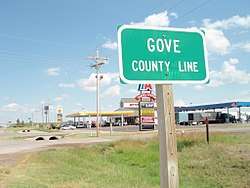
Municipalities and communities of Gove County, Kansas, United States | ||
|---|---|---|
| Cities | 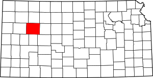 Map of Kansas highlighting Gove County | |
| Ghost towns | ||
| Townships | ||
| Footnotes | ‡This populated place also has portions in an adjacent county or counties | |
Municipalities and communities of Logan County, Kansas, United States | ||
|---|---|---|
| Cities | 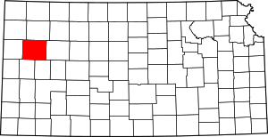 Map of Kansas highlighting Logan County | |
| Unincorporated communities | ||
| Ghost towns | ||
| Footnotes | ‡This populated place also has portions in an adjacent county or counties | |
Municipalities and communities of Thomas County, Kansas, United States | ||
|---|---|---|
| Cities | 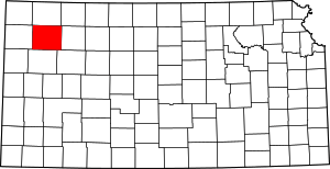 Map of Kansas highlighting Thomas County | |
| CDP | ||
| Unincorporated communities | ||
| Ghost towns | ||
| Footnotes | ‡This populated place also has portions in an adjacent county or counties | |
| Authority control |
|
|---|