Ivry-sur-le-Lac, Quebec
Ivry-sur-le-Lac is a village and municipality in the Laurentides region of Quebec, Canada, part of the Les Laurentides Regional County Municipality. The municipality completely encompasses Lake Manitou which is a popular cottage vacation location.
Ivry-sur-le-Lac | |
|---|---|
Municipality | |
 | |
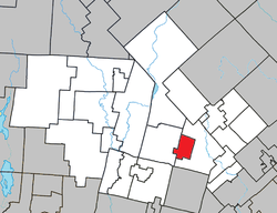 Location within Les Laurentides RCM | |
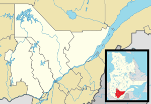 Ivry-sur-le-Lac Location in central Quebec | |
| Coordinates: 46°04′N 74°21′W[1] | |
| Country | |
| Province | |
| Region | Laurentides |
| RCM | Les Laurentides |
| Settled | 1852 |
| Constituted | January 1, 2006 |
| Government | |
| • Mayor | Daniel Charette |
| • Federal riding | Laurentides—Labelle |
| • Prov. riding | Bertrand |
| Area | |
| • Total | 34.70 km2 (13.40 sq mi) |
| • Land | 30.64 km2 (11.83 sq mi) |
| Population (2011)[3] | |
| • Total | 425 |
| • Density | 13.9/km2 (36/sq mi) |
| • Pop 2006-2011 | |
| • Dwellings | 413 |
| Time zone | UTC−5 (EST) |
| • Summer (DST) | UTC−4 (EDT) |
| Postal code(s) | J8C 2Z8 |
| Area code(s) | 819 |
| Highways | |
| Website | www |
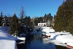
The village of Ivry-sur-le-Lac is located at the head of the north-east bay (Lacasse Bay), and the hamlet of Lac-Manitou-Sud is at the head of the south-east bay of Lake Manitou.[4]
History
From 1852 onwards, settlers came to the shores of Lake Manitou because of its beauty. In 1891, Countess Angela Ogier d'Ivry, from Le Mans (France), bought a farm for her son Viscount Raoul Ogier d'Ivry, who chose the name of the new municipality which formed in 1912 by separating from the parishes of Sainte-Agathe and Saint-Faustin. The post office opened in 1903, designated as Lac-Manitou until 1913 and as Ivry-Nord until 1958.[5]
On February 27, 2002, Ivry-sur-le-Lac was amalgamated with Sainte-Agathe-des-Monts in province-wide municipal reorganizations, but it was reinstated as a municipality on January 1, 2006.[5]
Demographics
Population trend:[6]
- Population in 2011: 425 (2006 to 2011 population change: 7.1%)
- Population in 2006: 397
- Population in 2001: 401
- Population in 1996: 346
- Population in 1991: 311
Private dwellings occupied by usual residents: 185 (total dwellings: 413)
Mother tongue:
- English as first language: 37.5%
- French as first language: 60%
- Other as first language: 2.5%
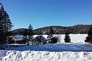 Lac Manitou
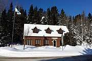 Town hall
Education
Saint Agathe Academy of the Sir Wilfrid Laurier School Board in Sainte-Agathe-des-Monts serves English-speaking students in this community for both elementary and secondary levels.[7]
References
- Reference number 388480 of the Commission de toponymie du Québec (in French)
- Geographic code 78042 in the official Répertoire des municipalités (in French)
- "(Code 2478042) Census Profile". 2011 census. Statistics Canada. 2012.
- "Lac-Manitou-Sud" (in French). Commission de toponymie du Québec. Retrieved 2009-03-27.
- "Ivry-sur-le-Lac (Municipalité)" (in French). Commission de toponymie du Québec. Retrieved 2009-03-27.
- Statistics Canada: 1996, 2001, 2006, 2011 census
- "About Us." Saint Agathe Academy. Retrieved on September 4, 2017. See Elementary zone map and Secondary zone map - Note that all areas covered in the elementary map are also covered in the secondary one.
External links

Places adjacent to Ivry-sur-le-Lac, Quebec | |
|---|---|
| Cities/towns | |
|---|---|
| Municipalities | |
| Townships | |
| Parishes | |
| Villages | |
| |