Itacoatiara, Amazonas
Itacoatiara is a municipality in the central eastern portion of state of Amazonas, inland northern Brazil.
Itacoatiara | |
|---|---|
| Município de Itacoatiara Municipality of Itacoatiara | |
 Itacoatiara, Amazonas, Brazil | |
 Flag  Seal | |
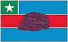
 Location in the state of Amazonas | |
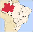
 Itacoatiara Location in Brazil | |
| Coordinates: 03°08′34″S 58°26′38″W | |
| Country | |
| Region | North |
| State | |
| Founded | April 24, 1874 |
| Government | |
| • Mayor | Antônio Peixoto de Oliveira (Workers Party) |
| Area | |
| • Municipality | 8,891.993 km2 (3,433.218 sq mi) |
| Elevation | 40 m (130 ft) |
| Population (2014) | |
| • Metro | 95,714 |
| • Metro density | 10.016/km2 (25.94/sq mi) |
| Time zone | UTC-4 (UTC-4) |
| • Summer (DST) | UTC-4 |
| Area code(s) | +55 (92) |
| Climate | Af |
It is 176 km east by air or 270 km downstream by river from Manaus. It is the third most populous town in the state, on the bank of the Amazon River.
Its population was 95,714 (2014) and its area is 8,600 km².[1]
The town is known as "City of painted stone" - which is its name translated from Tupi. Itacoatiara has an important port, which is responsible for a considerable amount of cargo transportation in Amazonas.
Its Catedral Prelatícia Nossa Senhora do Rosário, dedicated to Our Lady of the Rosary, is the episcopal see of the pre-diocesan Roman Catholic Territorial Prelature of Itacoatiara.
History
- In 1655, an aldea (hamlet) named Arroquis, on Albi Island on the Madeira River, was founded by Portuguese Jesuit missionary António Vieira. It was thereafter moved four times due to aggression by the indigenous Mura people.
- In 1757, the inhabitants of aldea Abacaxi (where did the inhabitants of Arroquis go?) moved to the left bank of the Amazon River, where Itacoatiara is now located.
- In 1758, Francisco Xavier de Mendonça passed through the region for the second time in order to found the captaincy of São José do Rio Negro.
- In 1759, the aldea was elevated to the category of village, and was then called Serpa.
- Itacoatiara became an actual town by law 74 of December 10, 1857, but in 1858 it was once more demoted as village, named Nossa Senhora do Rosário de Serpa. Finally, on April 25, 1874, by law 283, Itacoatiara was again elevated to the category of town, with its current name.
Demography
Ethnic composition
Itacoatiara is marked by the cultural, political and economic traits inherited from the Portuguese, Spanish and Dutch people. The city grew that way, but going back a bit in history, one can not forget the importance of Amerindians in the ethnic contribution. It was the Amerindians who began human occupation in the Amazon, and their descendants, the caboclos, developed in intimate contact with the environment, adapting to the regional peculiarities and opportunities offered by the forest.
In historical formation, Itacoatiara's demography is the result of the miscegenation of the three basic ethnic groups that compose the Brazilian population: Native Brazilian, European and African, thus forming the region's mestizos (caboclos). Later on, with the arrival of the immigrants, especially Japanese,[2] Arabs,[3] Syrians, Lebanese[4] and Jews coming mostly from Morocco,[5] a unique culture was formed that characterizes the population of the city, its values and way of life.
According to the IBGE 2000 census, the population of Itacoatiara is composed of: Pardo (58.37% or 41.367 inhabitants), White (32.21% or 22.504 inhabitants), Black (5.7% or 4 110 inhabitants), Amerindians (3.09% or 2,228 inhabitants) and Yellow (0.63% or 430 inhabitants).[6][7] There are also 50 people who did not declare their ethnicity, representing 0.10% of the total population.[6][7]
Climate
| Climate data for Itacoatiara, Amazonas (1981–2010, extremes 1971–present) | |||||||||||||
|---|---|---|---|---|---|---|---|---|---|---|---|---|---|
| Month | Jan | Feb | Mar | Apr | May | Jun | Jul | Aug | Sep | Oct | Nov | Dec | Year |
| Record high °C (°F) | 36.0 (96.8) |
36.2 (97.2) |
36.5 (97.7) |
37.0 (98.6) |
36.1 (97.0) |
36.0 (96.8) |
37.9 (100.2) |
36.8 (98.2) |
37.8 (100.0) |
38.8 (101.8) |
37.6 (99.7) |
38.6 (101.5) |
38.8 (101.8) |
| Average high °C (°F) | 31.1 (88.0) |
30.9 (87.6) |
31.0 (87.8) |
31.1 (88.0) |
31.4 (88.5) |
31.8 (89.2) |
32.2 (90.0) |
33.0 (91.4) |
33.7 (92.7) |
33.8 (92.8) |
33.1 (91.6) |
32.1 (89.8) |
32.1 (89.8) |
| Daily mean °C (°F) | 26.1 (79.0) |
26.2 (79.2) |
26.3 (79.3) |
26.4 (79.5) |
26.7 (80.1) |
26.7 (80.1) |
26.8 (80.2) |
27.2 (81.0) |
27.9 (82.2) |
28.0 (82.4) |
27.5 (81.5) |
26.9 (80.4) |
26.9 (80.4) |
| Average low °C (°F) | 22.5 (72.5) |
22.6 (72.7) |
22.6 (72.7) |
22.7 (72.9) |
23.0 (73.4) |
22.7 (72.9) |
22.6 (72.7) |
22.8 (73.0) |
23.1 (73.6) |
23.3 (73.9) |
23.2 (73.8) |
23.0 (73.4) |
22.8 (73.0) |
| Record low °C (°F) | 18.9 (66.0) |
18.8 (65.8) |
18.0 (64.4) |
17.5 (63.5) |
19.8 (67.6) |
19.0 (66.2) |
16.9 (62.4) |
18.4 (65.1) |
18.3 (64.9) |
19.2 (66.6) |
18.5 (65.3) |
18.8 (65.8) |
16.9 (62.4) |
| Average precipitation mm (inches) | 327.2 (12.88) |
286.0 (11.26) |
371.2 (14.61) |
301.6 (11.87) |
255.5 (10.06) |
152.1 (5.99) |
100.6 (3.96) |
74.9 (2.95) |
84.3 (3.32) |
97.0 (3.82) |
147.1 (5.79) |
214.9 (8.46) |
2,412.4 (94.98) |
| Average precipitation days (≥ 1.0 mm) | 18 | 17 | 20 | 19 | 18 | 14 | 10 | 7 | 7 | 7 | 8 | 12 | 157 |
| Average relative humidity (%) | 87.7 | 87.3 | 87.8 | 87.9 | 87.2 | 85.2 | 82.7 | 81.3 | 79.7 | 79.3 | 81.6 | 84.4 | 84.3 |
| Mean monthly sunshine hours | 106.2 | 99.2 | 92.1 | 103.8 | 124.4 | 154.9 | 202.6 | 202.7 | 187.4 | 173.6 | 136.8 | 127.4 | 1,704.3 |
| Source 1: Instituto Nacional de Meteorologia[8] | |||||||||||||
| Source 2: Meteo Climat (record highs and lows)[9] | |||||||||||||
Notable People
- Mayra Dias, Brazilian model and Miss Brazil 2018
See also
- Silves another old town, originally a mission, nearby
References
- Brazilian Institute of Geography and Statistics (IBGE) - "Archived copy". Archived from the original on 2007-01-09. Retrieved 2014-08-03.CS1 maint: archived copy as title (link)
- "A quarta raça". Japão 100. 2007. Archived from the original on 2 June 2015. Retrieved 28 January 2011.
- "Árabes". Wikipédia, a enciclopédia livre. 2017-04-28.
- "Libaneses". Wikipédia, a enciclopédia livre. 2017-04-20.
- "Judeus marroquinos que vieram para a Amazônia". Revista Morashá. December 2010. Retrieved 28 January 2011.
- "Tabela 2094 — População residente por cor ou raça e religião". IBGE. 2000. Retrieved 28 January 2010.
- "Tabela 2094 — População residente por cor ou raça e religião". IBGE. 2000. Retrieved 28 January 2011.
- "Normais Climatológicas Do Brasil 1981–2010" (in Portuguese). Instituto Nacional de Meteorologia. Retrieved 26 October 2018.
- "Station Itacoatiara" (in French). Meteo Climat. Retrieved 26 October 2018.
Capital: Manaus | ||||||||||||||
| Mesoregion Centro Amazonense |
|  | ||||||||||||
| Mesoregion Norte Amazonense |
| |||||||||||||
| Mesoregion Sudoeste Amazonense |
| |||||||||||||
| Mesoregion Sul Amazonense |
| |||||||||||||